 Image 1 of 3
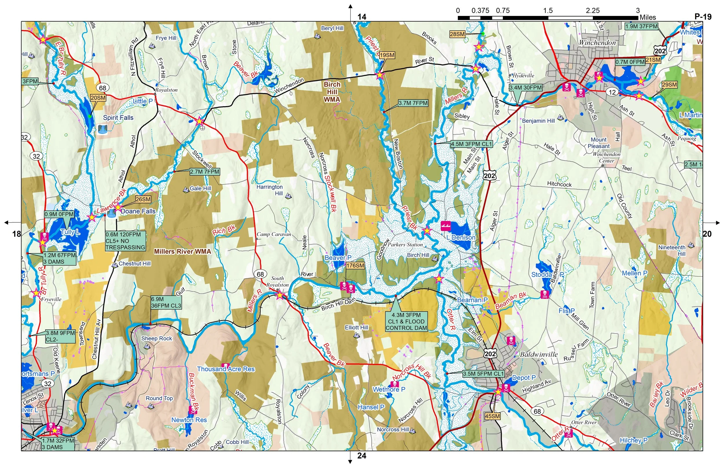 Image 2 of 3
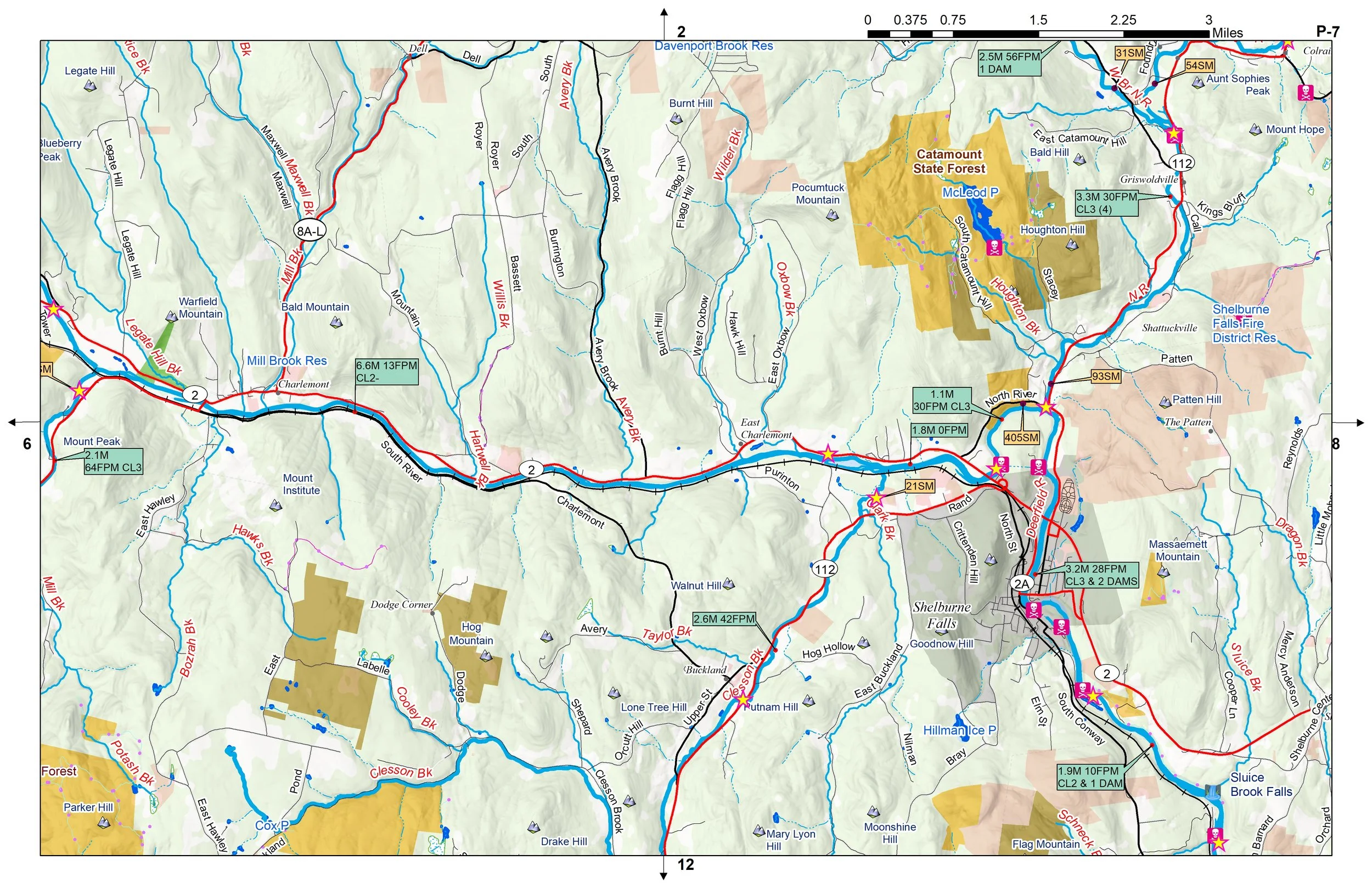 Image 3 of 3
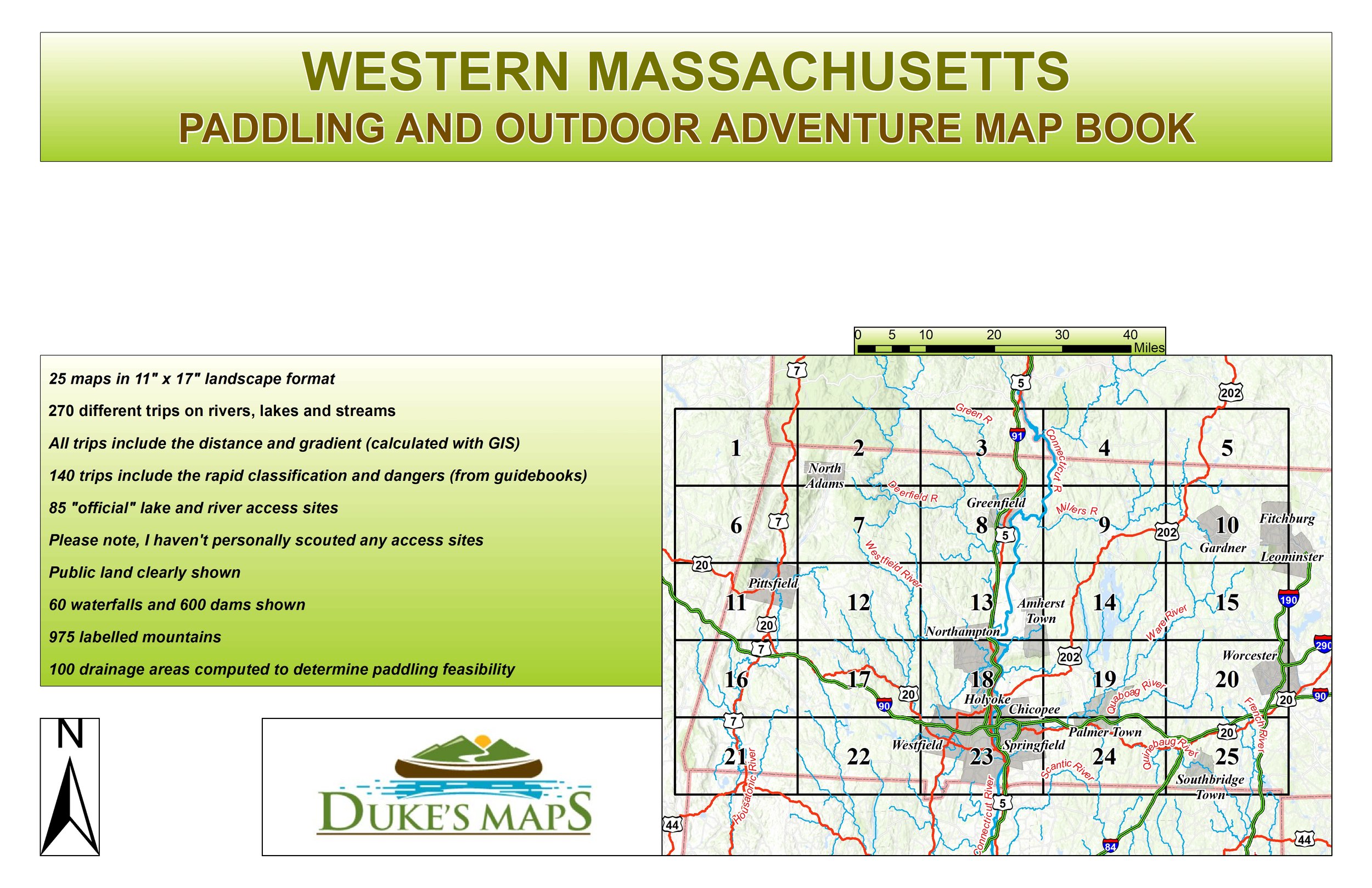
Come explore the Berkshire, Taconic, and Hoosac Mountain ranges. Plenty of whitewater runs, lakes to paddle, and rivers to float fish!
“The Berkshires seemed dreamlike on account of that frosting” James Taylor
You’ll receive a secure link to the file lasting 24 hours after the first download.
Some of the items found in these maps:
25 maps in 11" x 17" landscape format
270 different trips on rivers, lakes and streams
All trips include the distance and gradient (calculated with GIS)
140 trips include the rapid classification and dangers (from guidebooks)
85 "official" lake and river access sites
Please note, I haven't personally scouted any access sites
Public land clearly shown
60 waterfalls and 600 dams shown
975 labelled mountains
100 drainage areas computed to determine paddling feasibility