 Image 1 of 4
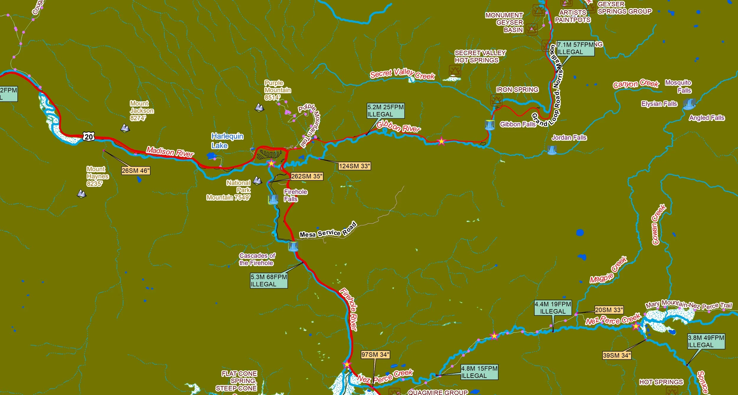 Image 2 of 4
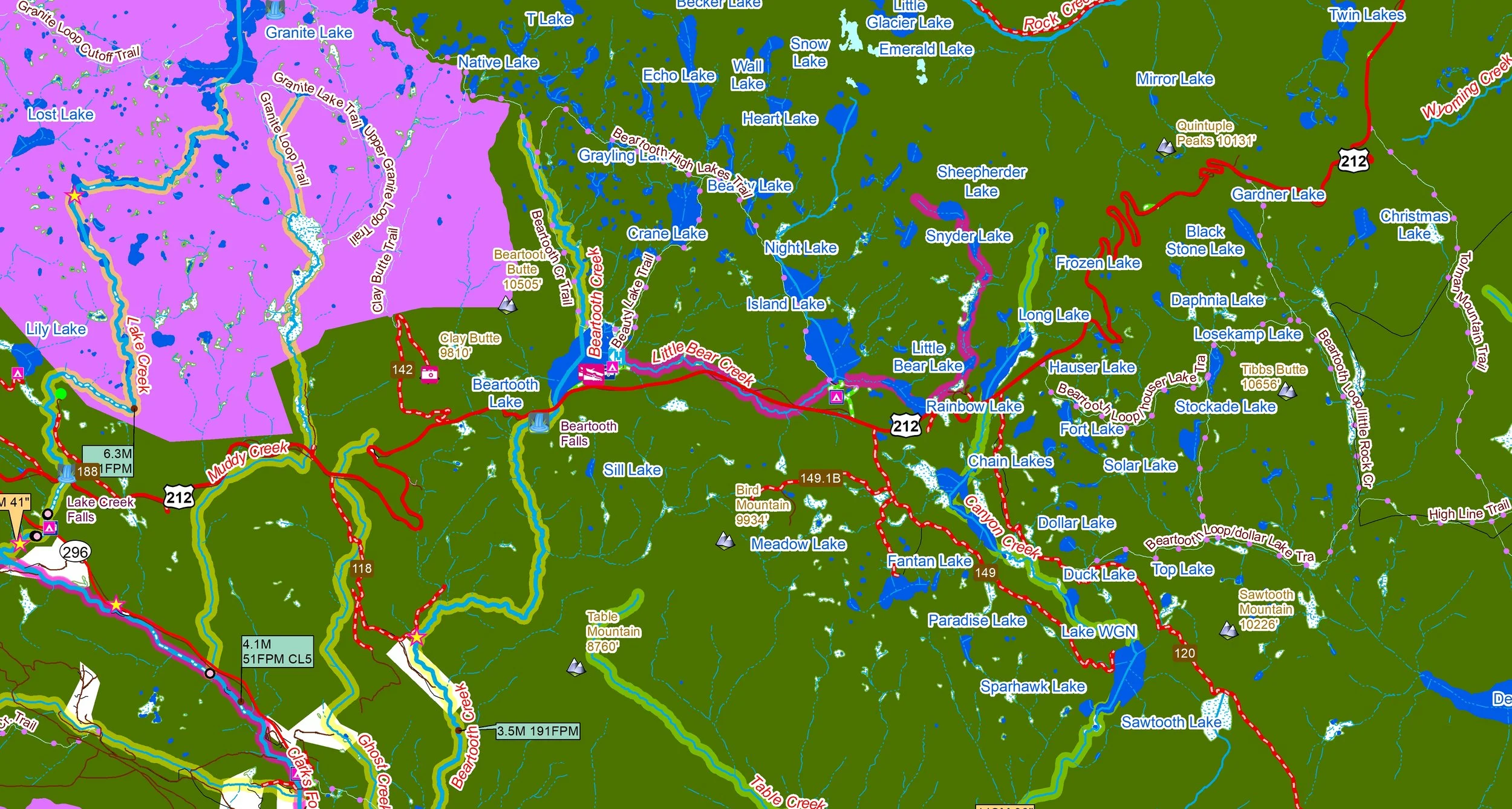 Image 3 of 4
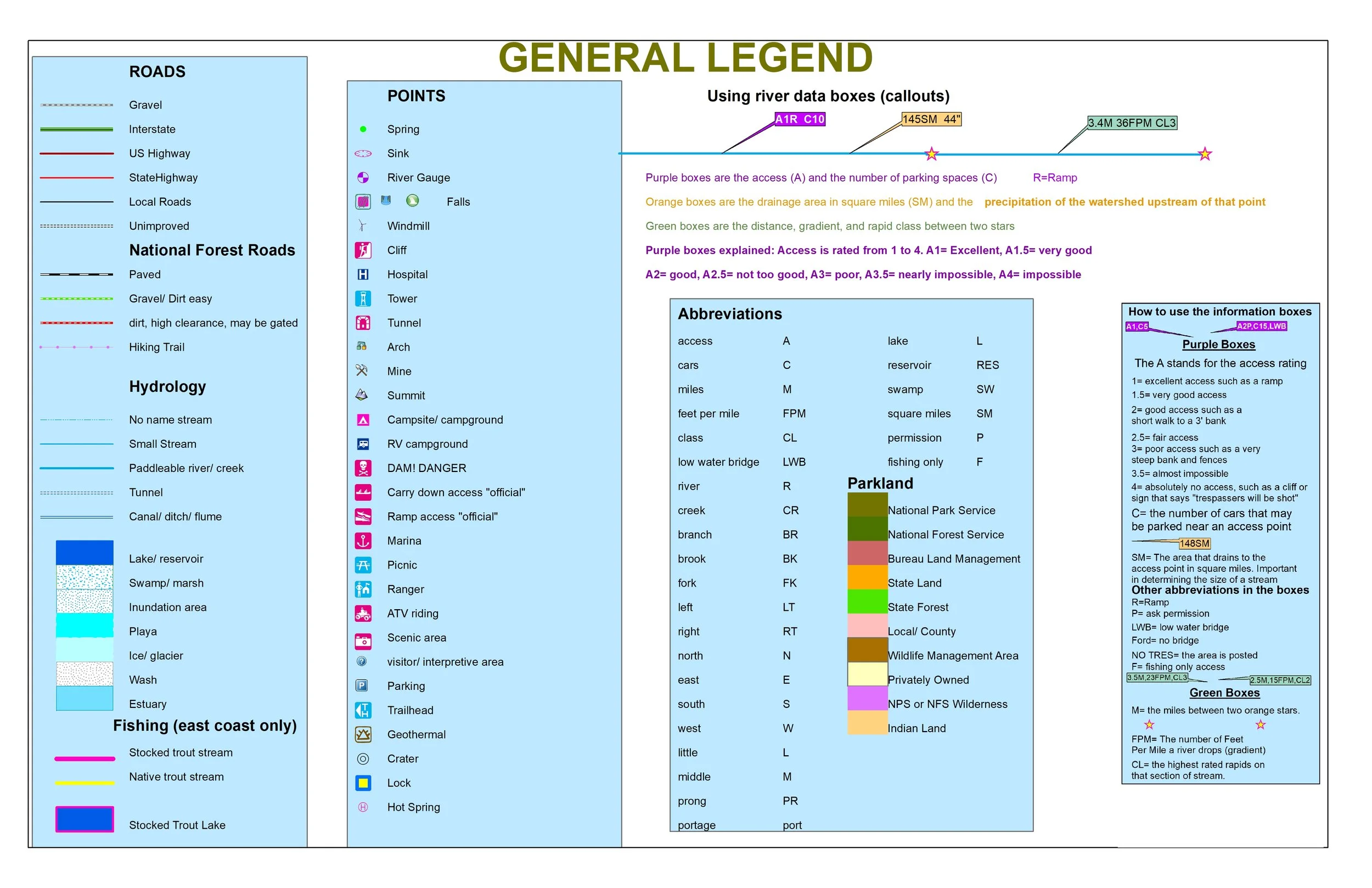 Image 4 of 4
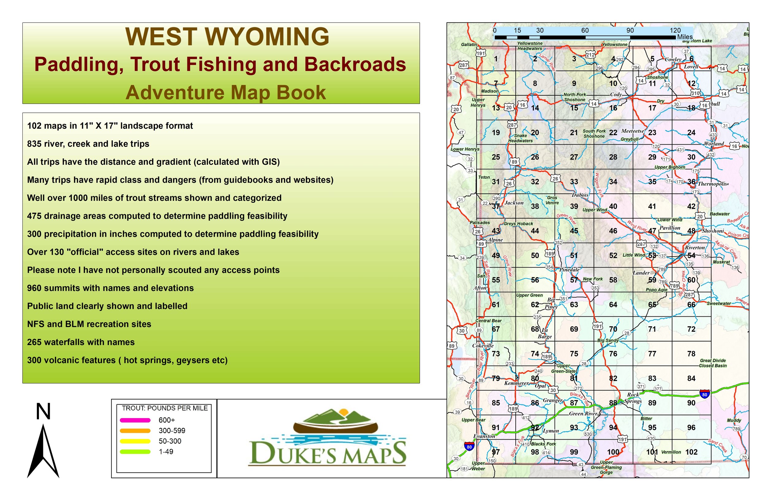
From the Tetons and Yellowstone in the North to the Wind River Range in the center to the Flaming Gorge in the south this is a wonderous place to explore! Paddle, fish, hike and ATV, it’s all here!
You’ll receive a secure link to the file lasting 24 hours after the first download.
Some items included in these maps are:
102 maps in 11" X 17" landscape format
835 river, creek and lake trips
All trips have the distance and gradient (calculated with GIS)
Many trips have rapid class and dangers (from guidebooks and websites)
Well over 1000 miles of trout streams shown and categorized
475 drainage areas computed to determine paddling feasibility
300 precipitation in inches computed to determine paddling feasibility
Over 130 "official" access sites on rivers and lakes
Please note I have not personally scouted any access points
960 summits with names and elevations
Public land clearly shown and labelled
NFS and BLM recreation sites
265 waterfalls with names
300 volcanic features ( hot springs, geysers etc.)