 Image 1 of 4
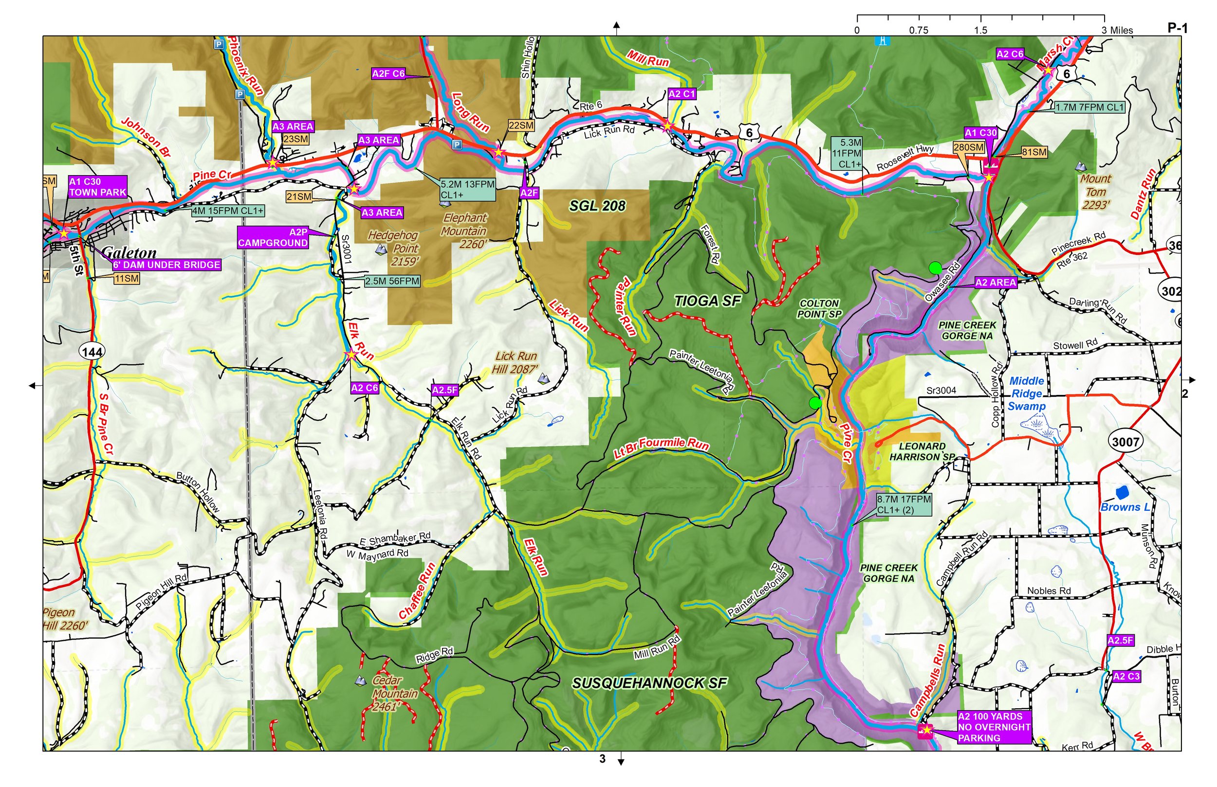 Image 2 of 4
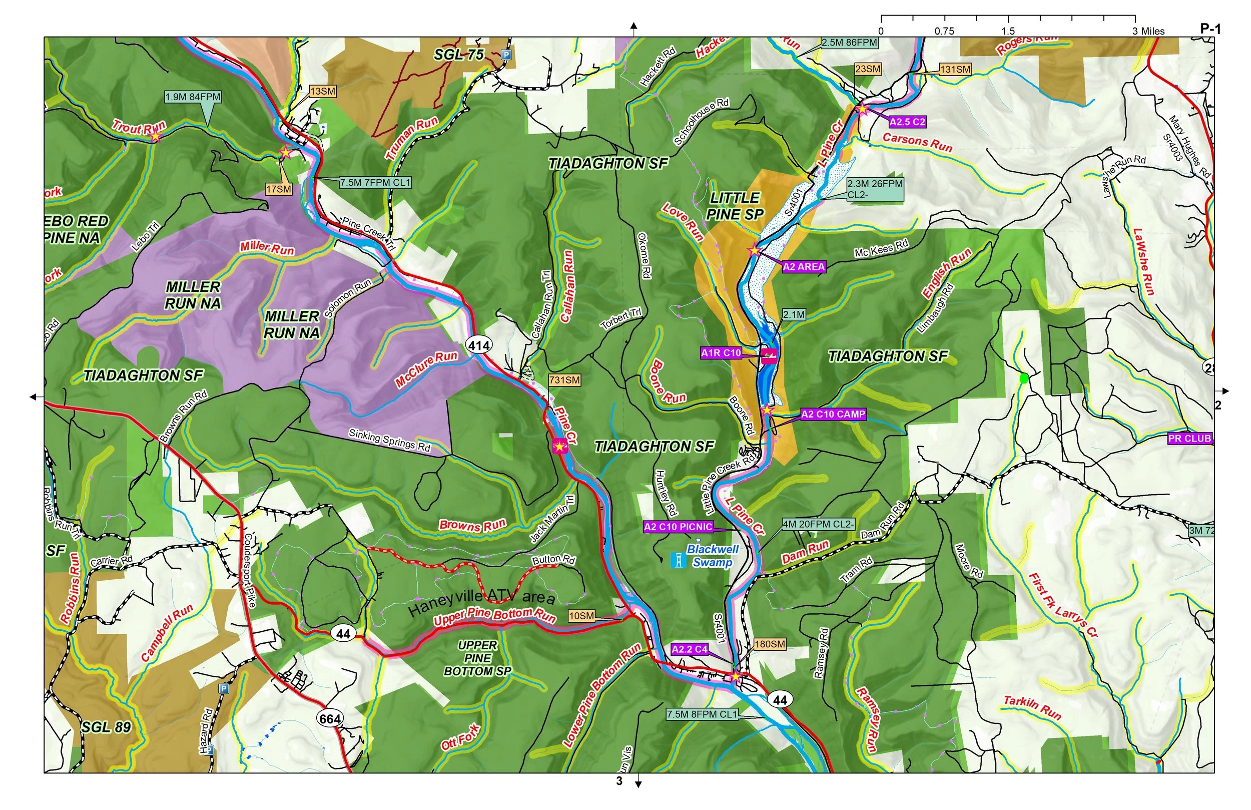 Image 3 of 4
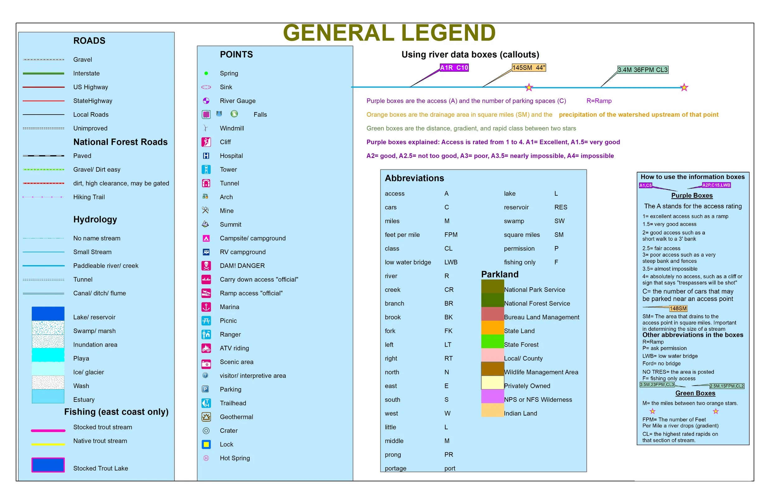 Image 4 of 4
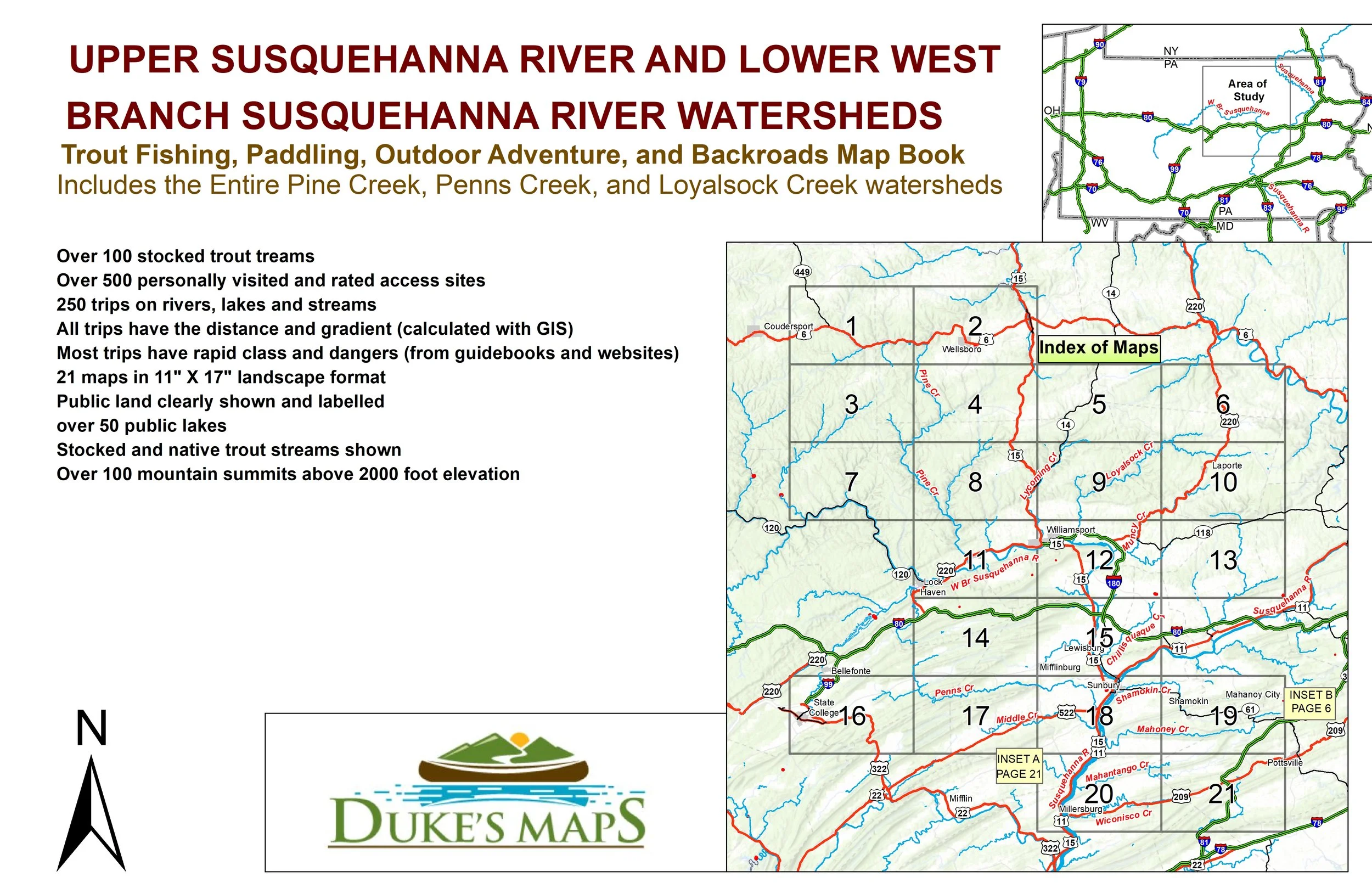
Trout Fishing, Paddling, Outdoor Adventure, and Backroads Map Book.
Come explore the sparsely populated east part of the Pennsylvania Wilds. Chock full of vast state forests and game lands. Oh yeah, lots of state parks too. This area includes Pennsylvania’s most popular paddling destination The Grand Canyon of Pine Creek.
Includes the Entire Pine Creek, Penns Creek, and Loyalsock Creek watersheds.
You’ll receive a secure link to the file lasting 24 hours after the first download.
Some items included in these maps are:
21 maps in 11" X 17" landscape format
Over 500 personally visited and rated access sites
250 trips on rivers, lakes and streams
All trips have the distance and gradient (calculated with GIS)
Most trips have rapid class and dangers (from guidebooks and websites)
Public land clearly shown and labelled
Over 100 mountain summits above 2000 foot elevation
Stocked and native trout streams shown
Over 100 stocked trout streams