 Image 1 of 3
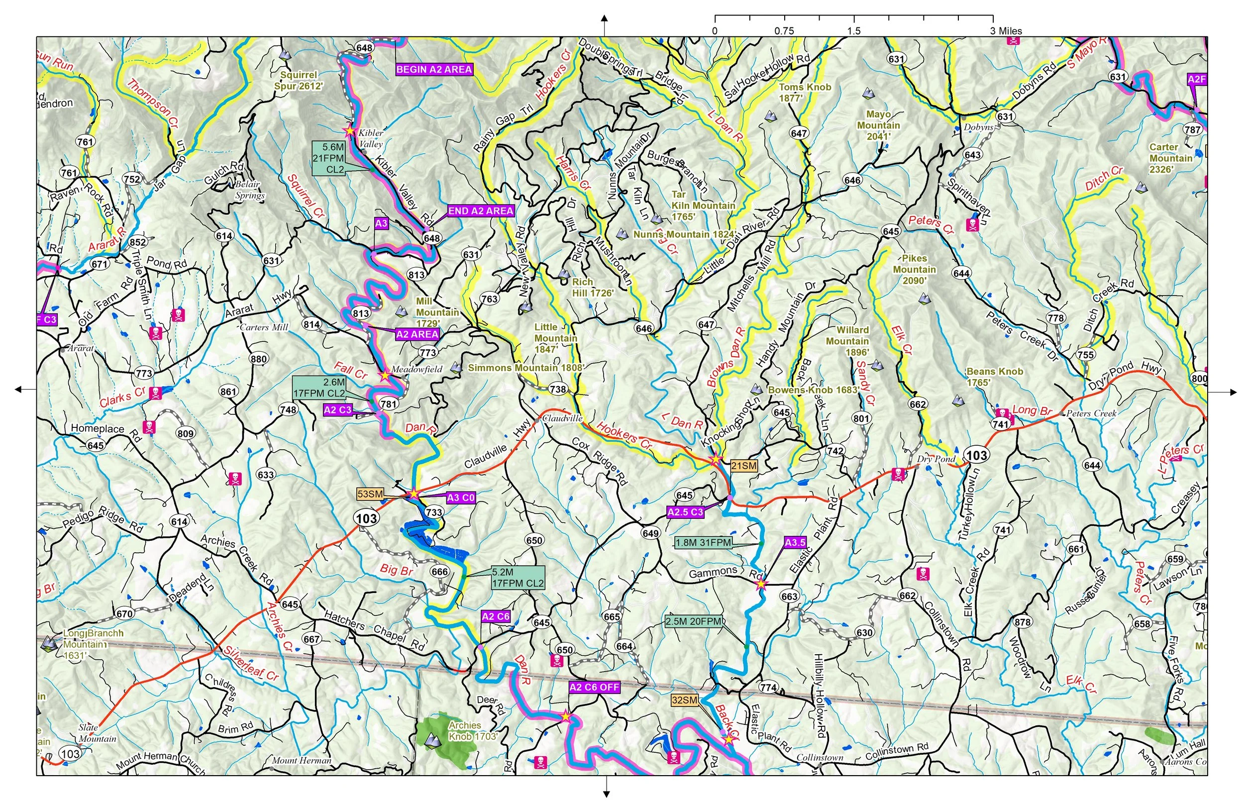 Image 2 of 3
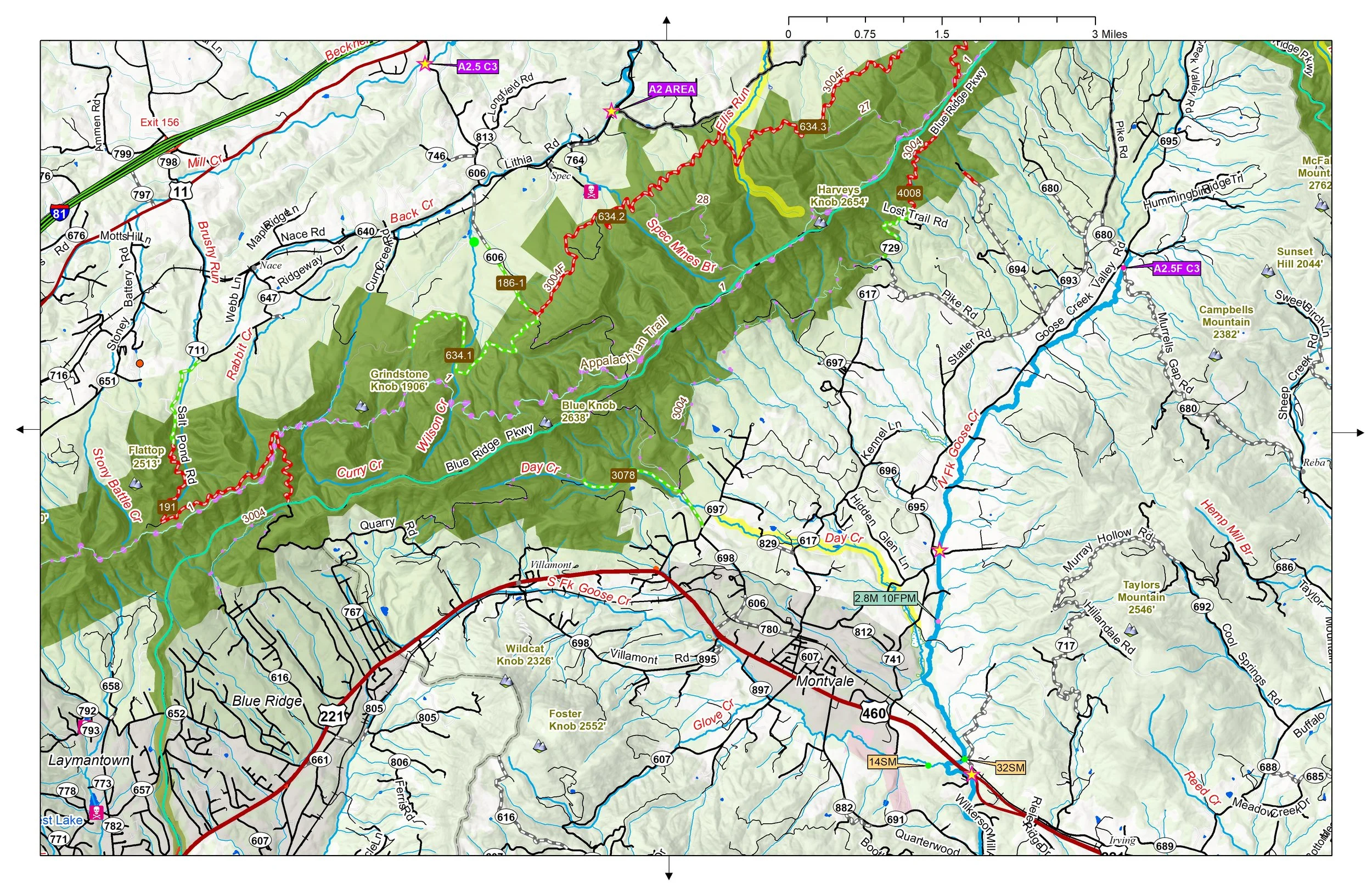 Image 3 of 3
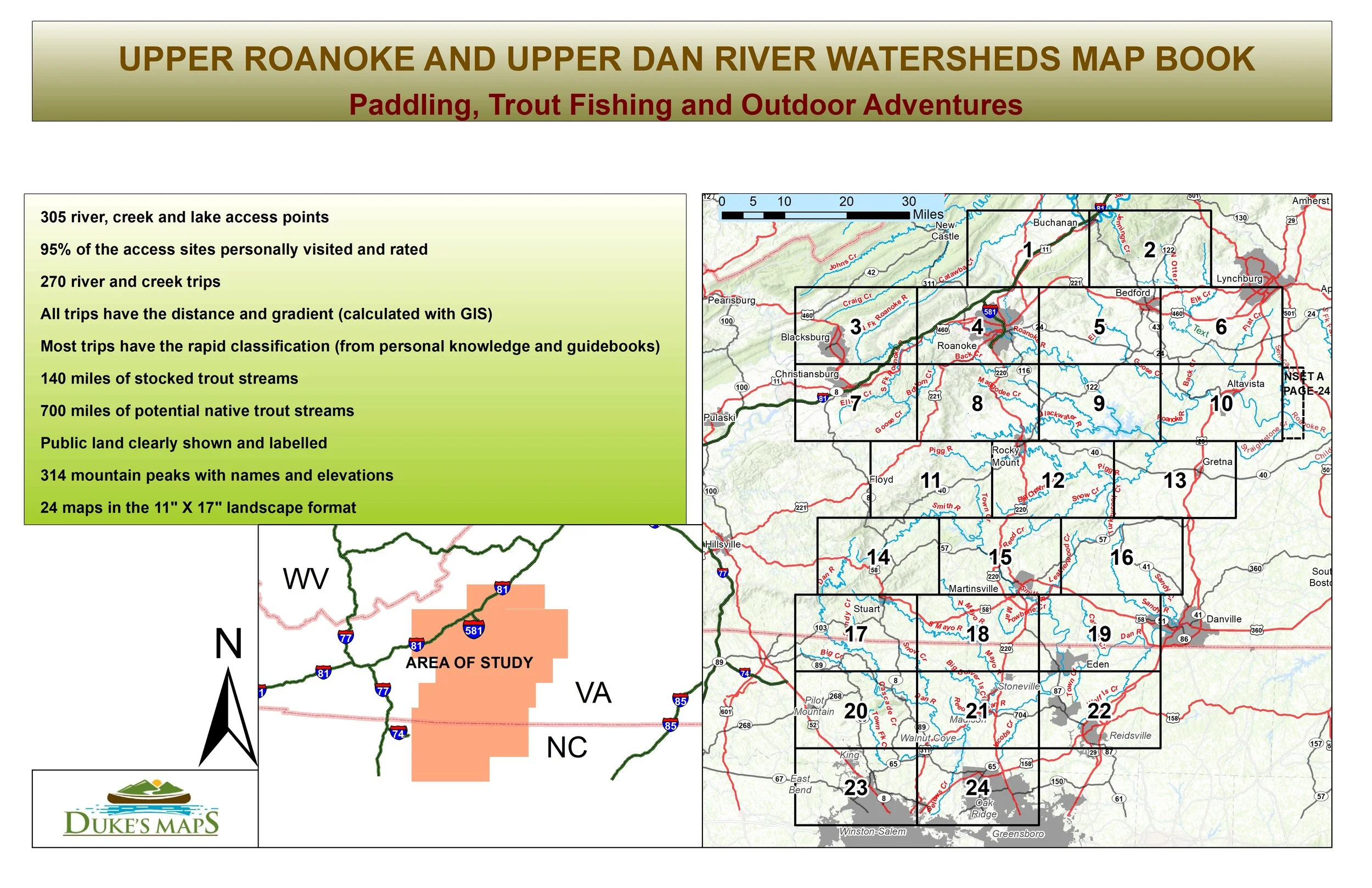
Paddling, Trout Fishing and Outdoor Adventures
Enjoy great float fishing rivers like the Dan and Roanoke. Explore whitewater rivers like the Smith and Mayo.
You’ll receive a secure link to the file lasting 24 hours after the first download
Some items found in these maps include:
24 maps in the 11" X 17" landscape format
305 river, creek and lake access points
95% of the access sites personally visited and rated
270 river and creek trips
All trips have the distance and gradient (calculated with GIS)
Most trips have the rapid classification (from personal knowledge and guidebooks)
140 miles of stocked trout streams
700 miles of potential native trout streams
Public land clearly shown and labelled
314 mountain peaks with names and elevations