 Image 1 of 4
 Image 2 of 4
 Image 3 of 4
 Image 4 of 4
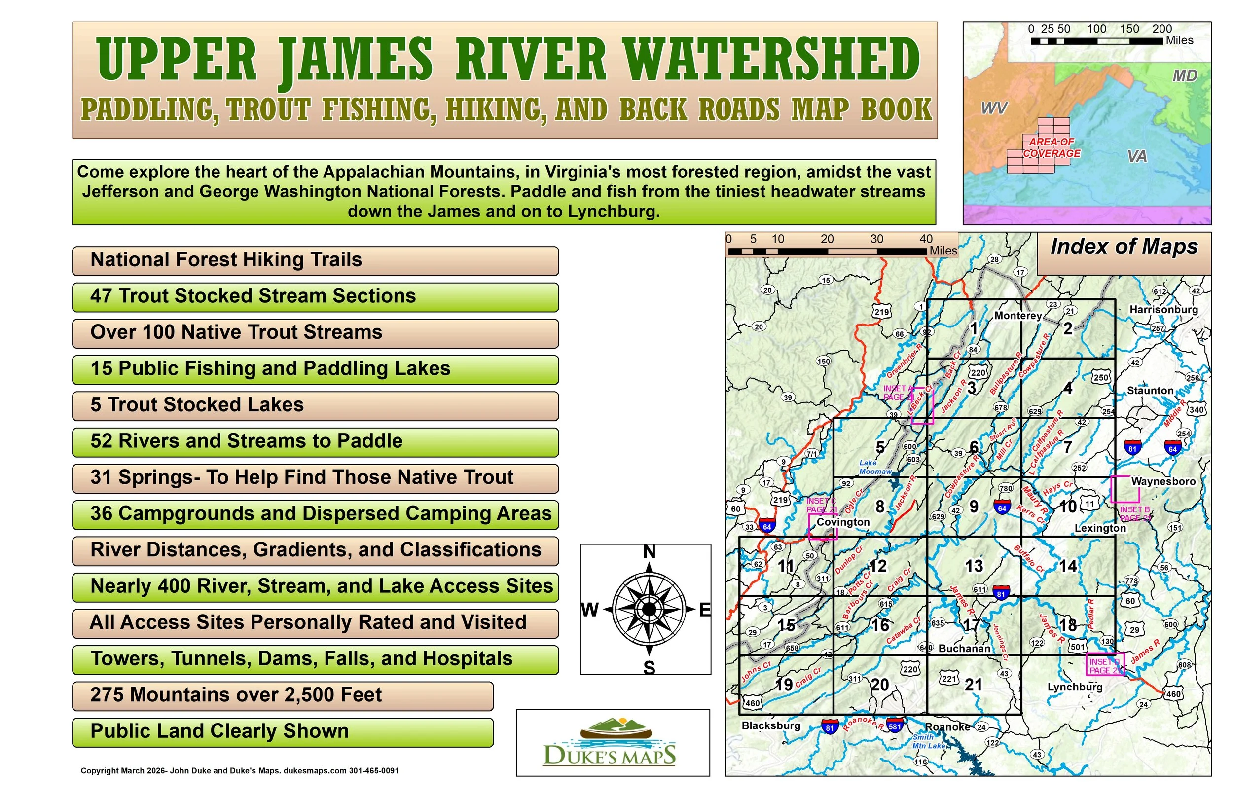
Come explore the heart of the Appalachian Mountains, in Virginia's most forested region, amidst the vast Jefferson and George Washington National Forests. Paddle and fish from the tiniest headwater streams down the James and on to Lynchburg.
You’ll receive a secure link to the file lasting 24 hours after the first download.
Items in these maps include:
21 maps in 11” X 17” landscape format
52 Rivers and Streams to Paddle
230 River and Stream Trips
Nearly 400 River, Stream, and Lake Access Sites
All 340 Access Sites Personally Rated and Visited
National Forest Hiking Trails
47 Trout Stocked Stream Sections
Over 100 Native Trout Streams
15 Public Fishing and Paddling Lakes
5 Trout Stocked Lakes
31 Springs- To Help Find Those Native Trout
36 Campgrounds and Dispersed Camping Areas
All trips have the distance and gradient (drop in feet per mile)
Most trips have rapid class and dangers (obtained from personal experience and guidebooks)
275 Mountains over 2,500 Feet
Public Land Clearly Shown