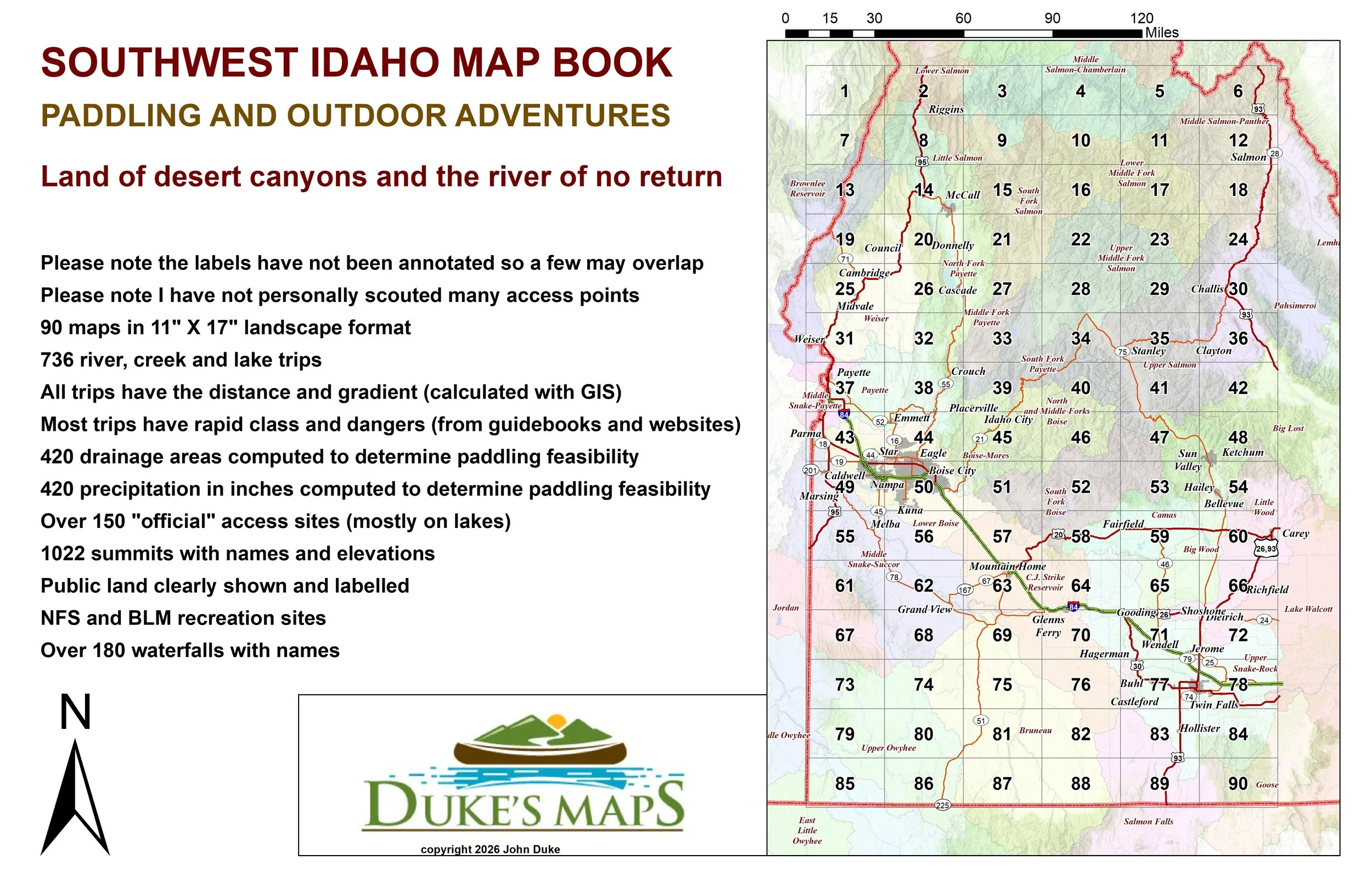
 Image 1 of 4
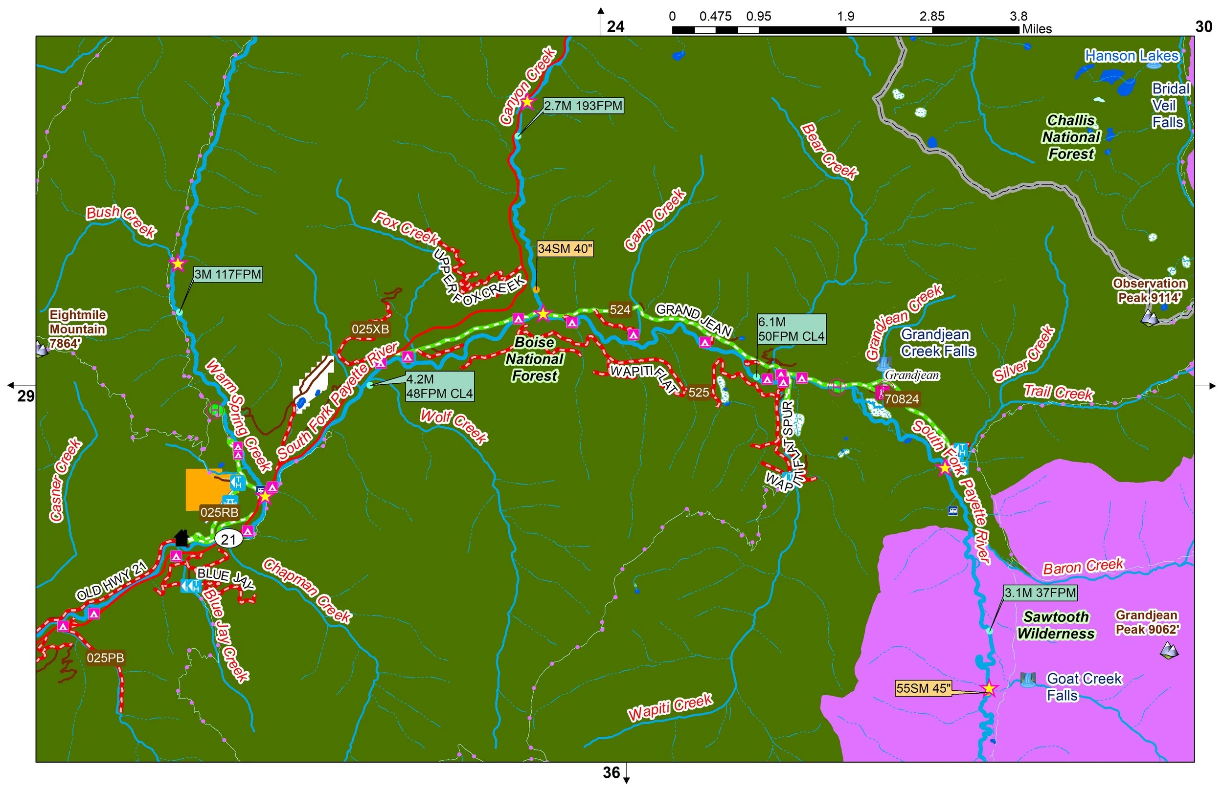 Image 2 of 4
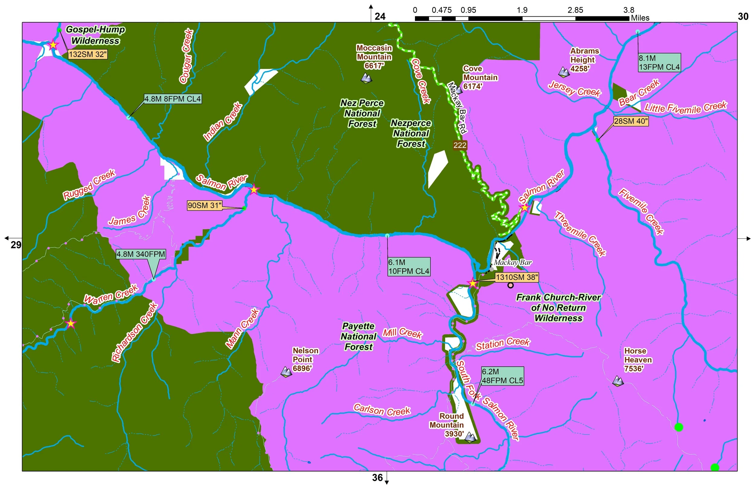 Image 3 of 4
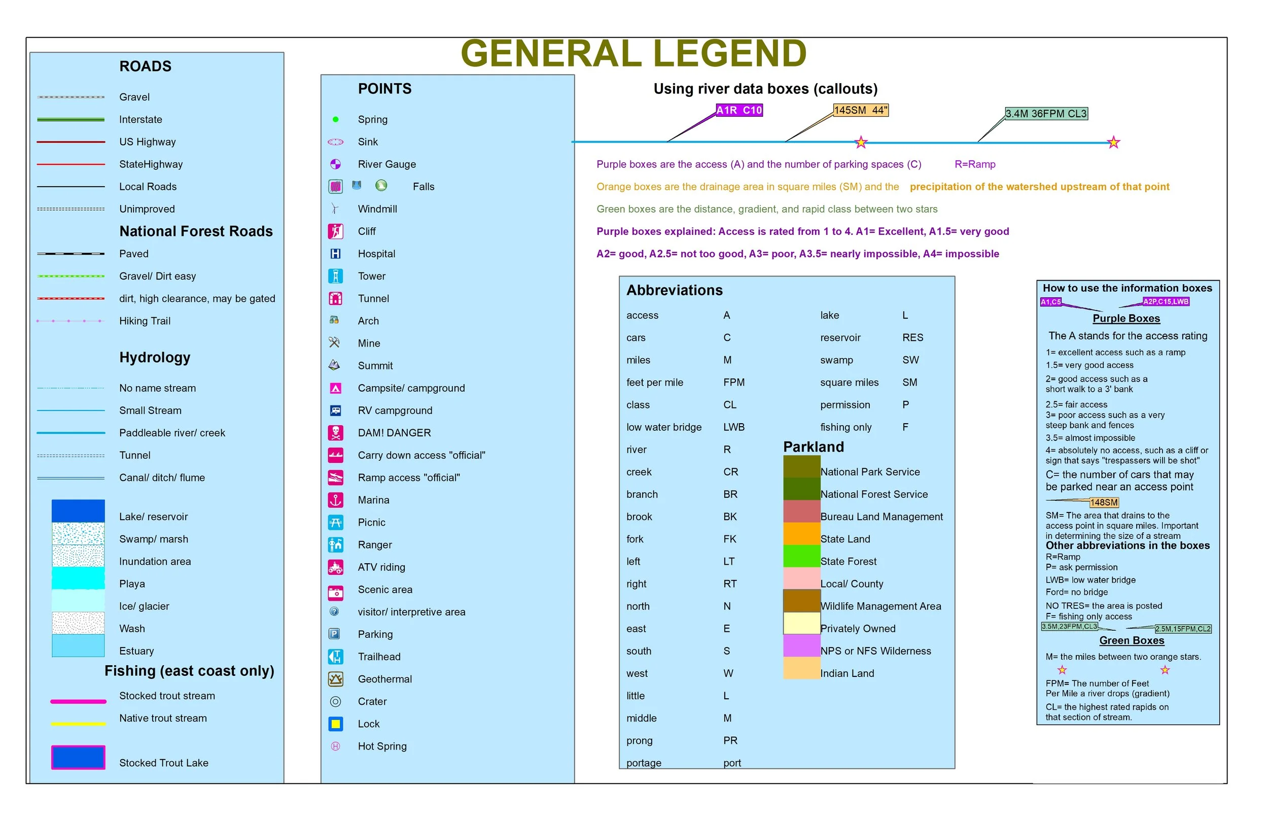 Image 4 of 4
If you want wilderness this is the place to be! Sawtooth, Frank Church River of no Return, White Clouds, and Hells Canyon Wilderness are some. Huge desert canyons and alpine likes will be found here.
Some items found in these maps include:
90 maps in 11" X 17" landscape format
736 river, creek and lake trips
All trips have the distance and gradient (calculated with GIS)
Most trips have rapid class and dangers (from guidebooks and websites)
420 drainage areas computed to determine paddling feasibility
420 precipitation in inches computed to determine paddling feasibility
Over 150 "official" access sites (mostly on lakes)
1022 summits with names and elevations
Public land clearly shown and labelled
NFS and BLM recreation sites
Over 180 waterfalls with names
Please note the labels have not been annotated so a few may overlap
Please note I have not personally scouted many access points
Please note many shown roads may be private, gated or non-existent
Paddle and fish great rivers like the Snake, Salmon, Payette, Boise, Bruneau, and Owyhee. Dozens of steep whitewater creeks, many not found in any guidebooks.