 Image 1 of 3
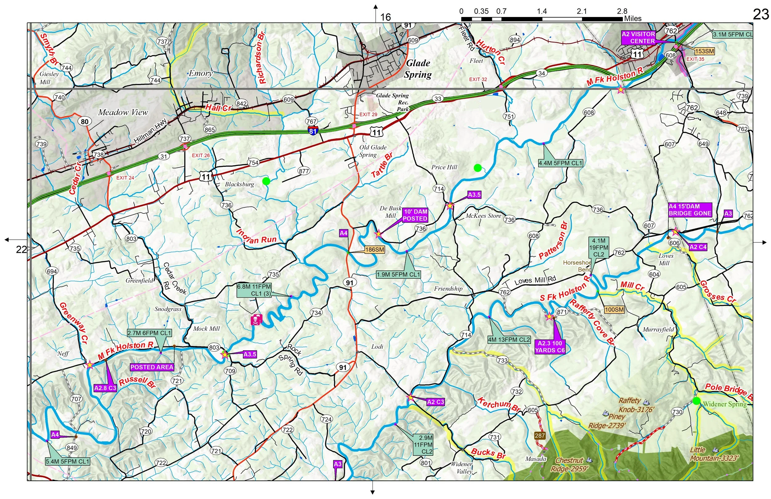 Image 2 of 3
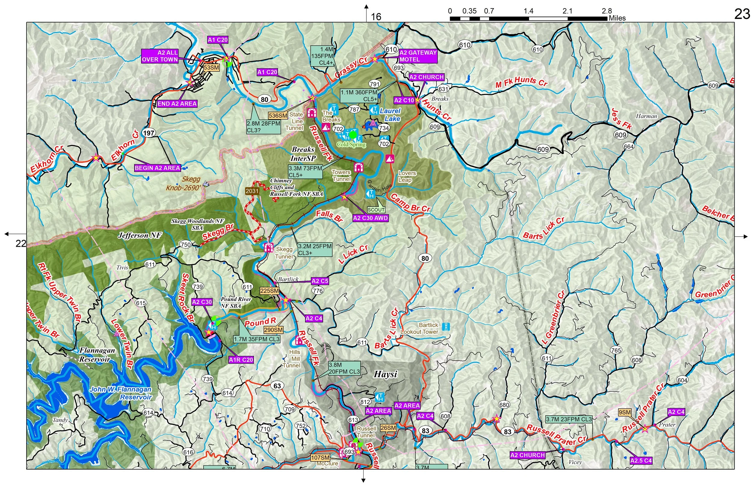 Image 3 of 3
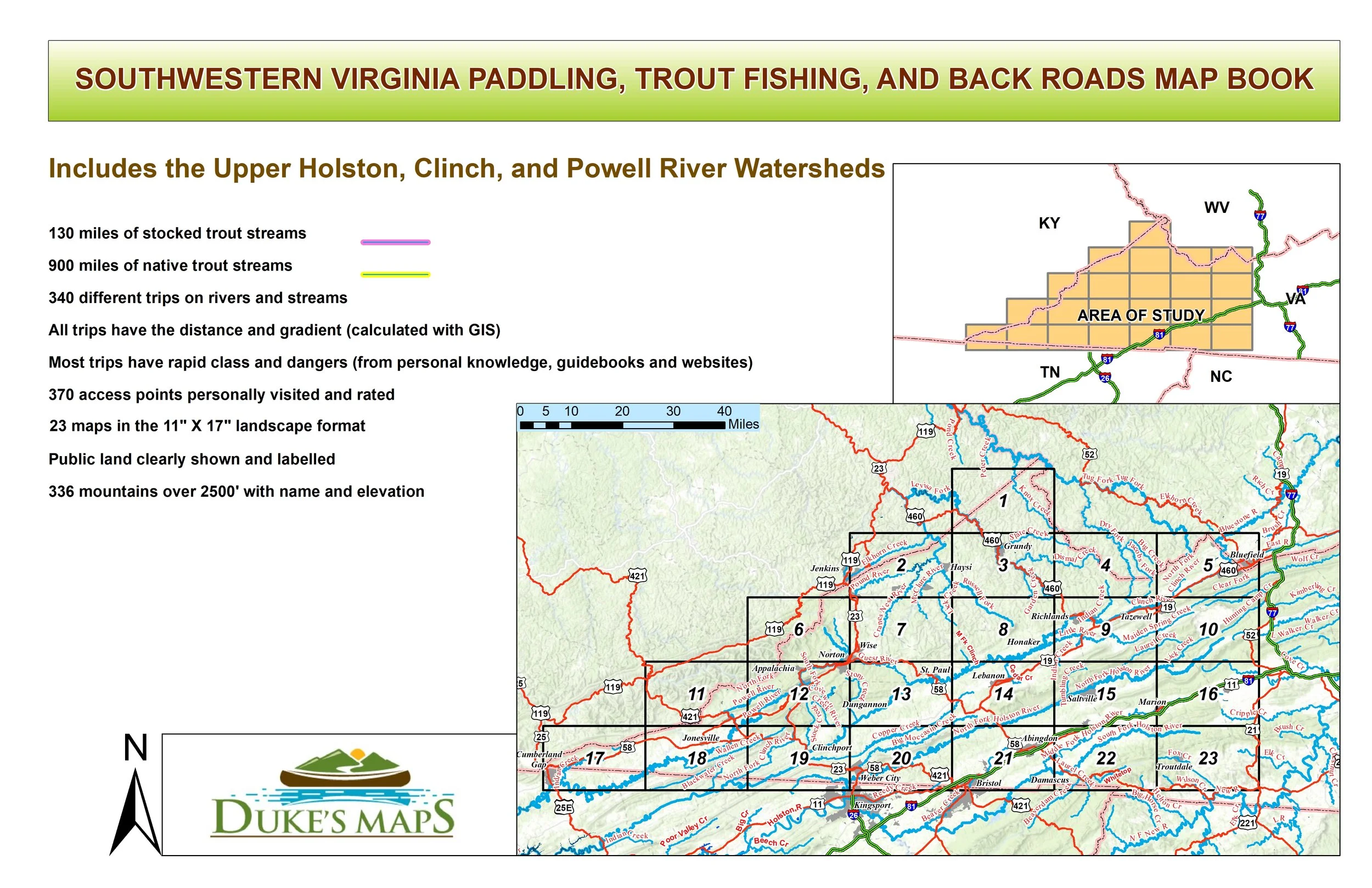
This is a less explored but beautiful part of Mountain Virginia. It includes Virginias 3 highest peaks (Mount Rogers at 5728’, Whitetop Mountain at 5525’, and Pine Mountain at 5525’). Three great float fishing rivers are the Holston, Clinch, and Powell. Whitewater trips include the Big Moccasin, Big Wilson, Tennessee Laurel and Tumbling Creeks. Also the Russell Fork and Guest Rivers have great whitewater.
You’ll receive a secure link to the file lasting 24 hours after the first download.
Some items in these maps include
23 maps in the 11" X 17" landscape format
130 miles of stocked trout streams
900 miles of native trout streams
340 different trips on rivers and streams
All trips have the distance and gradient (calculated with GIS)
Most trips have rapid class and dangers (from personal knowledge, guidebooks and websites)
370 access points personally visited and rated
Public land clearly shown and labelled
336 mountains over 2500' with name and elevation