 Image 1 of 3
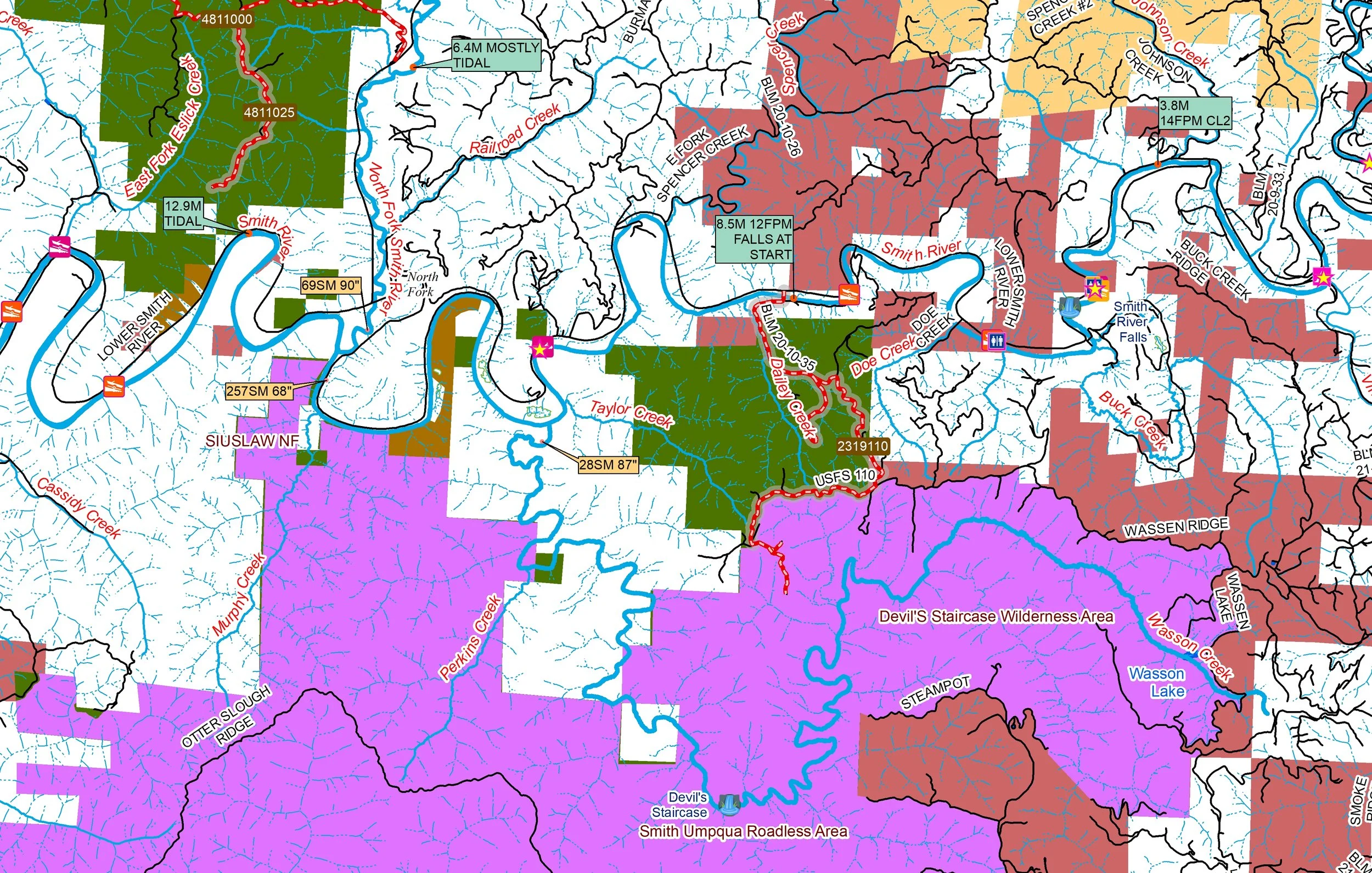 Image 2 of 3
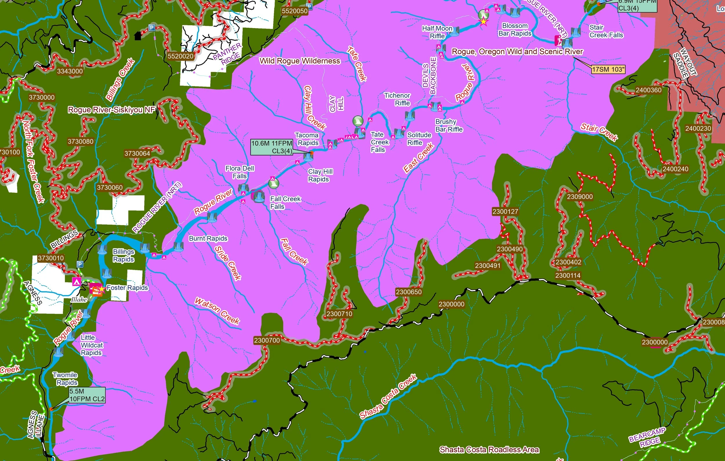 Image 3 of 3
The Beautiful Rogue River with its major tributaries—the Illinois, Applegate, and Bear Creek—and the nearby Smith and Chetco rivers, this area boasts the highest concentration of Wild and Scenic designated river segments in the contiguous United States.
You’ll receive a secure link to the file lasting 24 hours after the first download.
Some of the items found in these maps:
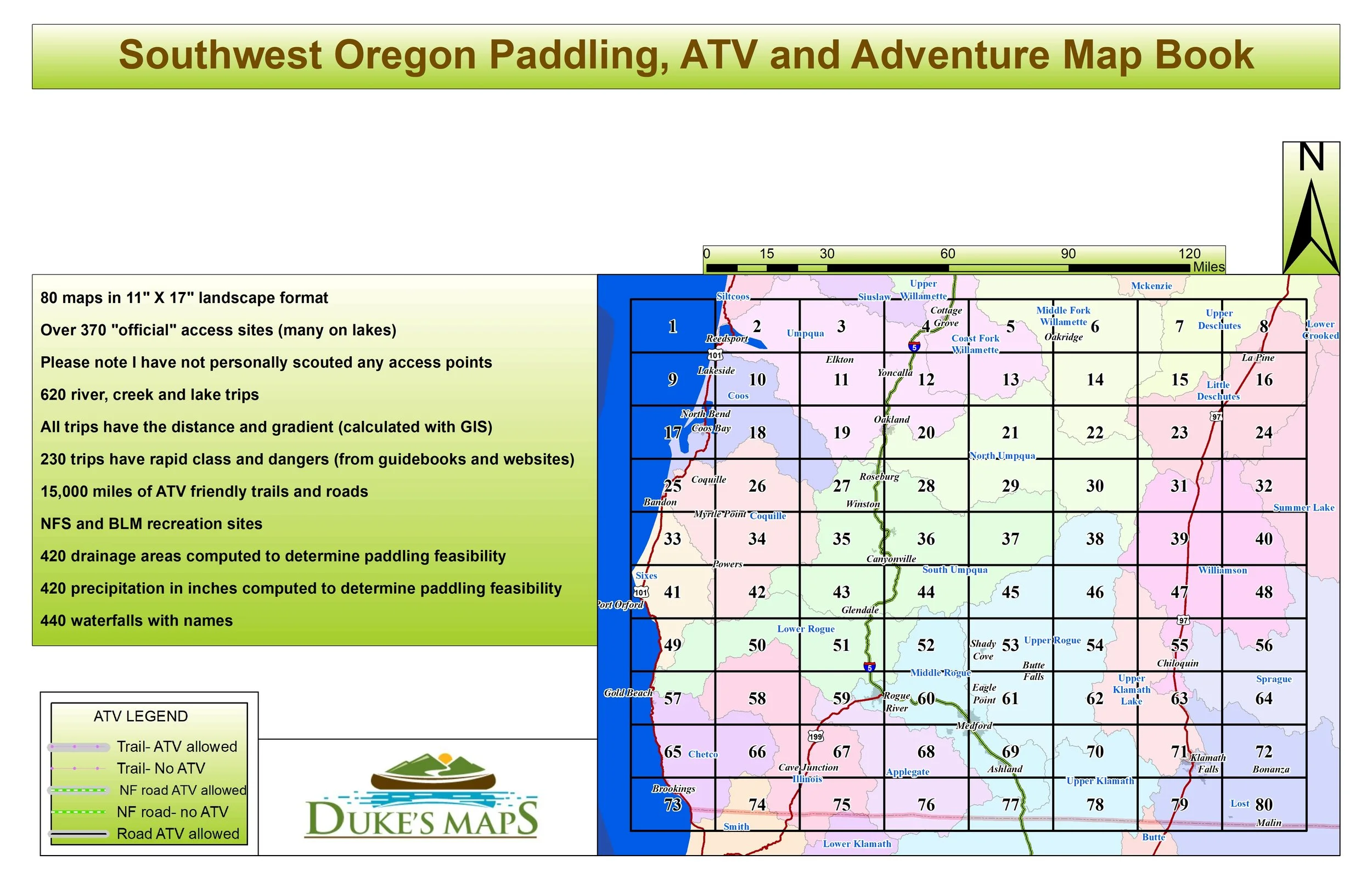
80 maps in 11" X 17" landscape format
Over 370 "official" access sites (many on lakes)
Please note I have not personally scouted any access points
620 river, creek and lake trips
All trips have the distance and gradient (calculated with GIS)
230 trips have rapid class and dangers (from guidebooks and websites)
15,000 miles of ATV friendly trails and roads
NFS and BLM recreation sites
420 drainage areas computed to determine paddling feasibility
420 precipitation in inches computed to determine paddling feasibility
440 waterfalls with names
The Beautiful Rogue River with its major tributaries—the Illinois, Applegate, and Bear Creek—and the nearby Smith and Chetco rivers, this area boasts the highest concentration of Wild and Scenic designated river segments in the contiguous United States.
You’ll receive a secure link to the file lasting 24 hours after the first download.
Some of the items found in these maps:
80 maps in 11" X 17" landscape format
Over 370 "official" access sites (many on lakes)
Please note I have not personally scouted any access points
620 river, creek and lake trips
All trips have the distance and gradient (calculated with GIS)
230 trips have rapid class and dangers (from guidebooks and websites)
15,000 miles of ATV friendly trails and roads
NFS and BLM recreation sites
420 drainage areas computed to determine paddling feasibility
420 precipitation in inches computed to determine paddling feasibility
440 waterfalls with names