 Image 1 of 3
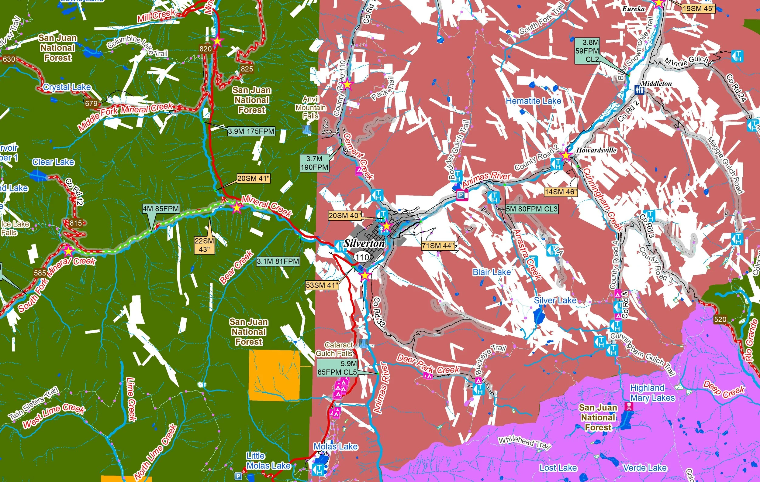 Image 2 of 3
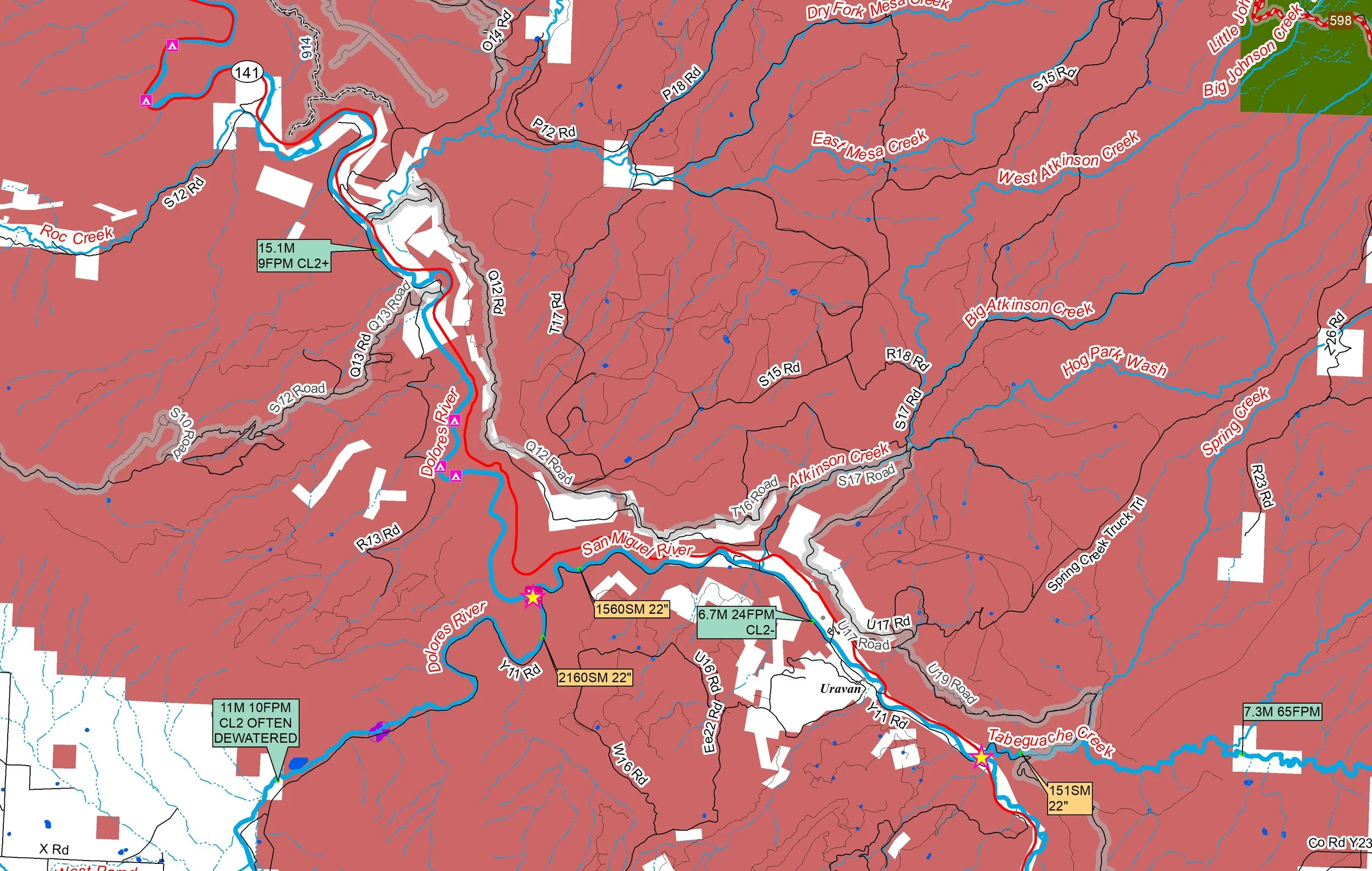 Image 3 of 3
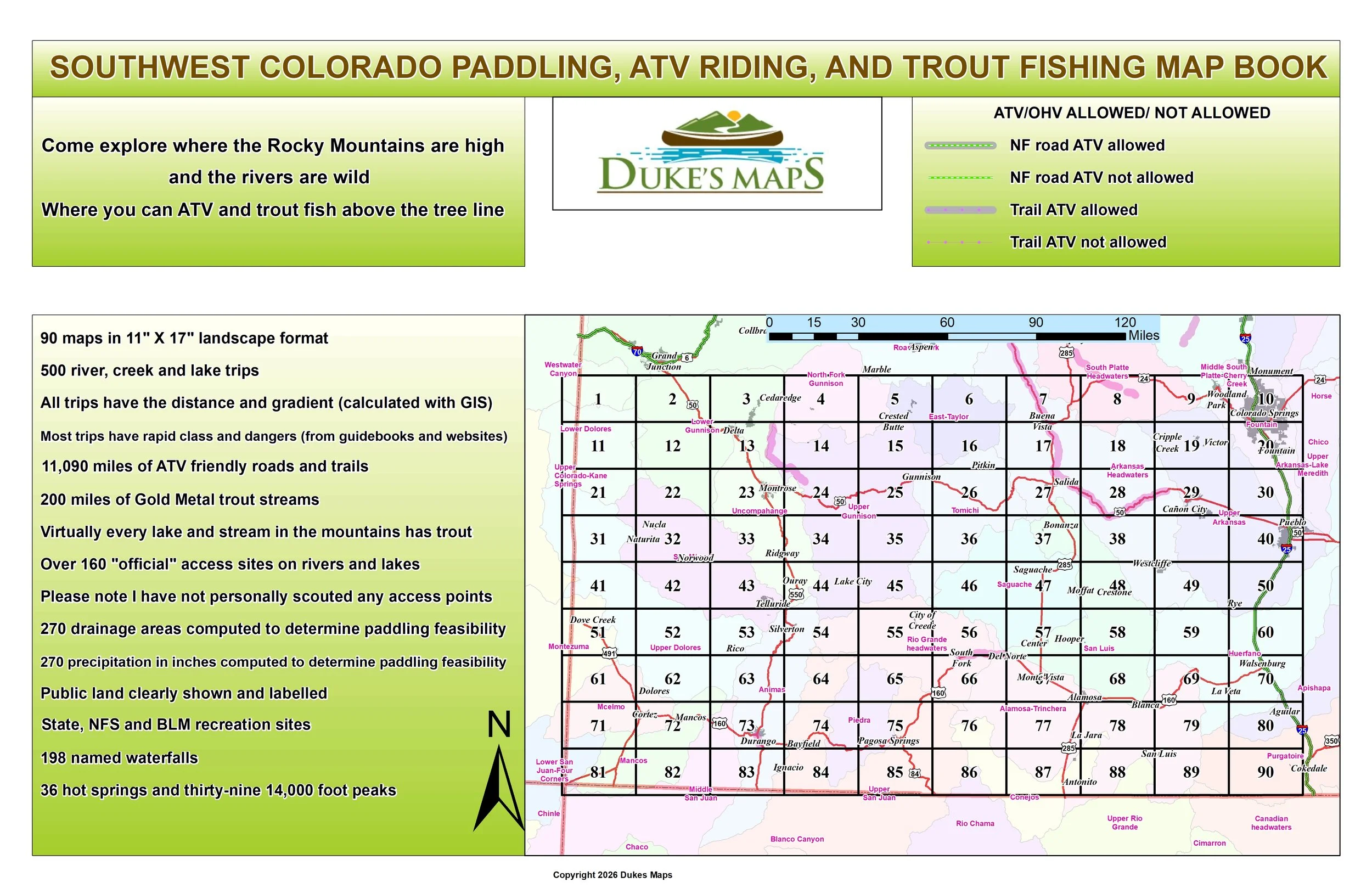
Come explore the Sn Juan Mountains, Colorado Plateau and the Grand Mesa. Take your ATV above tree line to a remote trout lake. Paddle great rivers like the Animas, San Juan, San Miguel, Dolores, and Uncompahgre Rivers.
You’ll receive a secure link to the file lasting 24 hours after the first download.
Some items found in these maps:
90 maps in 11" X 17" landscape format
500 river, creek and lake trips
All trips have the distance and gradient (calculated with GIS)
Most trips have rapid class and dangers (from guidebooks and websites)
11,090 miles of ATV friendly roads and trails
200 miles of Gold Metal trout streams
Virtually every lake and stream in the mountains has trout
Over 160 "official" access sites on rivers and lakes
Please note I have not personally scouted any access points
36 hot springs and thirty-nine 14,000 foot peaks
198 named waterfalls
State, NFS and BLM recreation sites
Public land clearly shown and labelled
270 precipitation in inches computed to determine paddling feasibility
270 drainage areas computed to determine paddling feasibility