 Image 1 of 4
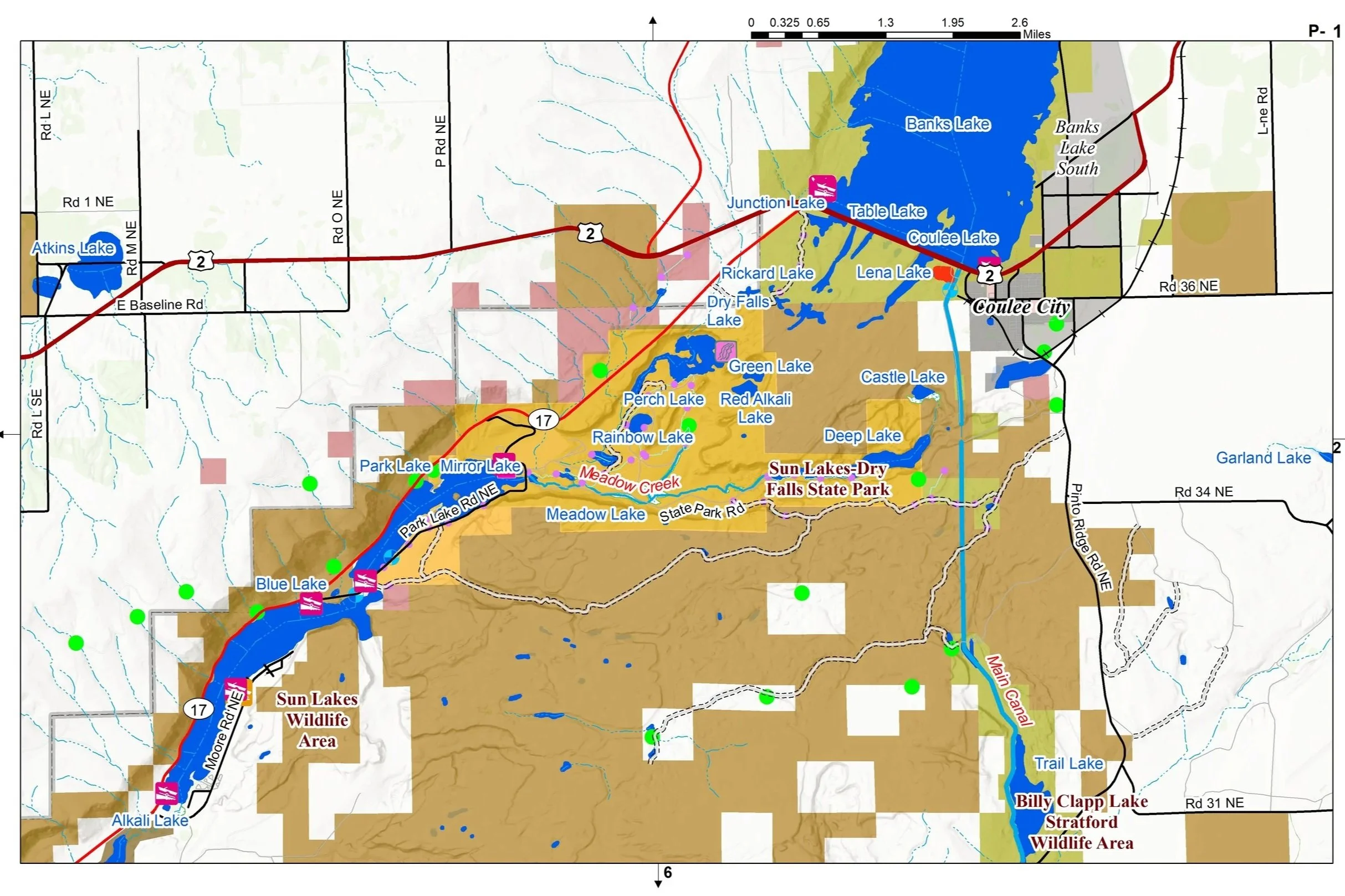 Image 2 of 4
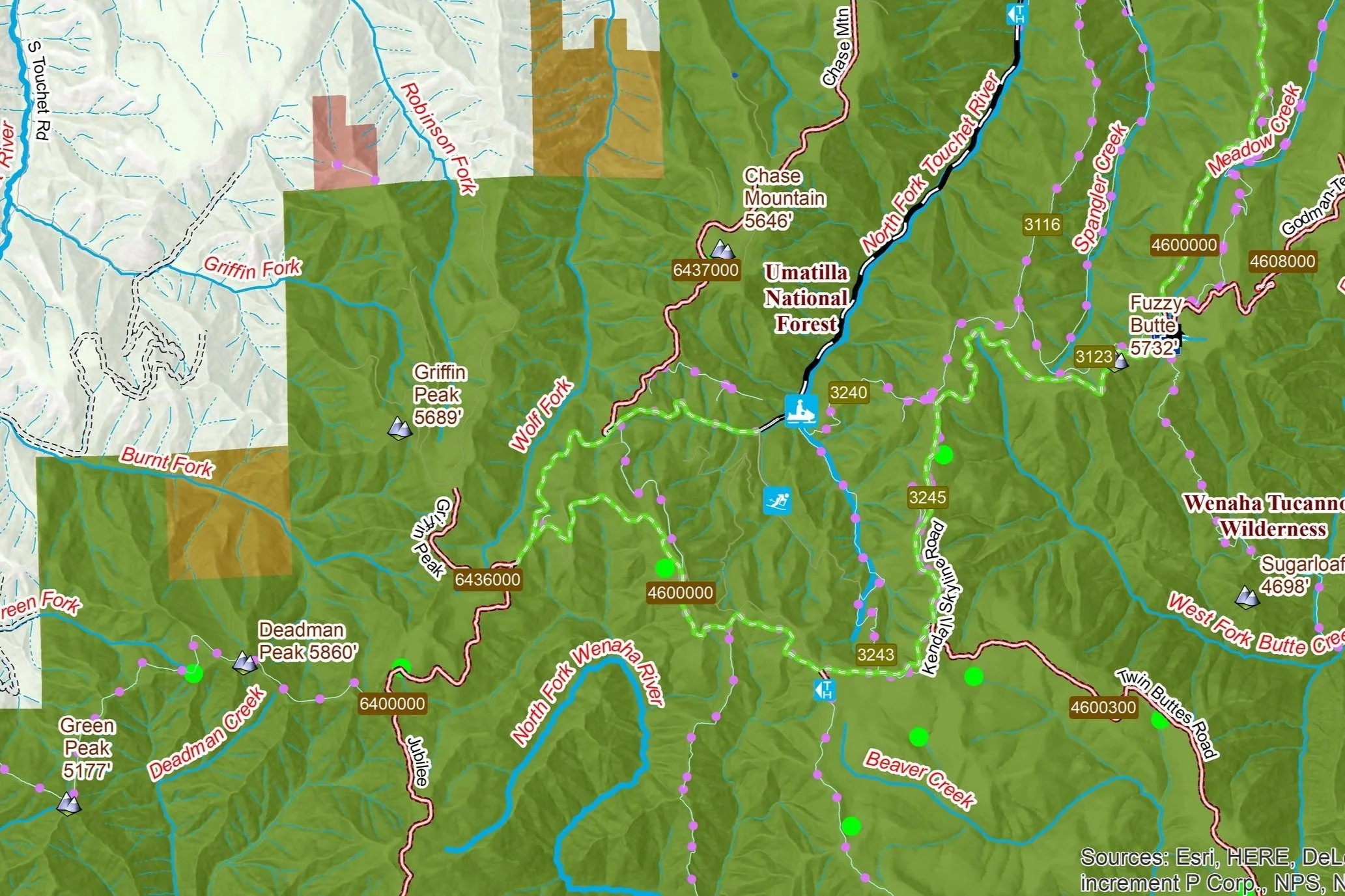 Image 3 of 4
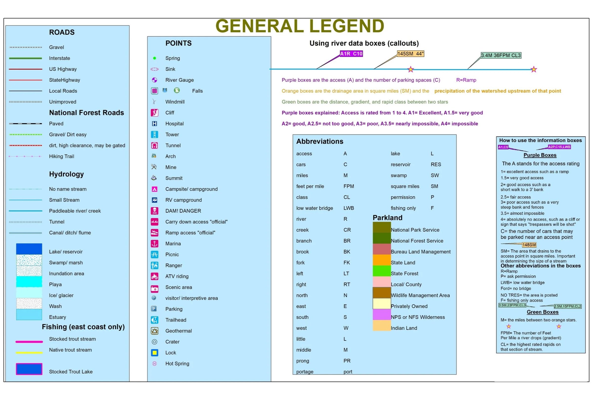 Image 4 of 4
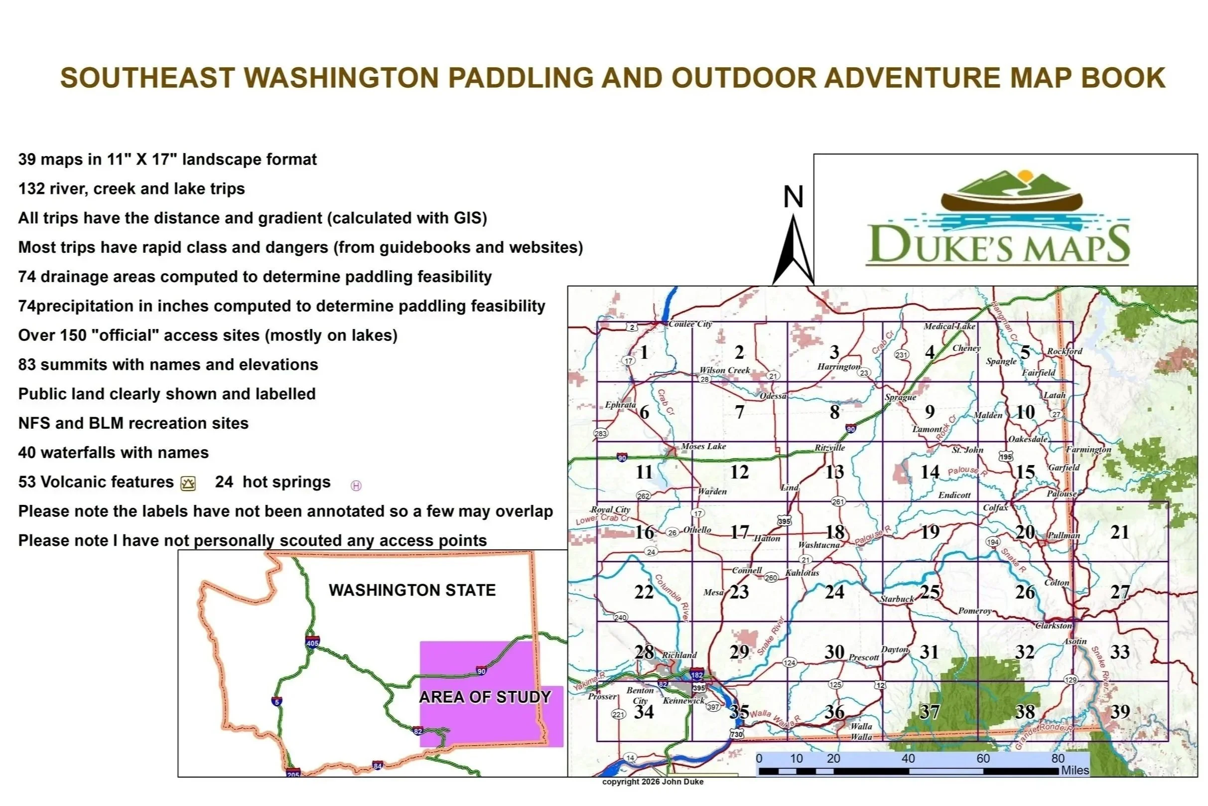
Come explore Southeast Washington defined by the dramatic, rolling vistas of the Palouse Hills and the rugged deep-cut canyons of the Blue Mountains. The Snake River carves a massive gorge along the eastern border, while the Walla Walla and Touchet Rivers wind through the southern valleys.
You’ll receive a secure link to the file lasting 24 hours after the first download.
Some items included in these maps:
39 maps in 11" X 17" landscape format
132 river, creek and lake trips
All trips have the distance and gradient (calculated with GIS)
Most trips have rapid class and dangers (from guidebooks and websites)
74 drainage areas computed to determine paddling feasibility
74 precipitation in inches computed to determine paddling feasibility
Over 150 "official" access sites (mostly on lakes)
83 summits with names and elevations
Public land clearly shown and labelled
NFS and BLM recreation sites
40 waterfalls with names
53 Volcanic features and 24 hot springs
Please note the labels have not been annotated so a few may overlap
Please note I have not personally scouted any access points
While most of this area is very dry it still has quite a few rivers to explore such as the Columbia, Grande Ronde, Touchet, Palouse, Snake, Tuncannon, Walla Walla and Yakima. Or maybe explore and fish unknown creeks like Asotin, Crab, Hangman, Joseph, Mill, Piney and Rock.