 Image 1 of 3
 Image 2 of 3
 Image 3 of 3
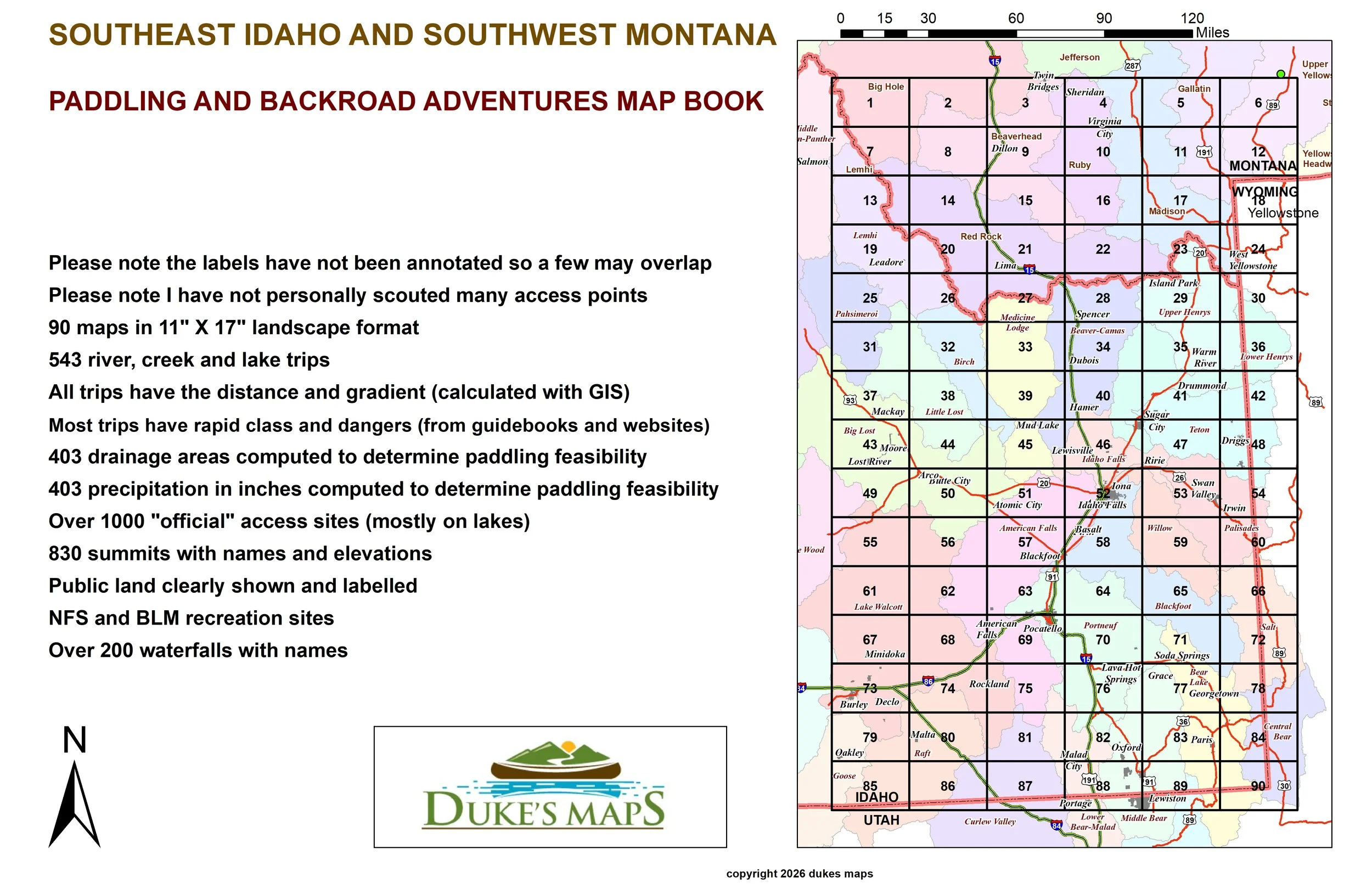
From Yellowstone, to Craters of the Moon, to the Snake River Valley, this region has a lot to explore! From high alpine lakes, to raging whitewater rivers, to dry deserts, this is a place stark of different geography.
You’ll receive a secure link to the file lasting 24 hours after the first download.
Some of the features these maps contain include:
90 maps in 11" X 17" landscape format
Please note the labels have not been annotated so a few may overlap
Please note I have not personally scouted many access points
543 river, creek and lake trips
All trips have the distance and gradient (calculated with GIS)
Most trips have rapid class and dangers (from guidebooks and websites)
403 drainage areas computed to determine paddling feasibility
403 precipitation in inches computed to determine paddling feasibility
Over 1000 "official" access sites (mostly on lakes)
830 summits with names and elevations
Public land clearly shown and labelled
NFS and BLM recreation sites
Over 200 waterfalls with names
Paddle and fish great rivers like The Blackfoot, Gallatin, Greys and Madison River. Also: The Henrys Fork, Madison, Snake, and Teton Rivers.