 Image 1 of 4
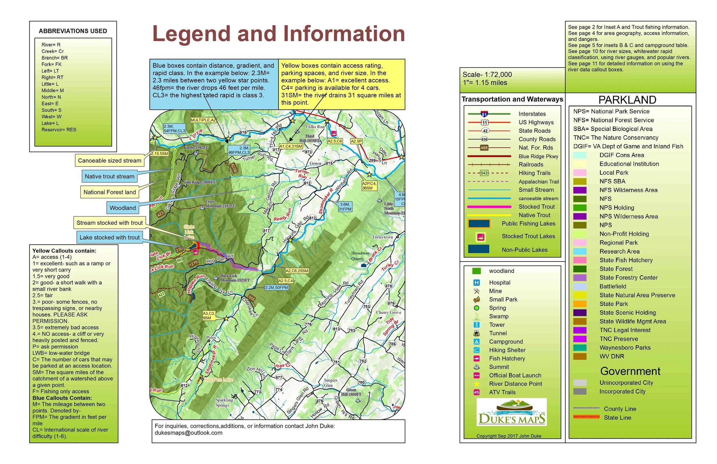 Image 2 of 4
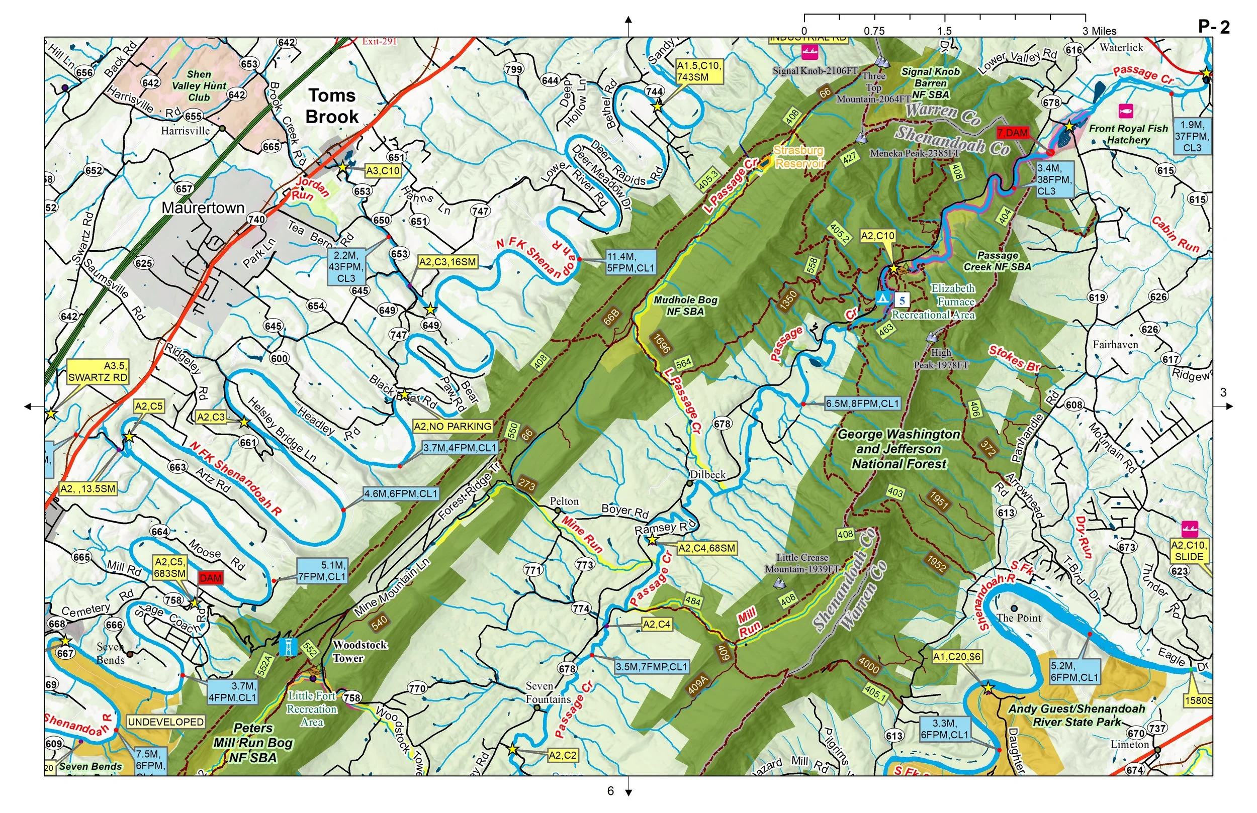 Image 3 of 4
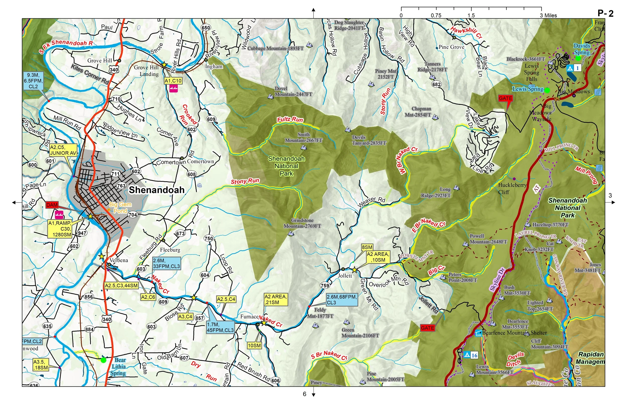 Image 4 of 4
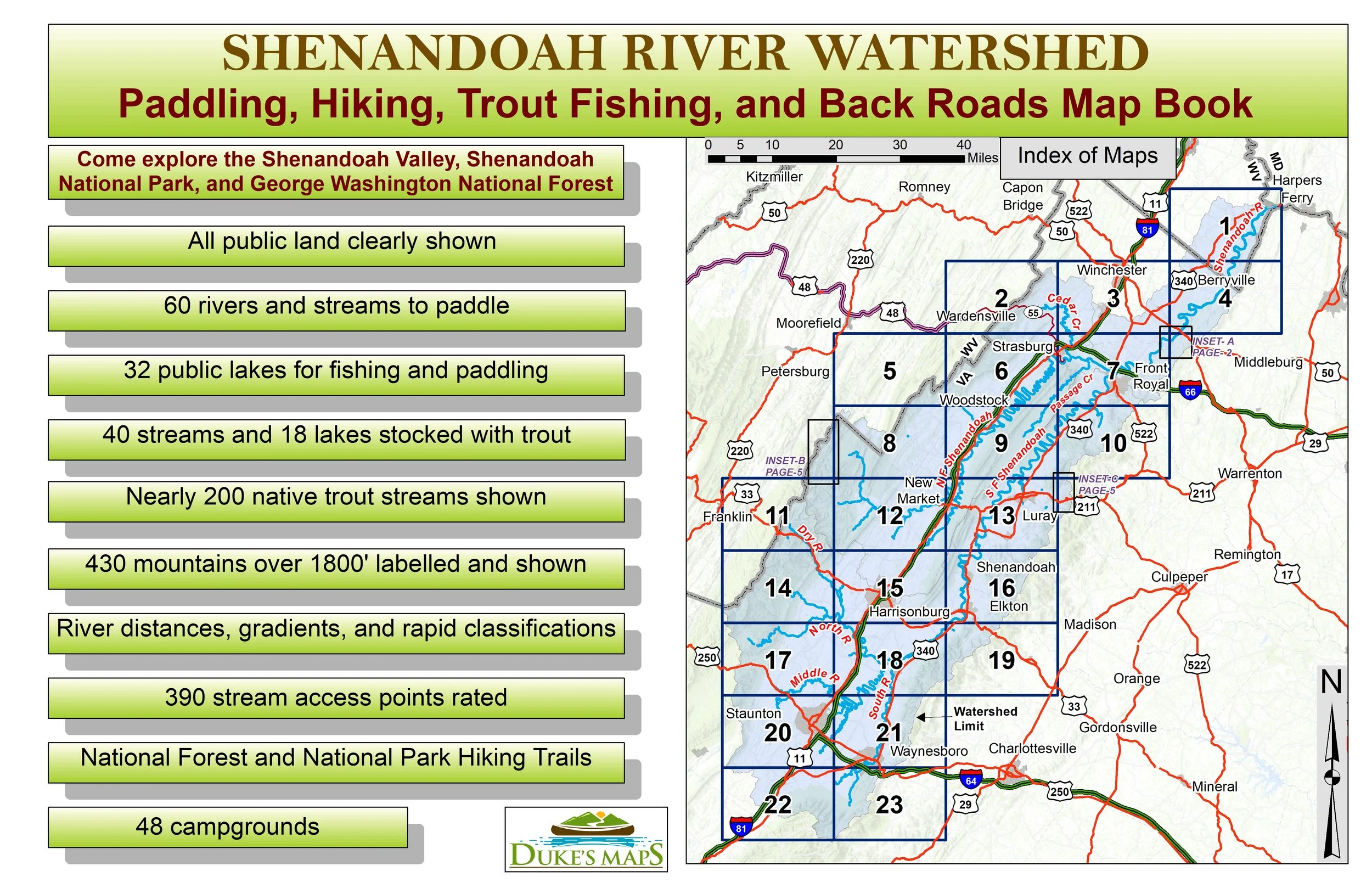
Come explore the Shenandoah Valley, Shenandoah National Park, and George Washington National Forest. Paddle classic Whitewater streams like Passage, Stony, and Cedar Creeks. Float fish well over a hundred miles on the Shenandoah River and its forks the North and South Forks.
There are 23 maps in 11” X 17” landscape format. Download to your computer and print at will.
You will receive a secure link to the file lasting 24 hours after the first download.
Some things these maps show:
60 rivers and streams to paddle
390 stream access points personally visited and rated
River distances, gradients, and rapid classifications
32 public lakes for fishing and paddling
40 streams and 18 lakes stocked with trout
Nearly 200 native trout streams shown
430 mountains over 1800' labelled and shown
National Forest and National Park Hiking Trails
All public land clearly shown