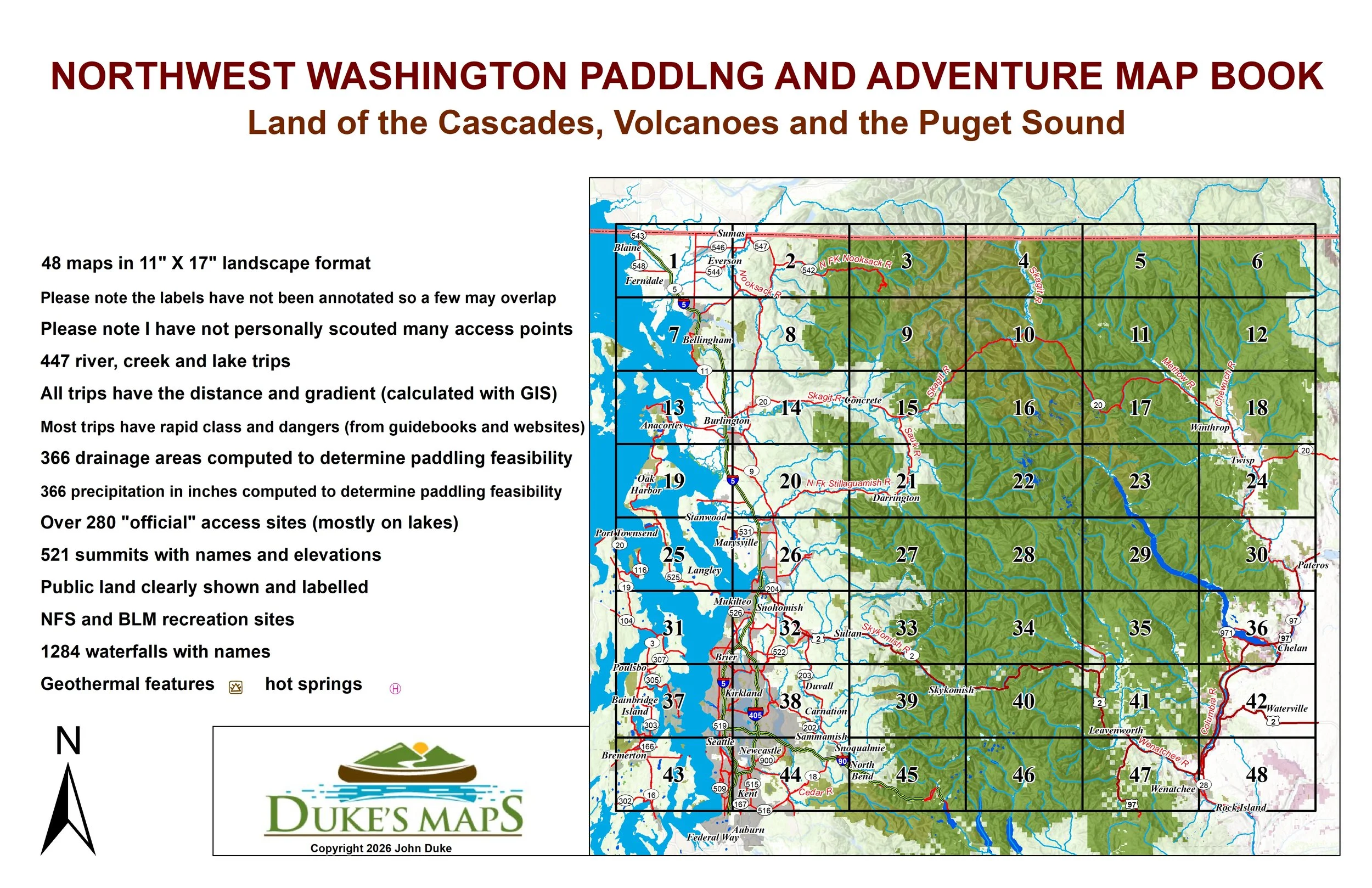
 Image 1 of 4
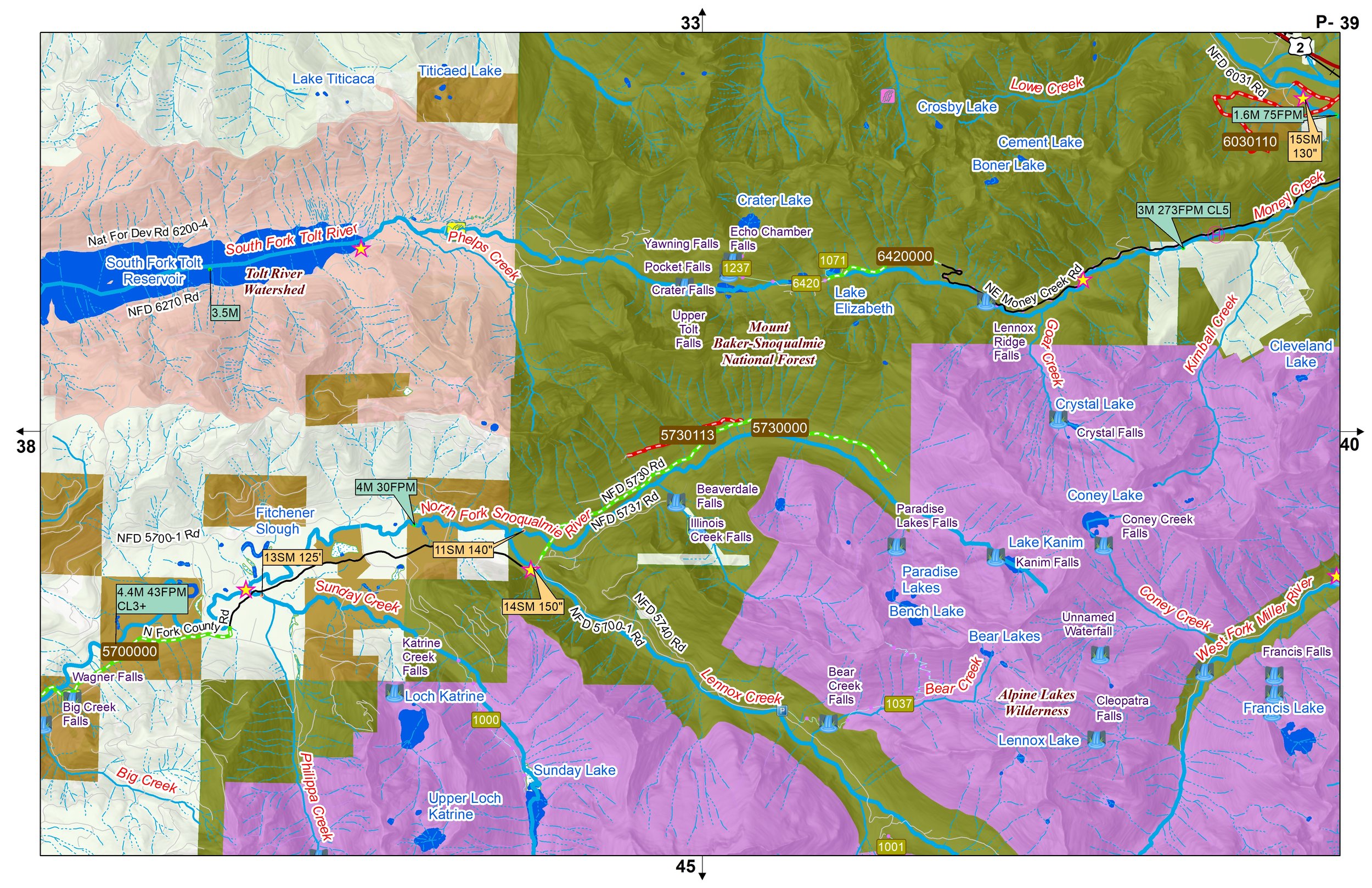 Image 2 of 4
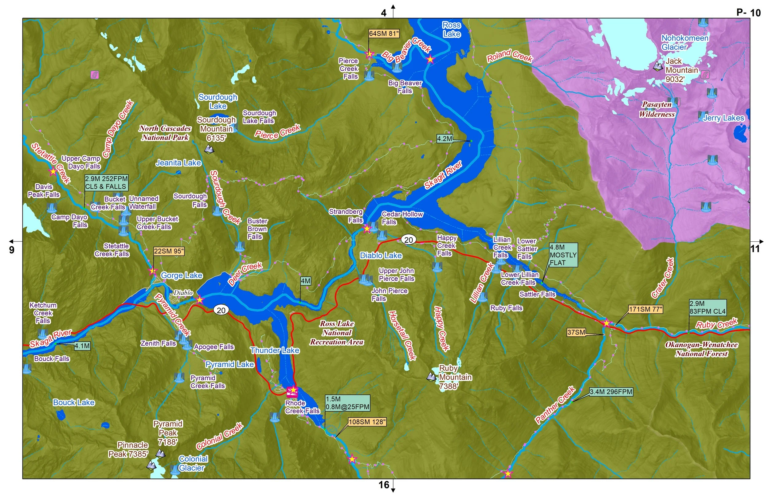 Image 3 of 4
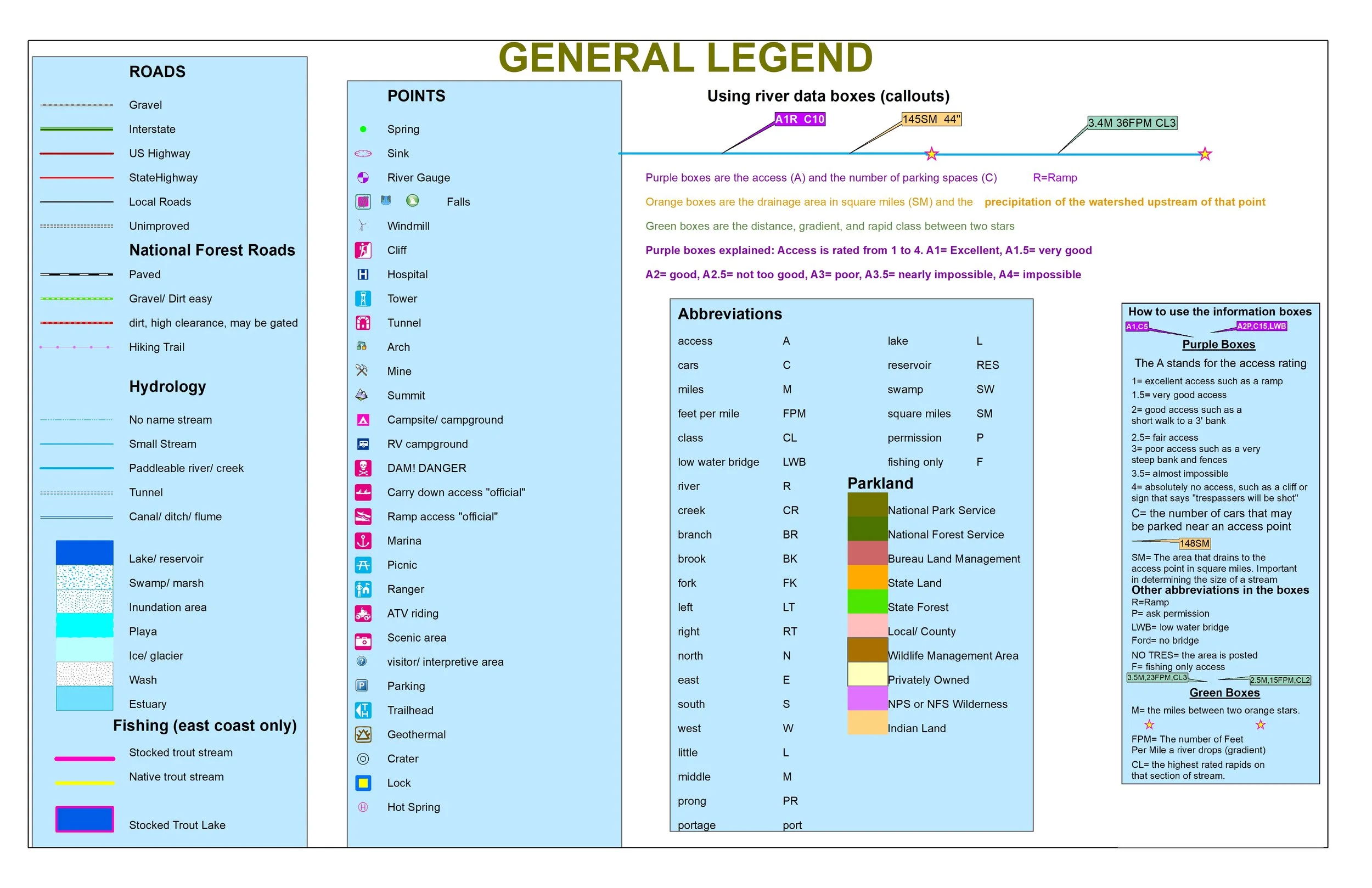 Image 4 of 4
Come Explore the Land of the Cascades, Volcanoes and the Puget Sound.
You’ll receive a secure link to the file lasting 24 hours after the first download.
Some items on these maps:
48 maps in 11" X 17" landscape format
Volcanic features and hot springs
447 river, creek and lake trips
All trips have the distance and gradient (calculated with GIS)
Most trips have rapid class and dangers (from guidebooks and websites)
366 drainage areas computed to determine paddling feasibility
366 precipitation in inches computed to determine paddling feasibility
Over 280 "official" access sites (mostly on lakes)
Please note the labels have not been annotated so a few may overlap
Please note I have not personally scouted many access points
521 summits with names and elevations
Public land clearly shown and labelled
NFS and BLM recreation sites
1284 waterfalls with names
Paddle and fish great rivers like the Columbia, Nooksack, Skagit, Sauk, Stillaguamish, Skykomish, Cedar, Wenatchee, Methow, and Chewuch.