 Image 1 of 4
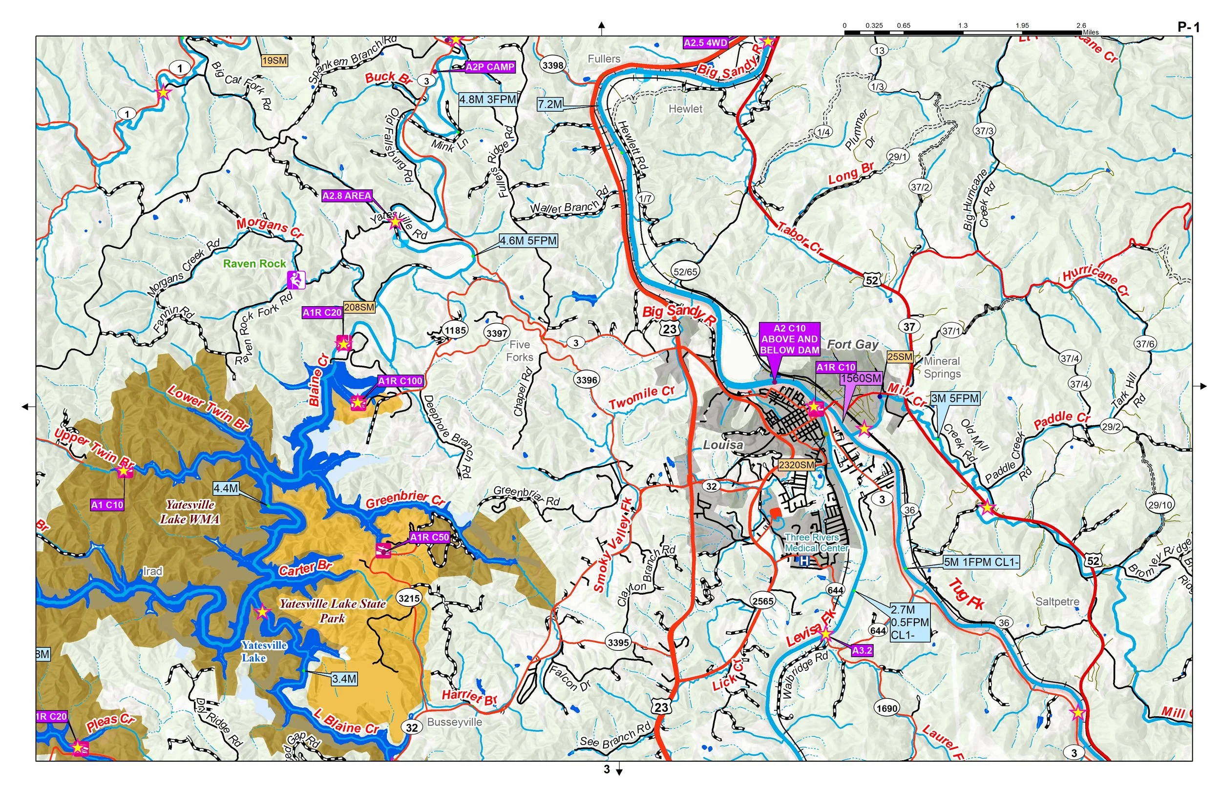 Image 2 of 4
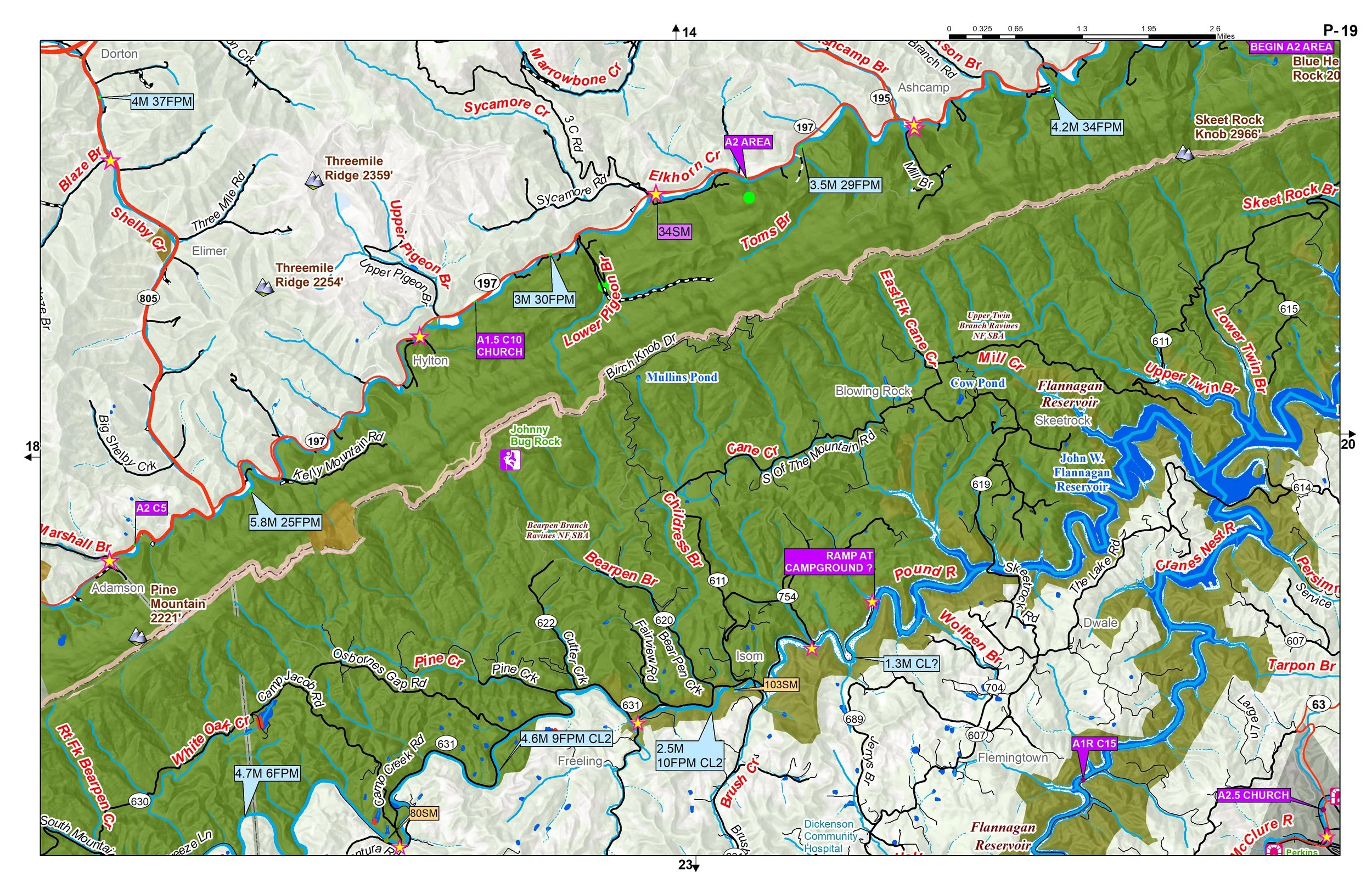 Image 3 of 4
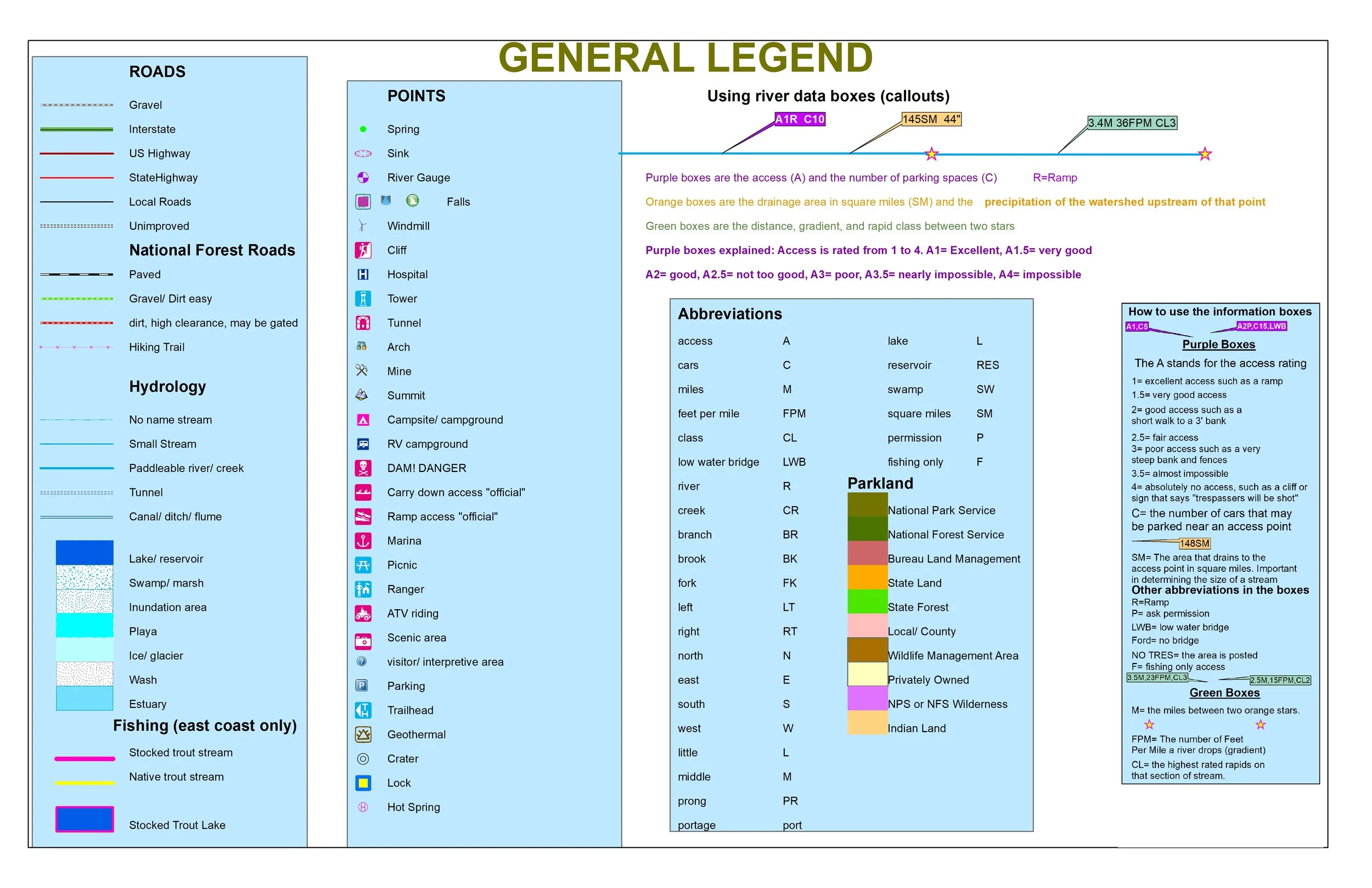 Image 4 of 4
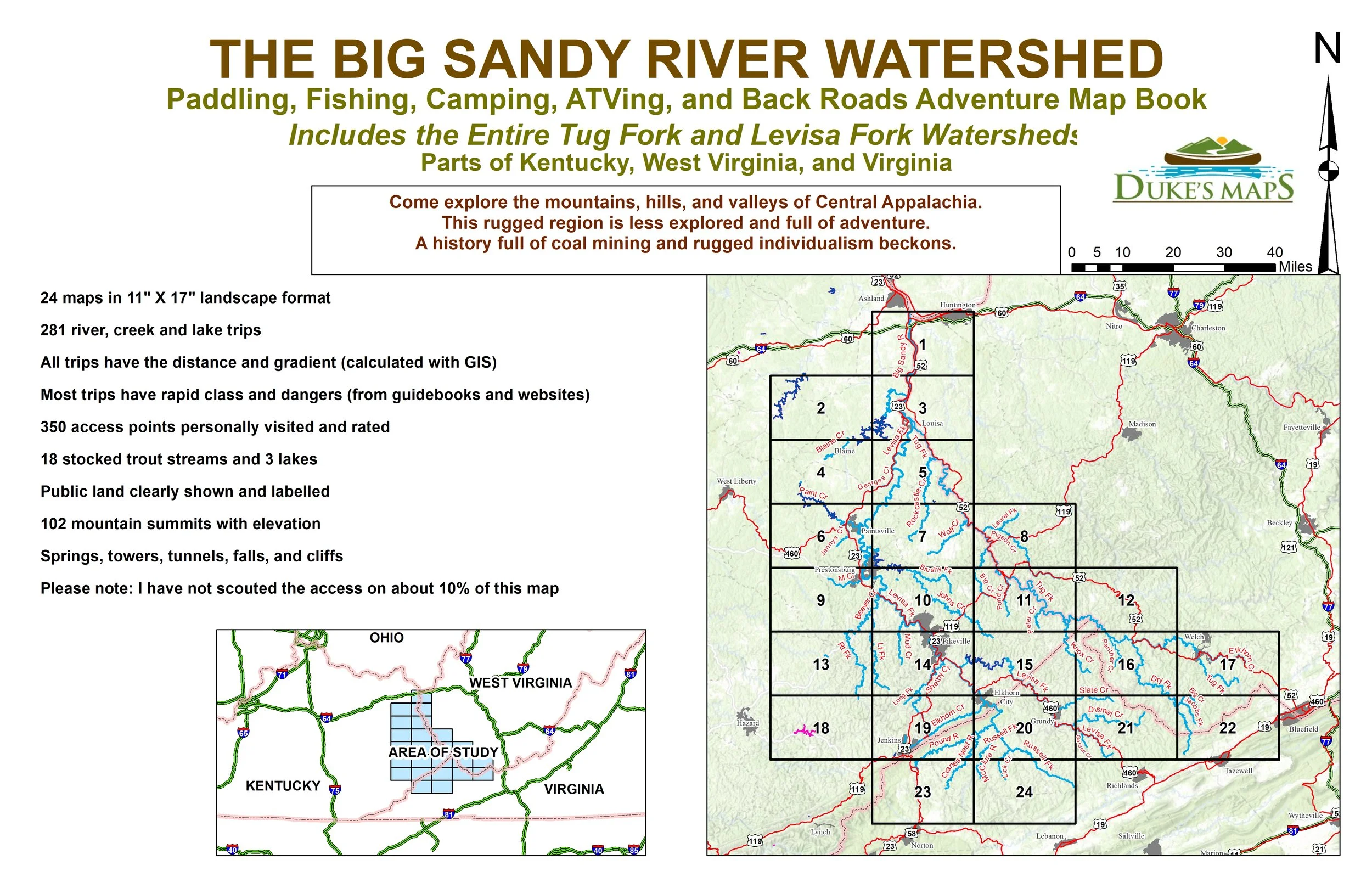
Paddling, fishing, camping, and back-roads adventure map book. Includes the entire Tug Fork and Levisa Fork watersheds. Come explore the mountains, hills, and valleys of Central Appalachia, a rugged and largely undiscovered region full of outdoor opportunity. Rich in history shaped by coal mining and fierce local independence, this area offers scenic routes, quiet waterways, and off-the-beaten-path adventures.
Some items these maps include:
You’ll receive a secure link to the file lasting 24 hours after the first download.
24 maps in 11" X 17" landscape format
281 river, creek and lake trips
All trips have the distance and gradient (calculated with GIS)
Most trips have rapid class and dangers (from guidebooks and websites)
350 access points personally visited and rated
18 stocked trout streams and 3 lakes
Public land clearly shown and labelled
102 mountain summits with elevation
Springs, towers, tunnels, falls, and cliffs
Please note: I have not scouted the access on about 10% of this map
Float fish classics like the Levisa and Tug Forks. Explore unknown creeks like Dry Fork, Elkhorn, Panther, Rockcastle, and Johns Creek. Try the Whitewater of the Russell Fork canyon, or grassy and Hunts creeks.