 Image 1 of 3
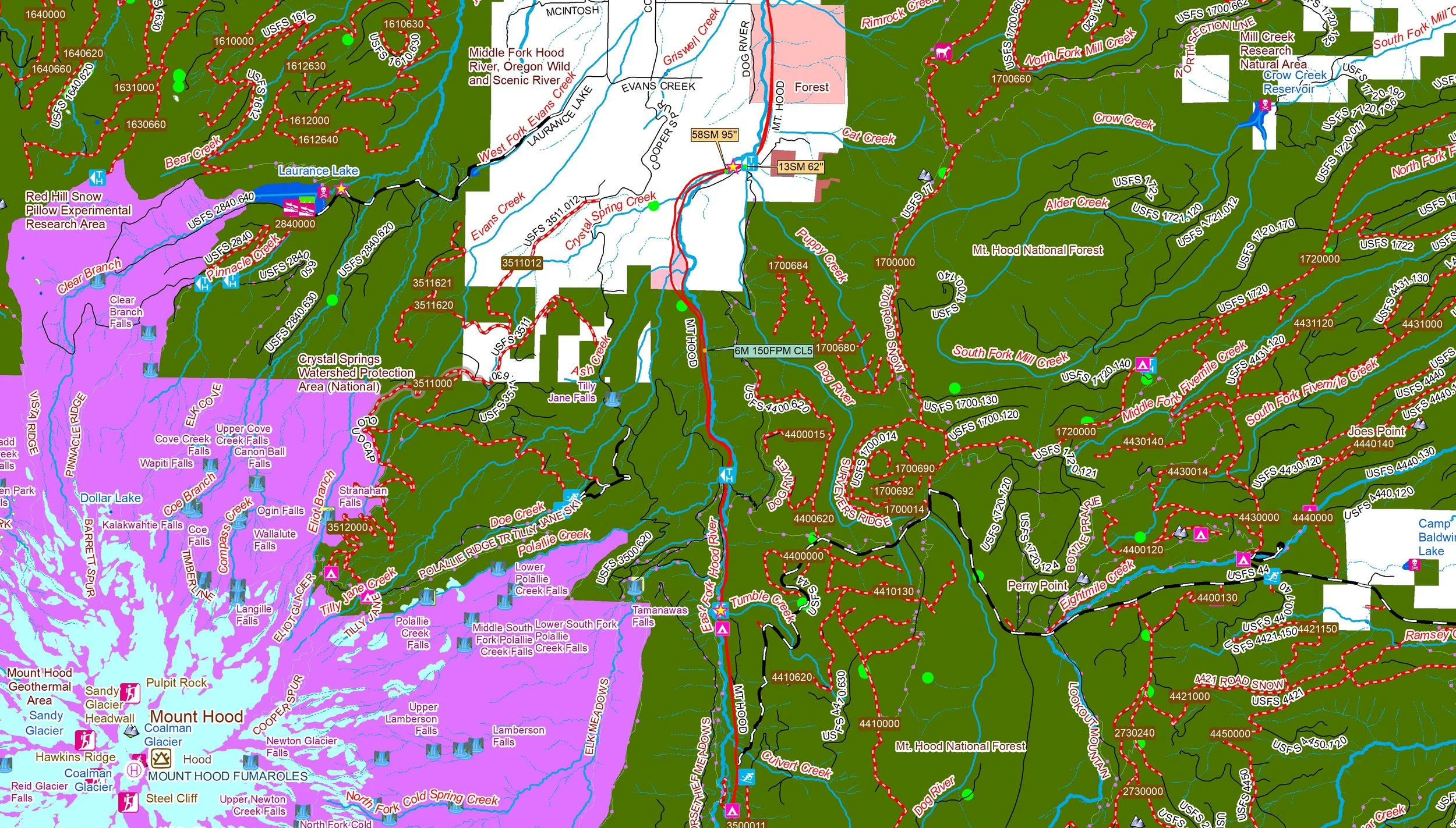 Image 2 of 3
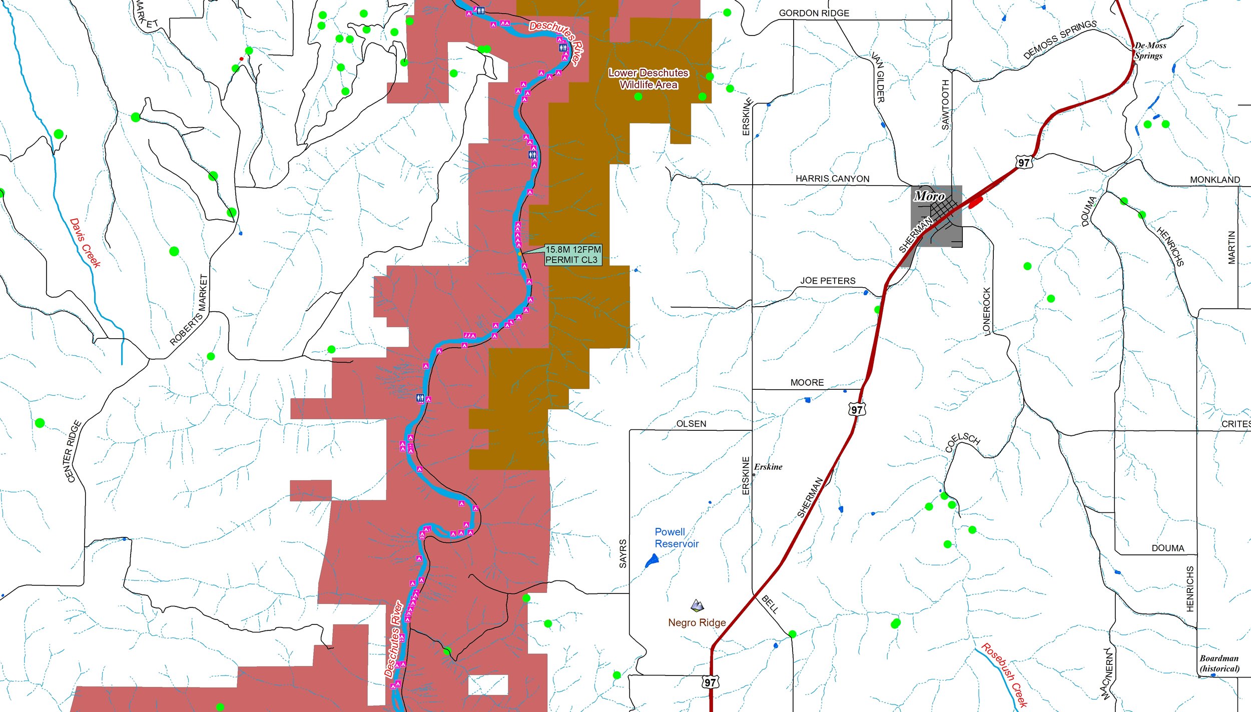 Image 3 of 3
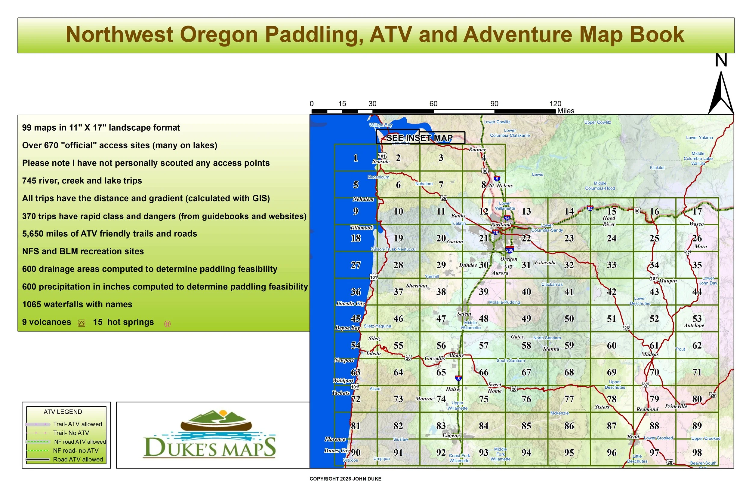
Come ATV the Coastal and Cascade Mountains. Paddle classic whitewater rivers like the Deschutes, Clackamas, Hood and Santiam. Or float around om the Willamette of Columbia Rivers.
Customers receive a secure link to the file lasting 24 hours after the first download
Some items found in these maps include:
99 maps in 11" X 17" landscape format
Over 670 "official" access sites (many on lakes)
Please note I have not personally scouted any access points
745 river, creek and lake trips
All trips have the distance and gradient (calculated with GIS)
370 trips have rapid class and dangers (from guidebooks and websites)
5,650 miles of ATV friendly trails and roads
NFS and BLM recreation sites
600 drainage areas computed to determine paddling feasibility
600 precipitation in inches computed to determine paddling feasibility
1065 waterfalls with names