 Image 1 of 3
 Image 2 of 3
 Image 3 of 3
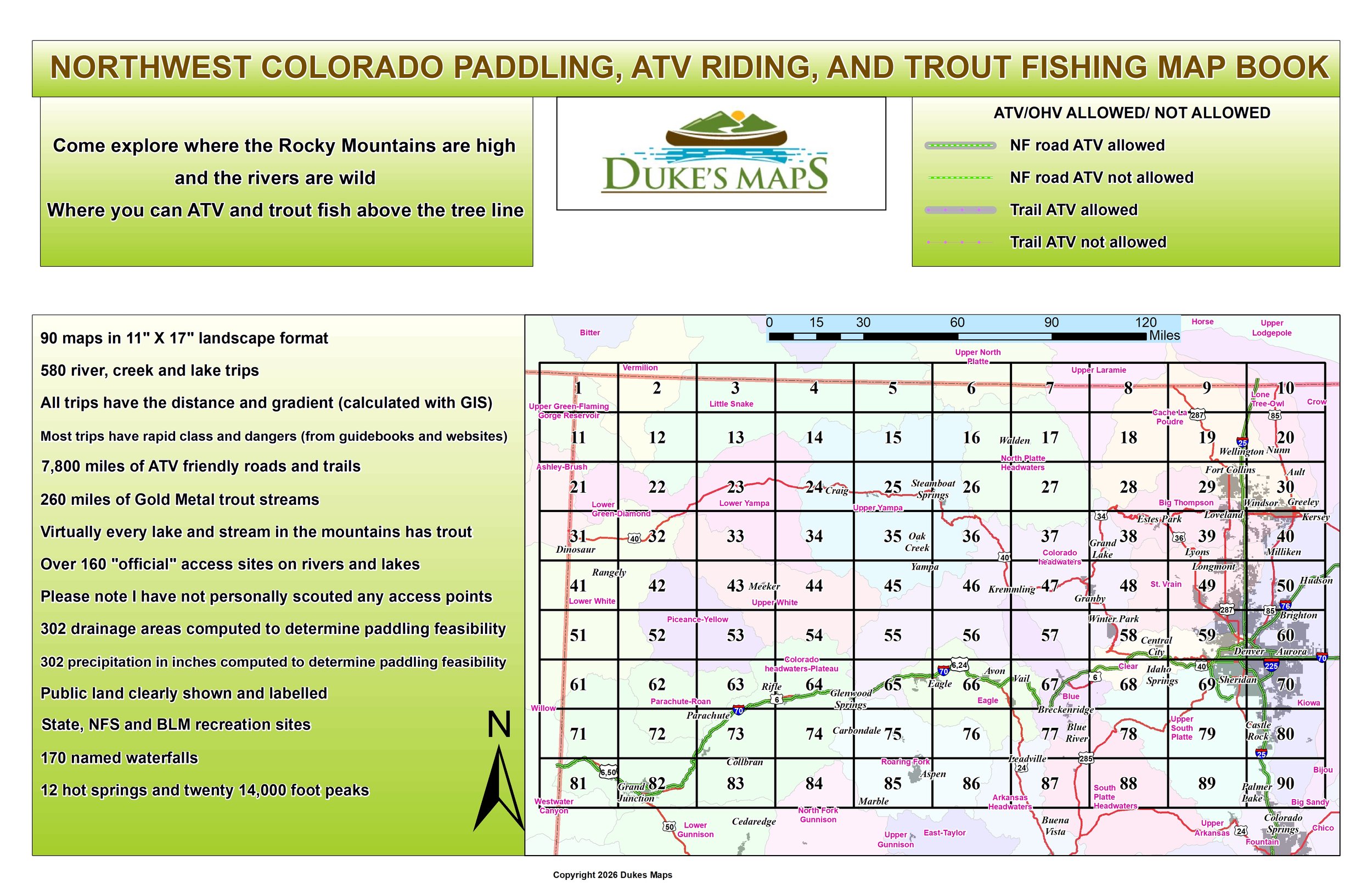
WOW, such beauty here in Rocky Mountain High! Try multi-day rafting trips in canyons on the Yampa, Green, or Colorado rivers. Take your ATV up above tree line to a secluded trout lake. Try crashing down some of the front range whitewater like the Cache La Poudre, Big Thompson, or South Platte rivers.
You’ll receive a secure link to the file lasting 24 hours after the first download.
Some items in these maps include:
90 maps in 11" X 17" landscape format
580 river, creek and lake trips
All trips have the distance and gradient (calculated with GIS)
Most trips have rapid class and dangers (from guidebooks and websites)
7,800 miles of ATV friendly roads and trails
260 miles of Gold Metal trout streams
Virtually every lake and stream in the mountains has trout
Over 160 "official" access sites on rivers and lakes
Please note I have not personally scouted any access points
Public land clearly shown and labelled
State, NFS and BLM recreation sites
170 named waterfalls
12 hot springs and twenty 14,000 foot peaks
302 precipitation in inches computed to determine paddling feasibility
302 drainage areas computed to determine paddling feasibility