 Image 1 of 4
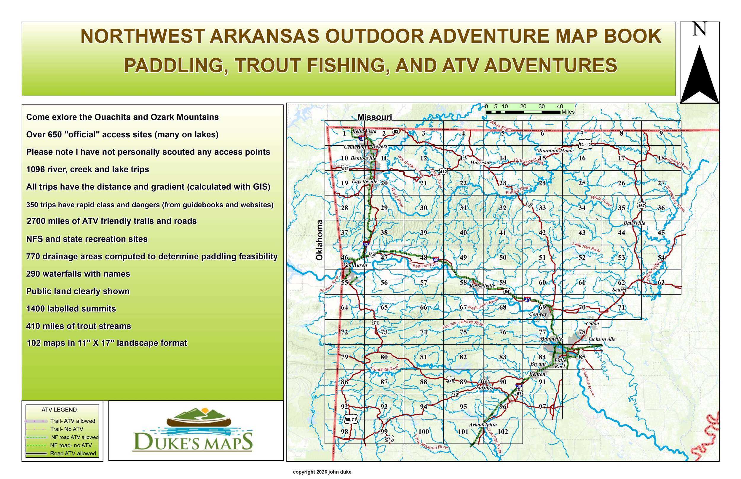 Image 2 of 4
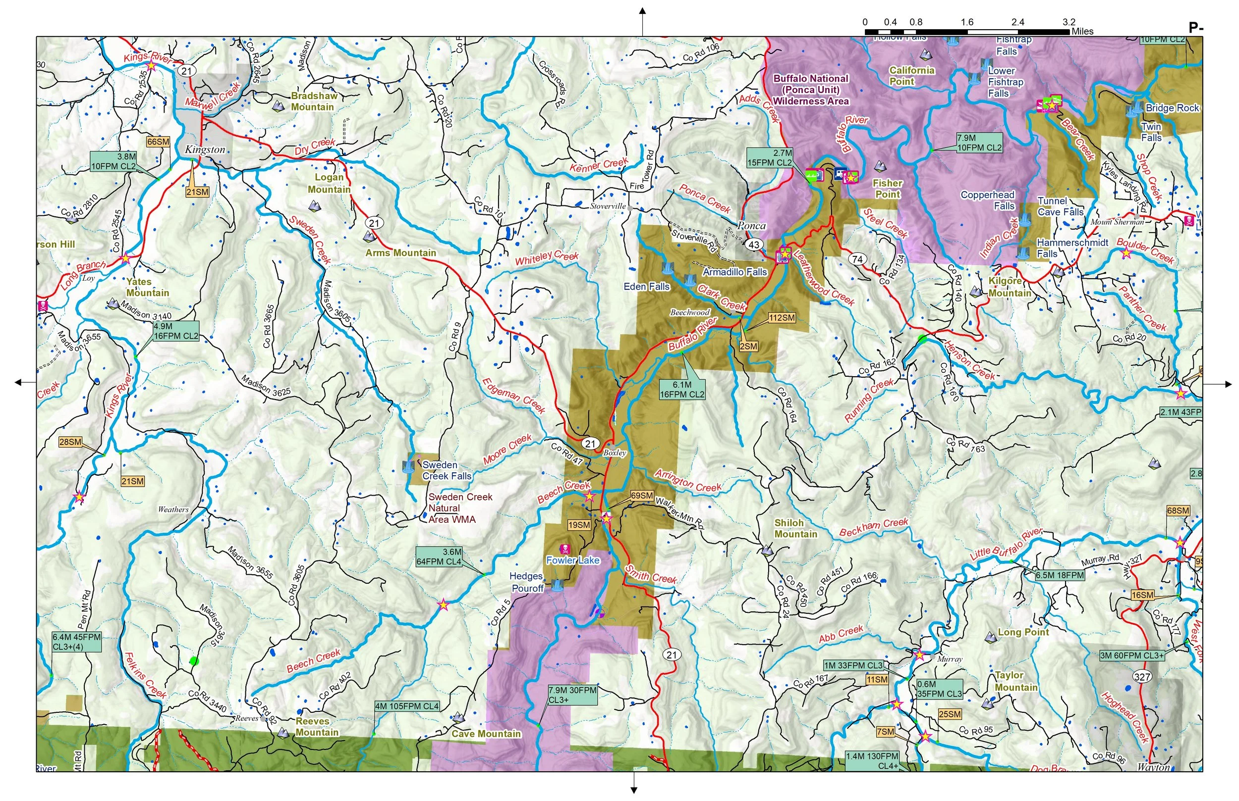 Image 3 of 4
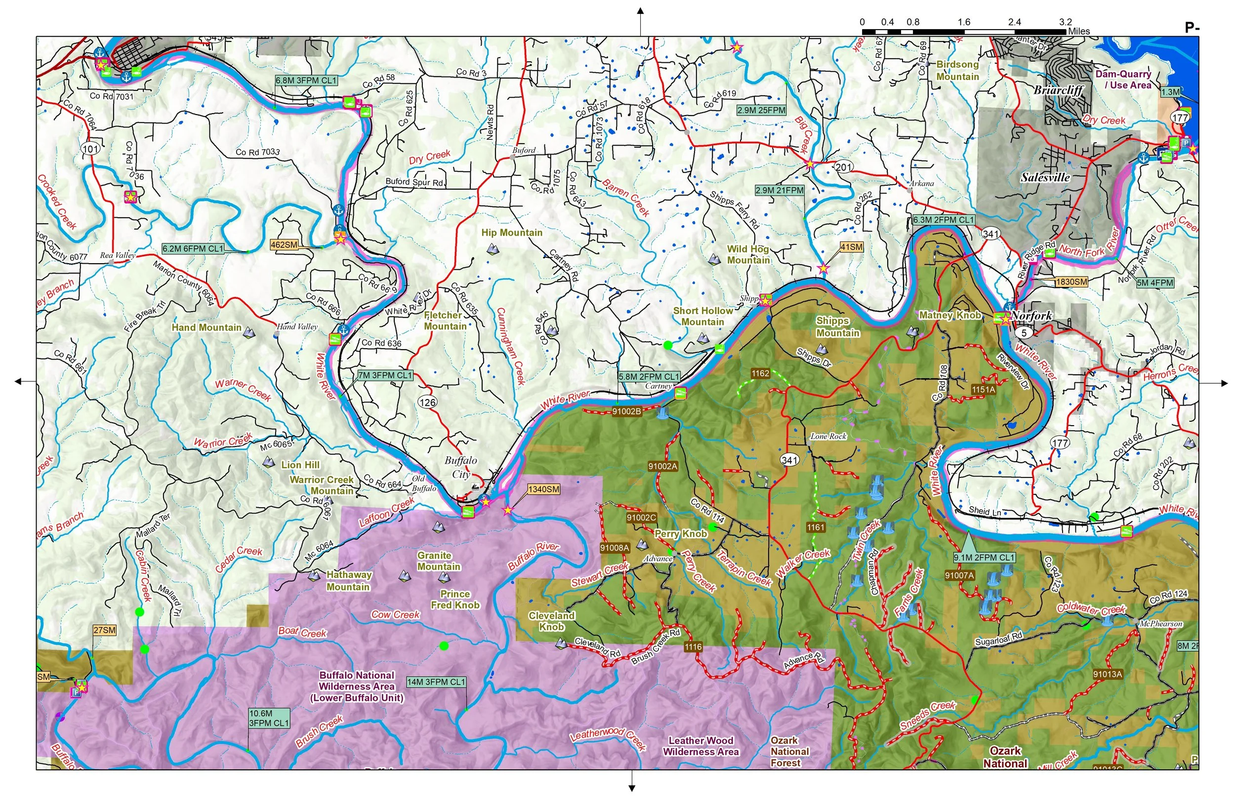 Image 4 of 4
PADDLING, TROUT FISHING, AND ATV ADVENTURES
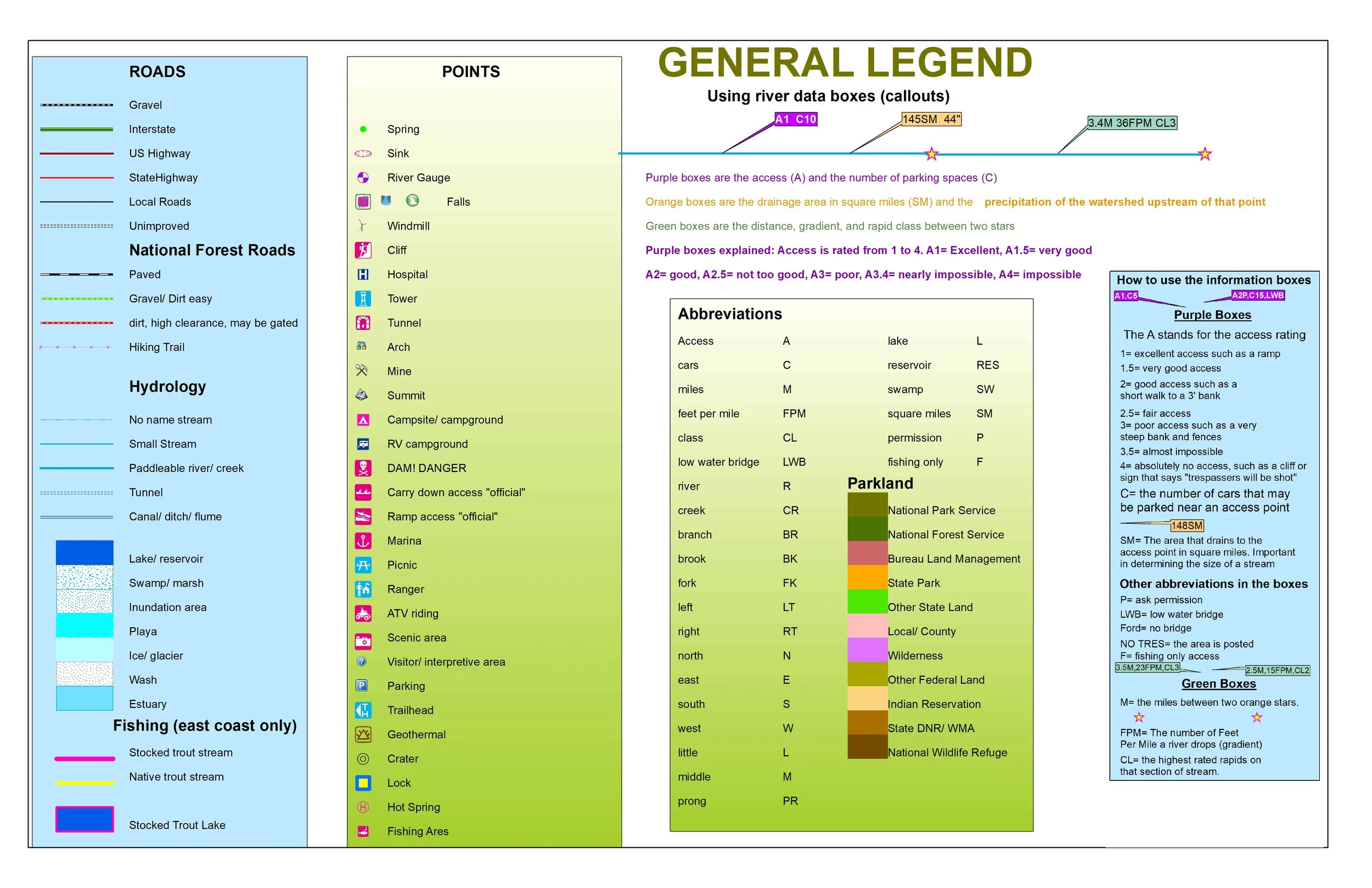
Come explore the Ouachita and Ozark Mountains
You’ll receive a secure link to the file lasting 24 hours after the first download
Some items in these maps include:
102 maps in 11" X 17" landscape format
Over 650 "official" access sites (many on lakes)
Please note I have not personally scouted any access points
1096 river, creek and lake trips
All trips have the distance and gradient (calculated with GIS)
350 trips have rapid class and dangers (from guidebooks and websites)
2700 miles of ATV friendly trails and roads
NFS and state recreation sites
770 drainage areas computed to determine paddling feasibility
290 waterfalls with names
Public land clearly shown
1400 labelled summits
410 miles of trout streams
PADDLING, TROUT FISHING, AND ATV ADVENTURES
Come explore the Ouachita and Ozark Mountains
You’ll receive a secure link to the file lasting 24 hours after the first download
Some items in these maps include:
102 maps in 11" X 17" landscape format
Over 650 "official" access sites (many on lakes)
Please note I have not personally scouted any access points
1096 river, creek and lake trips
All trips have the distance and gradient (calculated with GIS)
350 trips have rapid class and dangers (from guidebooks and websites)
2700 miles of ATV friendly trails and roads
NFS and state recreation sites
770 drainage areas computed to determine paddling feasibility
290 waterfalls with names
Public land clearly shown
1400 labelled summits
410 miles of trout streams