 Image 1 of 4
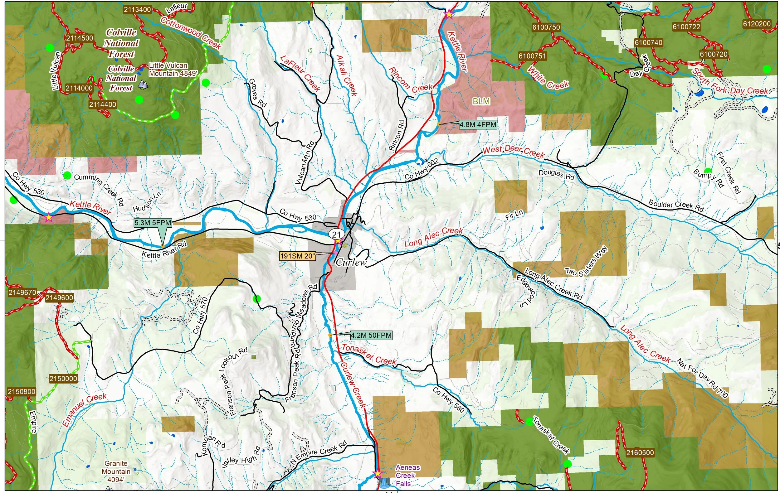 Image 2 of 4
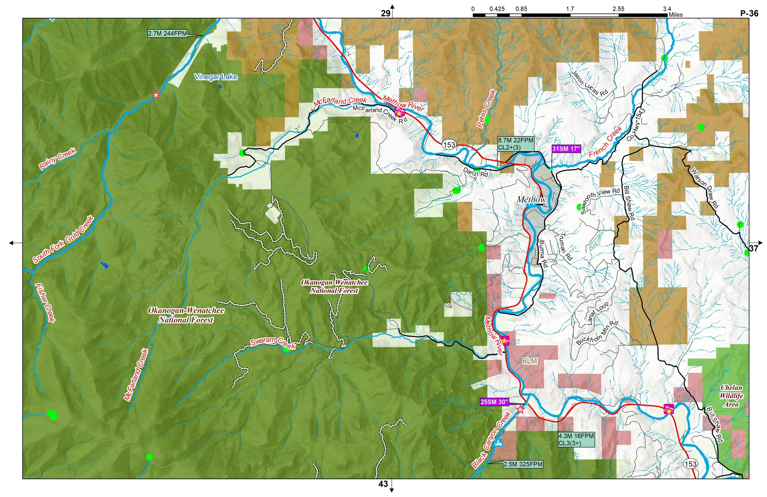 Image 3 of 4
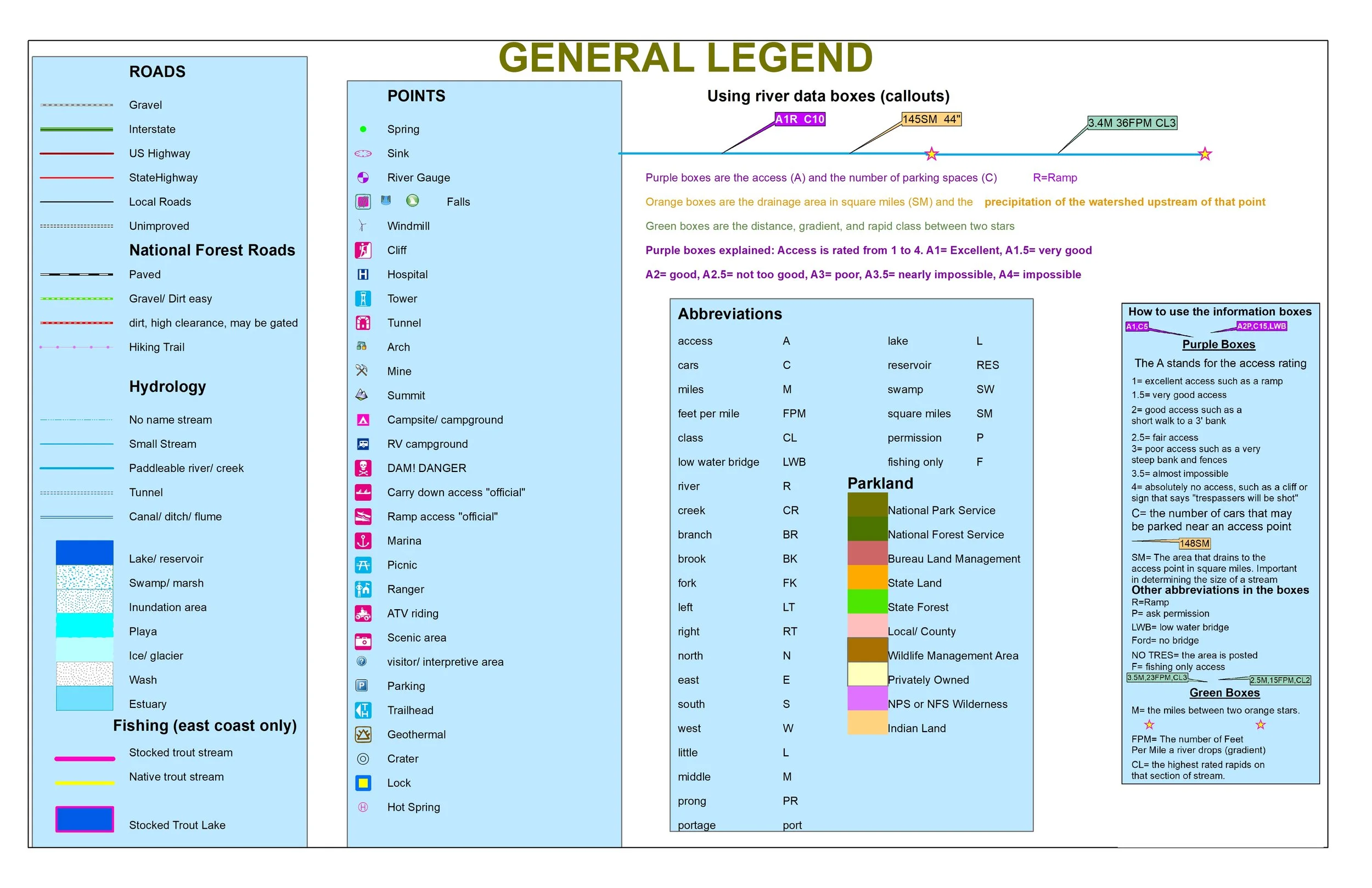 Image 4 of 4
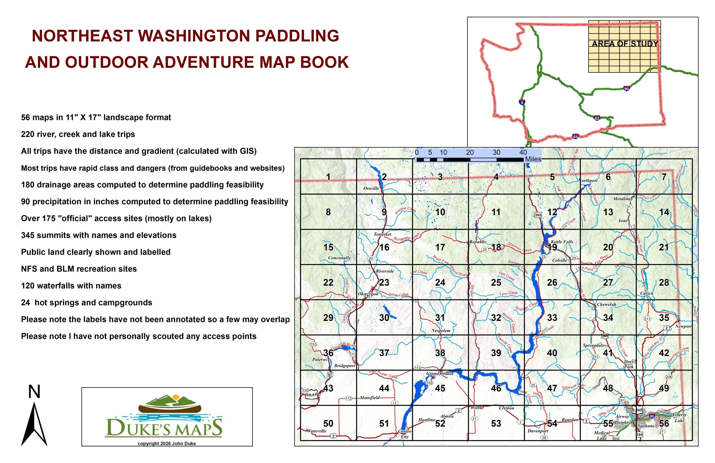
The geography of Northeast Washington is defined by the rugged beauty of the Columbia Mountains, a series of high ridges and deep valleys that stand in sharp contrast to the flat plateaus to the south. This region is dominated by the Okanogan Highlands and the Selkirk Range, featuring dense evergreen forests and rocky peaks. Carving through this mountainous terrain are several powerful waterways, most notably the Columbia River, which acts as the lifeblood of the area as it flows south from Canada.
You’ll receive a secure link to the file lasting 24 hours after the first download.
Some items these maps include:
56 maps in 11" X 17" landscape format
220 river, creek and lake trips
All trips have the distance and gradient (calculated with GIS)
Most trips have rapid class and dangers (from guidebooks and websites)
180 drainage areas computed to determine paddling feasibility
90 precipitation in inches computed to determine paddling feasibility
Over 175 "official" access sites (mostly on lakes)
345 summits with names and elevations
Public land clearly shown and labelled
NFS and BLM recreation sites
120 waterfalls with names
24 hot springs and campgrounds
Please note the labels have not been annotated so a few may overlap
Please note I have not personally scouted any access points
Paddle whitewater creeks like Big Sheep, Calispell, Onion, Sherman, and Sullivan. Whitewater rivers include the Kettle and Spokane. Lots of good float fishing rivers like the Columbia (100% dammed), Colville, Okanogan, Pend Oreille, and Sanpoil Rivers.