 Image 1 of 3
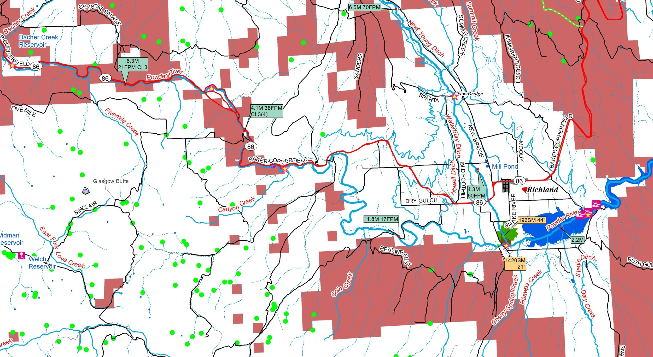 Image 2 of 3
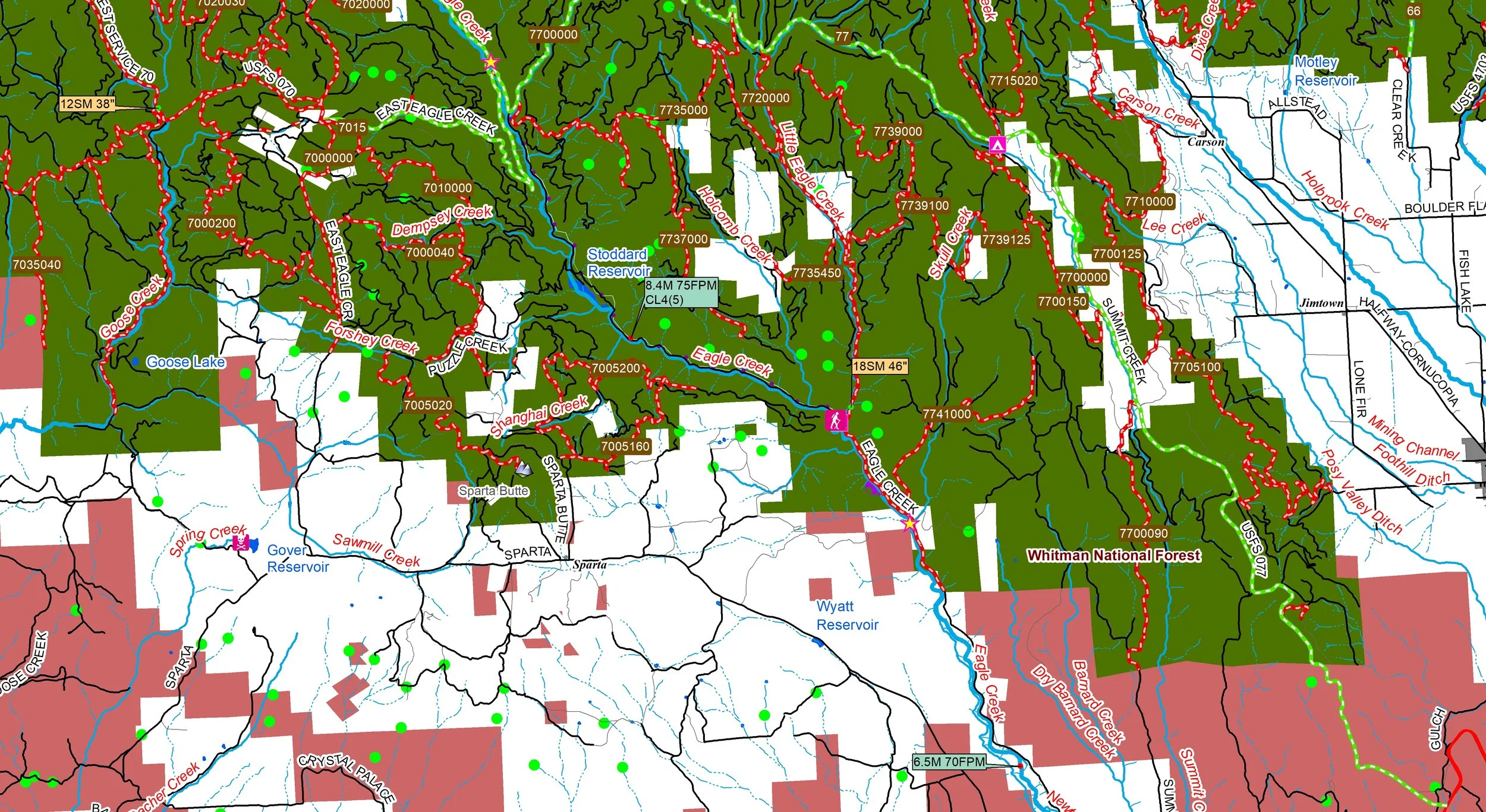 Image 3 of 3
Come explore a diverse, rugged geography defined by high alpine peaks, deep river gorges, and expansive semi-arid plateaus. This region is home to the Blue Mountains, which support vast forests despite the surrounding dry climate, and the Wallowa Mountains, often called the "Swiss Alps of Oregon" for their jagged granite peaks.
You’ll receive a secure link to the file lasting 24 hours after the first download.
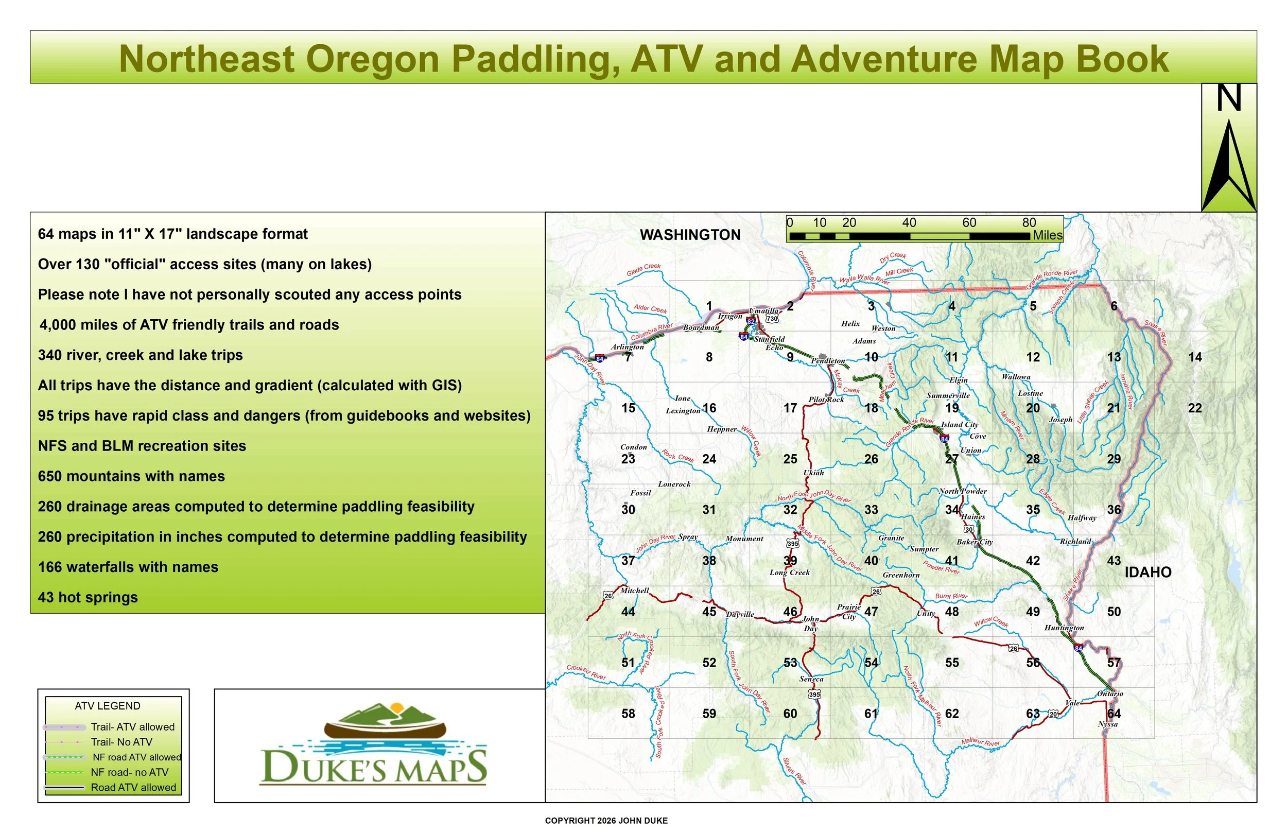
64 maps in 11" X 17" landscape format
4,000 miles of ATV friendly trails and roads
Over 130 "official" access sites (many on lakes)
Please note I have not personally scouted any access points
340 river, creek and lake trips
All trips have the distance and gradient (calculated with GIS)
95 trips have rapid class and dangers (from guidebooks and websites)
NFS and BLM recreation sites
650 mountains with names
260 drainage areas computed to determine paddling feasibility
260 precipitation in inches computed to determine paddling feasibility
166 waterfalls and 43 hot springs
Come explore a diverse, rugged geography defined by high alpine peaks, deep river gorges, and expansive semi-arid plateaus. This region is home to the Blue Mountains, which support vast forests despite the surrounding dry climate, and the Wallowa Mountains, often called the "Swiss Alps of Oregon" for their jagged granite peaks.
You’ll receive a secure link to the file lasting 24 hours after the first download.
64 maps in 11" X 17" landscape format
4,000 miles of ATV friendly trails and roads
Over 130 "official" access sites (many on lakes)
Please note I have not personally scouted any access points
340 river, creek and lake trips
All trips have the distance and gradient (calculated with GIS)
95 trips have rapid class and dangers (from guidebooks and websites)
NFS and BLM recreation sites
650 mountains with names
260 drainage areas computed to determine paddling feasibility
260 precipitation in inches computed to determine paddling feasibility
166 waterfalls and 43 hot springs