 Image 1 of 3
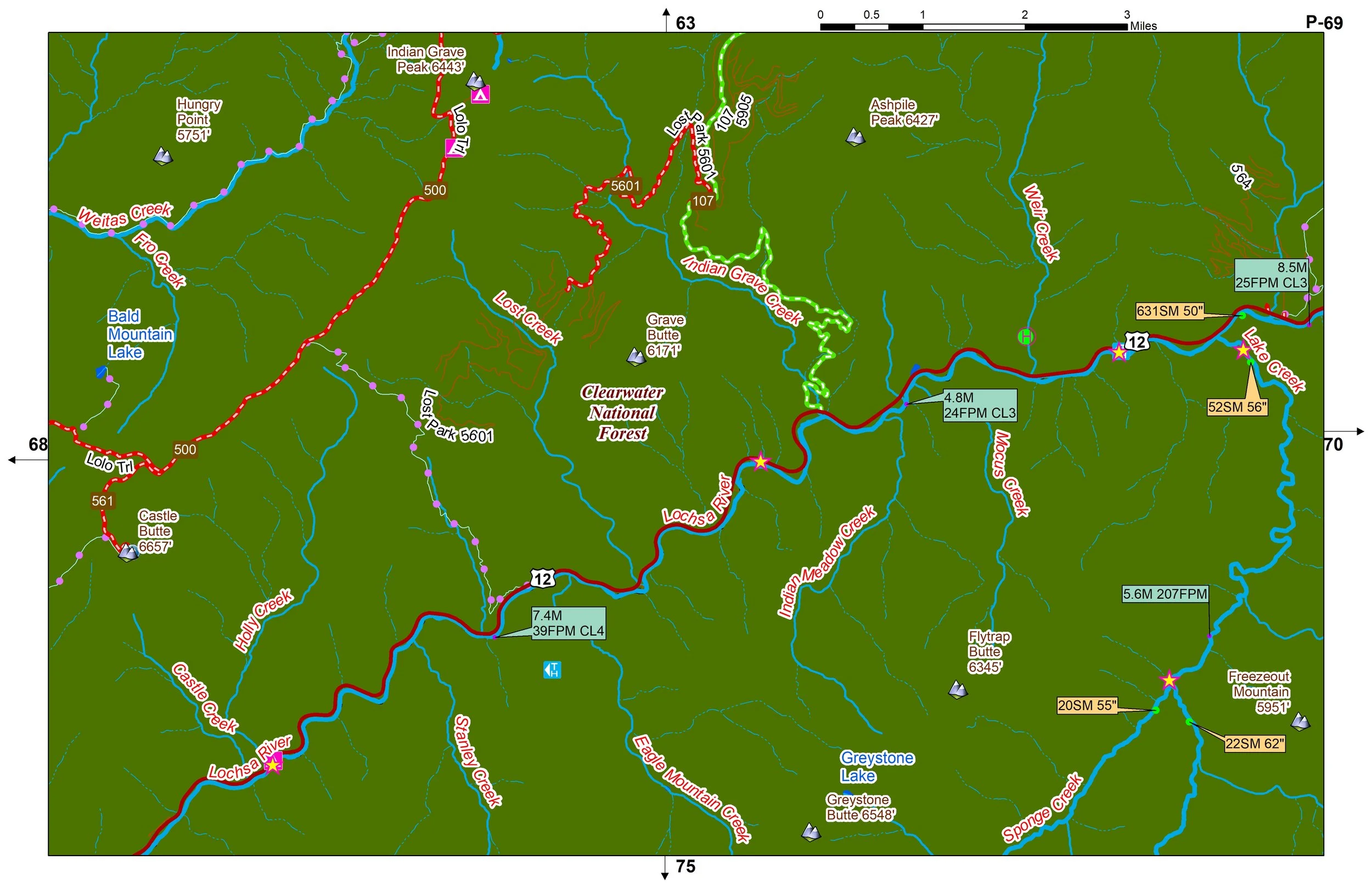 Image 2 of 3
 Image 3 of 3
Come explore the beautiful, sparsely populated Northern Rockies. Mountains, whitewater rivers, and trout are everywhere.
You’ll receive a secure link to the file lasting 24 hours after the first download.
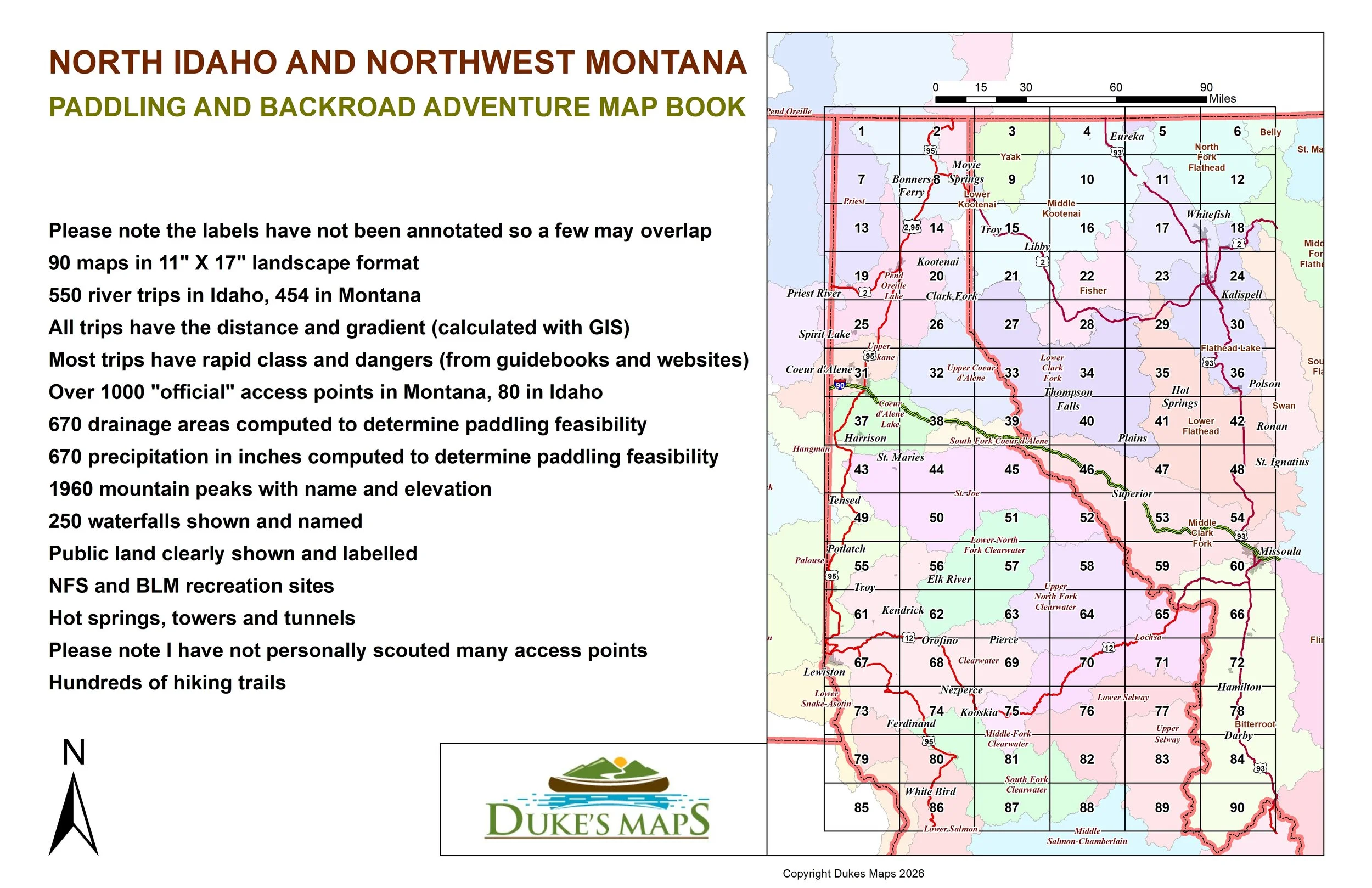
Please note the labels have not been annotated so a few may overlap
Some items these maps include:
90 maps in 11" X 17" landscape format
550 river trips in Idaho, 454 in Montana
All trips have the distance and gradient (calculated with GIS)
Most trips have rapid class and dangers (from guidebooks and websites)
Over 1000 "official" access points in Montana, 80 in Idaho (mostly on lakes)
670 drainage areas computed to determine paddling feasibility
670 precipitation in inches computed to determine paddling feasibility
1960 mountain peaks with name and elevation
250 waterfalls shown and named
Public land clearly shown and labelled
NFS and BLM recreation sites
Hot springs, towers and tunnels
Please note I have not personally scouted many access points
Hundreds of hiking trails
Some of the fantastic rivers include the Kootenai River, Clarks Fork, Coeur d’Alene River, St Joe River, Clearwater River and its forks, Lochsa River, Selway River, Salmon River, and Snake River.
Come explore the beautiful, sparsely populated Northern Rockies. Mountains, whitewater rivers, and trout are everywhere.
You’ll receive a secure link to the file lasting 24 hours after the first download.
Please note the labels have not been annotated so a few may overlap
Some items these maps include:
90 maps in 11" X 17" landscape format
550 river trips in Idaho, 454 in Montana
All trips have the distance and gradient (calculated with GIS)
Most trips have rapid class and dangers (from guidebooks and websites)
Over 1000 "official" access points in Montana, 80 in Idaho (mostly on lakes)
670 drainage areas computed to determine paddling feasibility
670 precipitation in inches computed to determine paddling feasibility
1960 mountain peaks with name and elevation
250 waterfalls shown and named
Public land clearly shown and labelled
NFS and BLM recreation sites
Hot springs, towers and tunnels
Please note I have not personally scouted many access points
Hundreds of hiking trails
Some of the fantastic rivers include the Kootenai River, Clarks Fork, Coeur d’Alene River, St Joe River, Clearwater River and its forks, Lochsa River, Selway River, Salmon River, and Snake River.