 Image 1 of 4
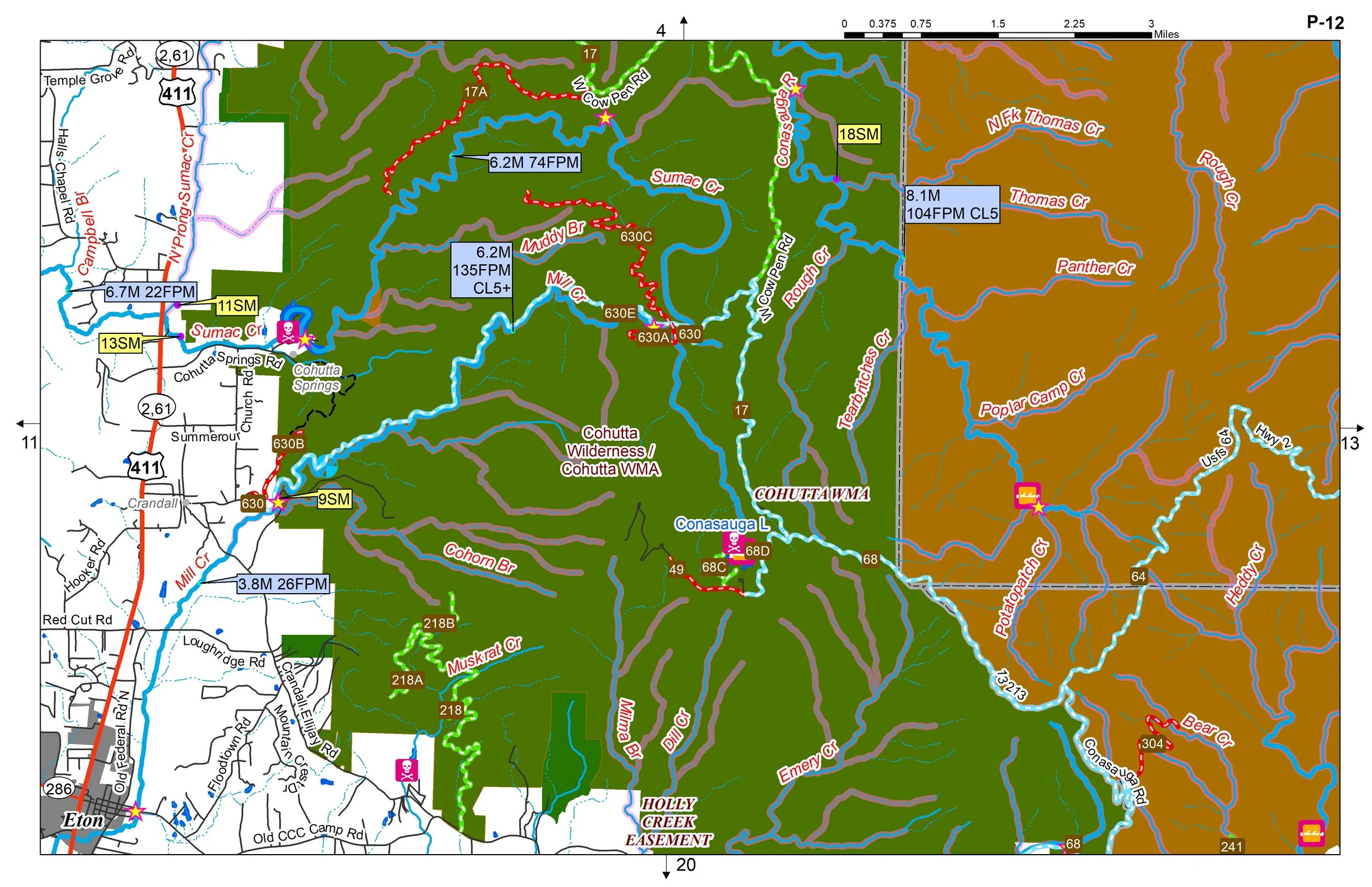 Image 2 of 4
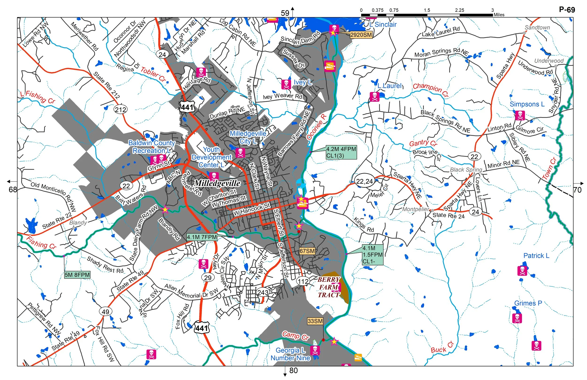 Image 3 of 4
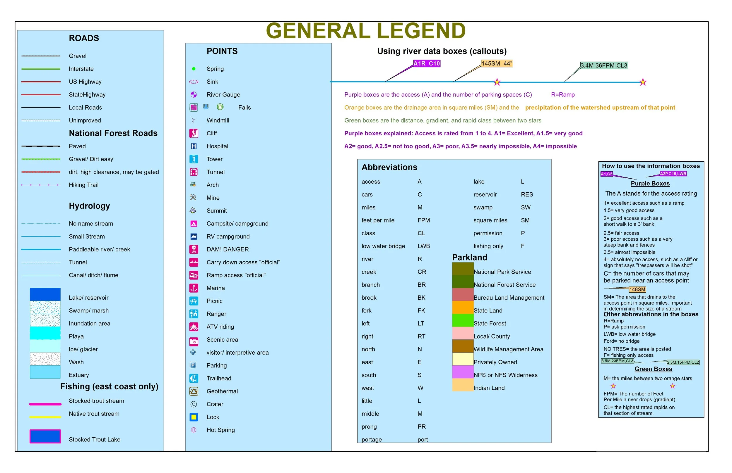 Image 4 of 4
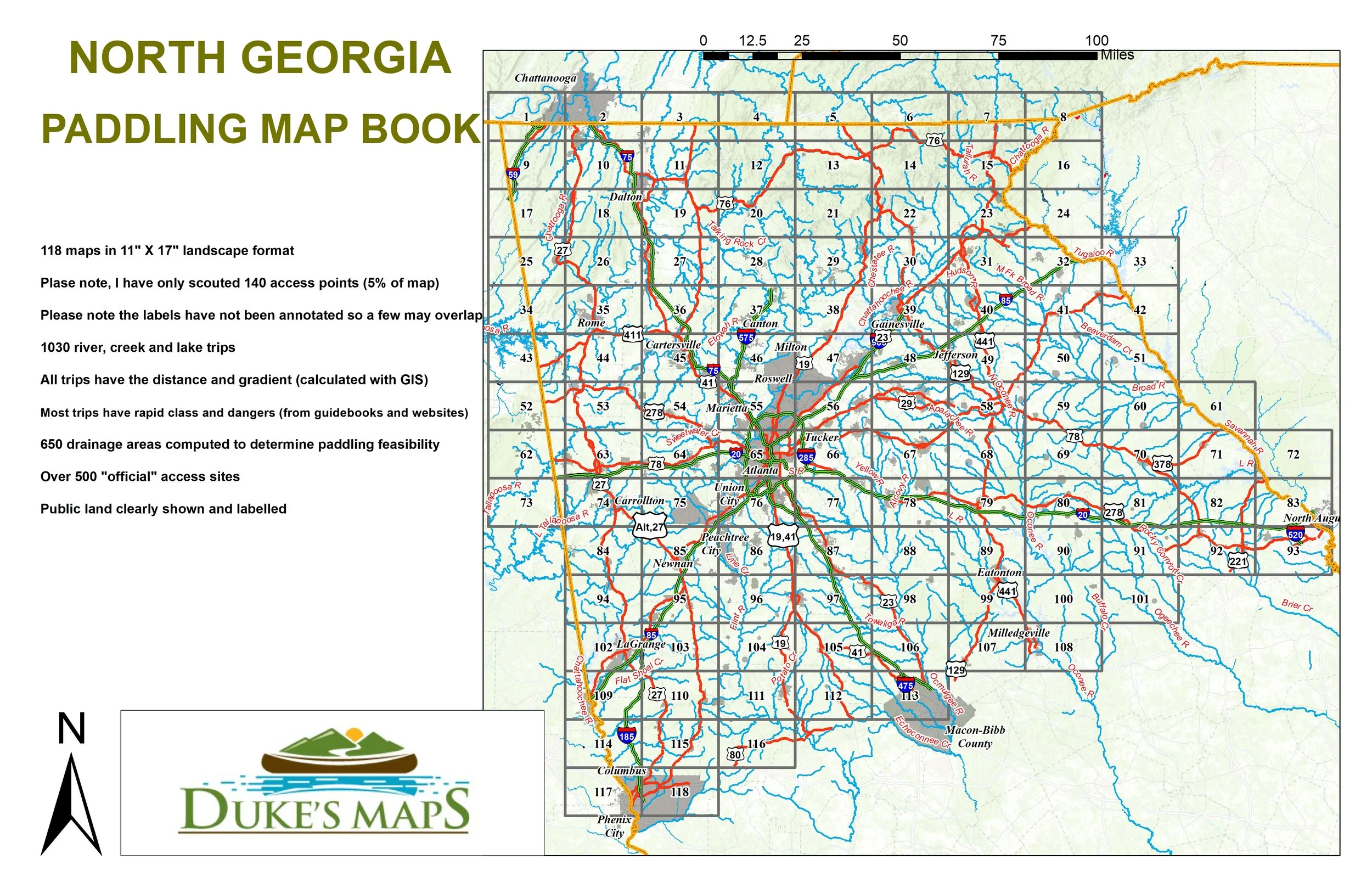
Come explore the southern terminus of the Appalachian Mountains. Kayak and canoe whitewater classics like the Chattahoochee, Chattooga, Conasauga, Etowah, Tallulah, and Taccoa rivers. Float fish rivers like the Savannah, Oconee, Ocmulgee, and Flint.
You’ll receive a secure link to the file lasting 24 hours after the first download.
Some items in the maps include:
118 maps in 11" X 17" landscape format
Please note, I have only scouted 140 access points (5% of map)
Please note the labels have not been annotated so a few may overlap
1030 river, creek and lake trips
All trips have the distance and gradient (calculated with GIS)
Most trips have rapid class and dangers (from guidebooks and websites)
650 drainage areas computed to determine paddling feasibility
Over 500 "official" access sites mostly on lakes
Public land clearly shown and labelled