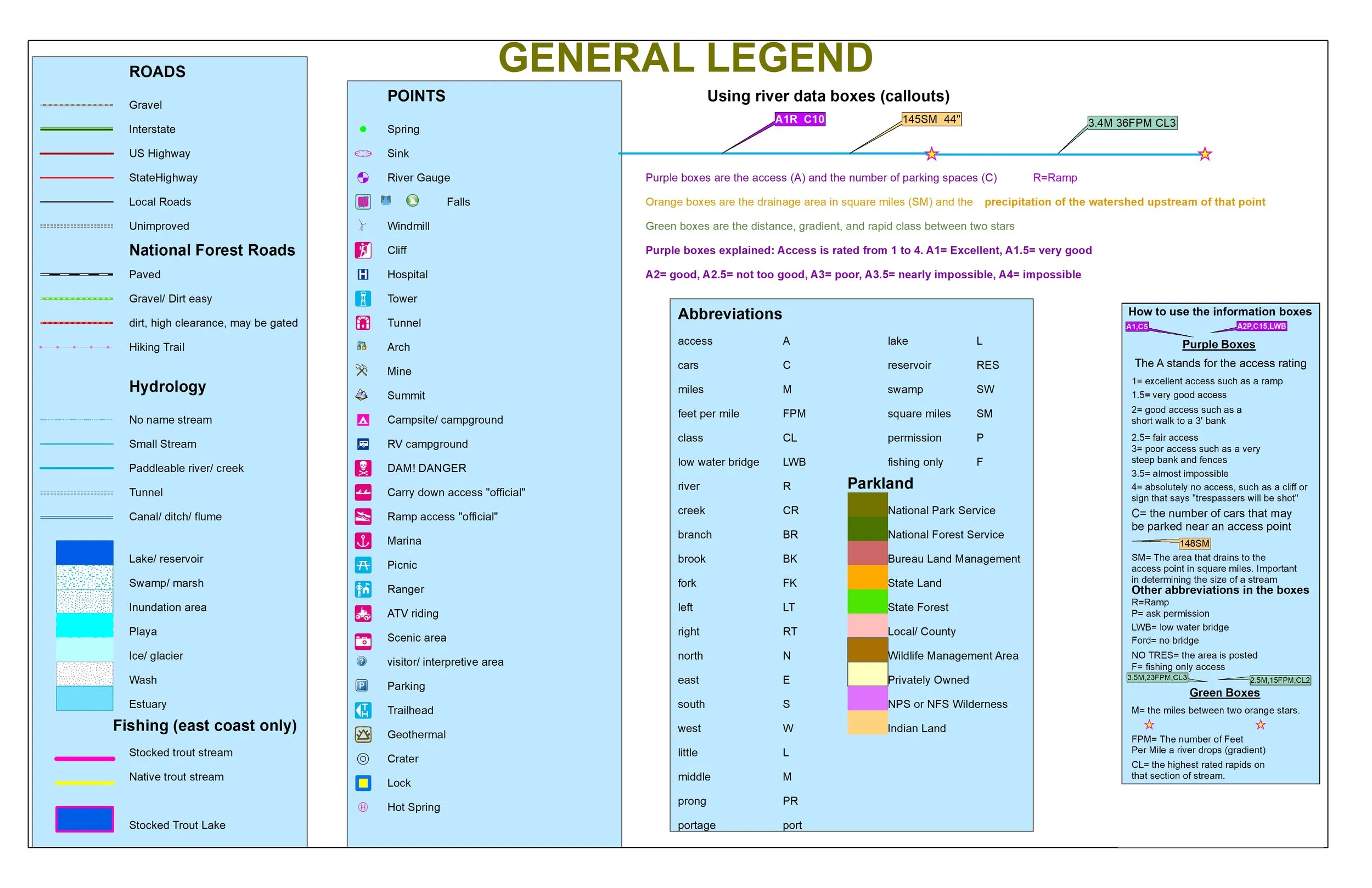
 Image 1 of 4
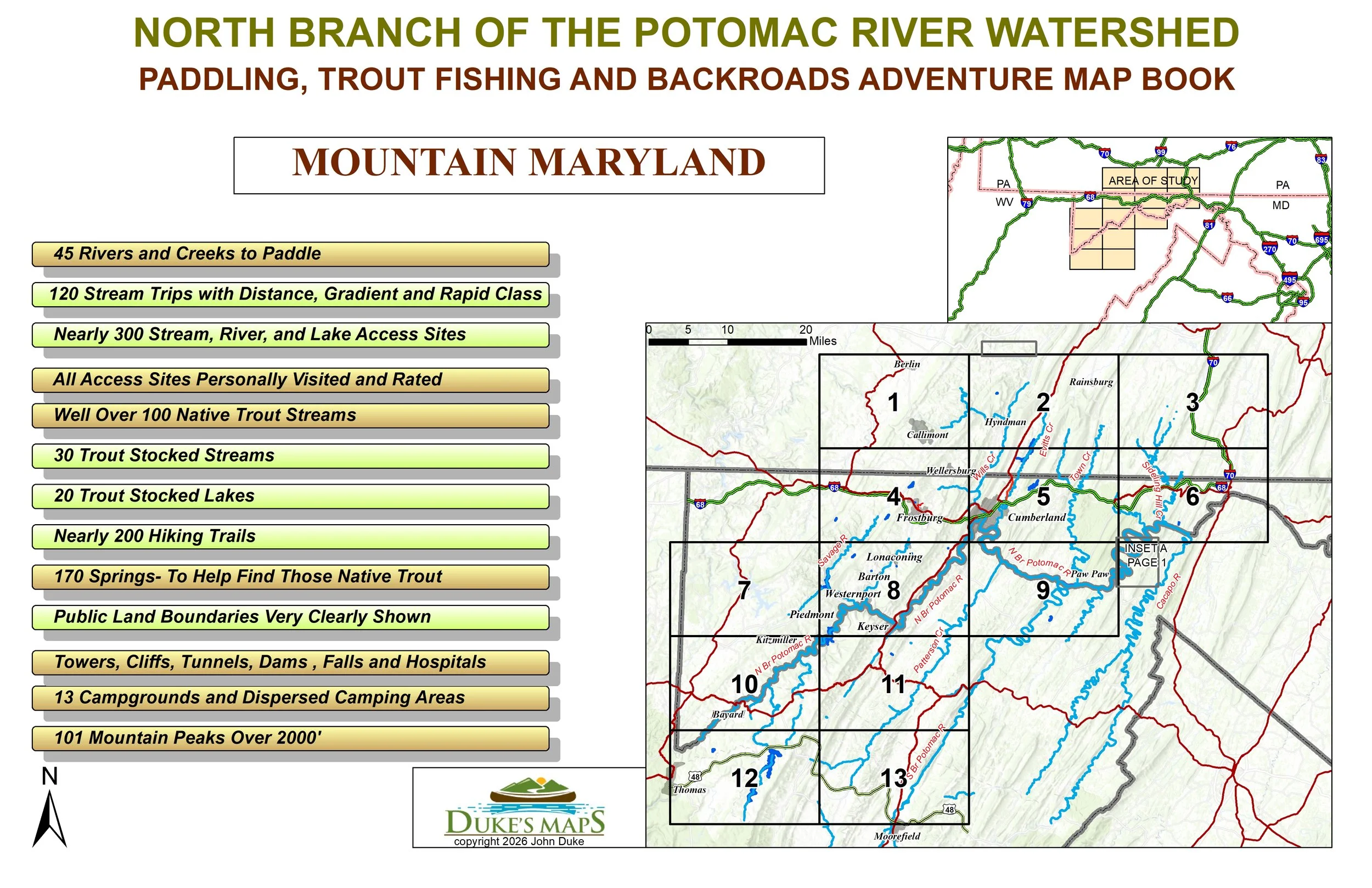 Image 2 of 4
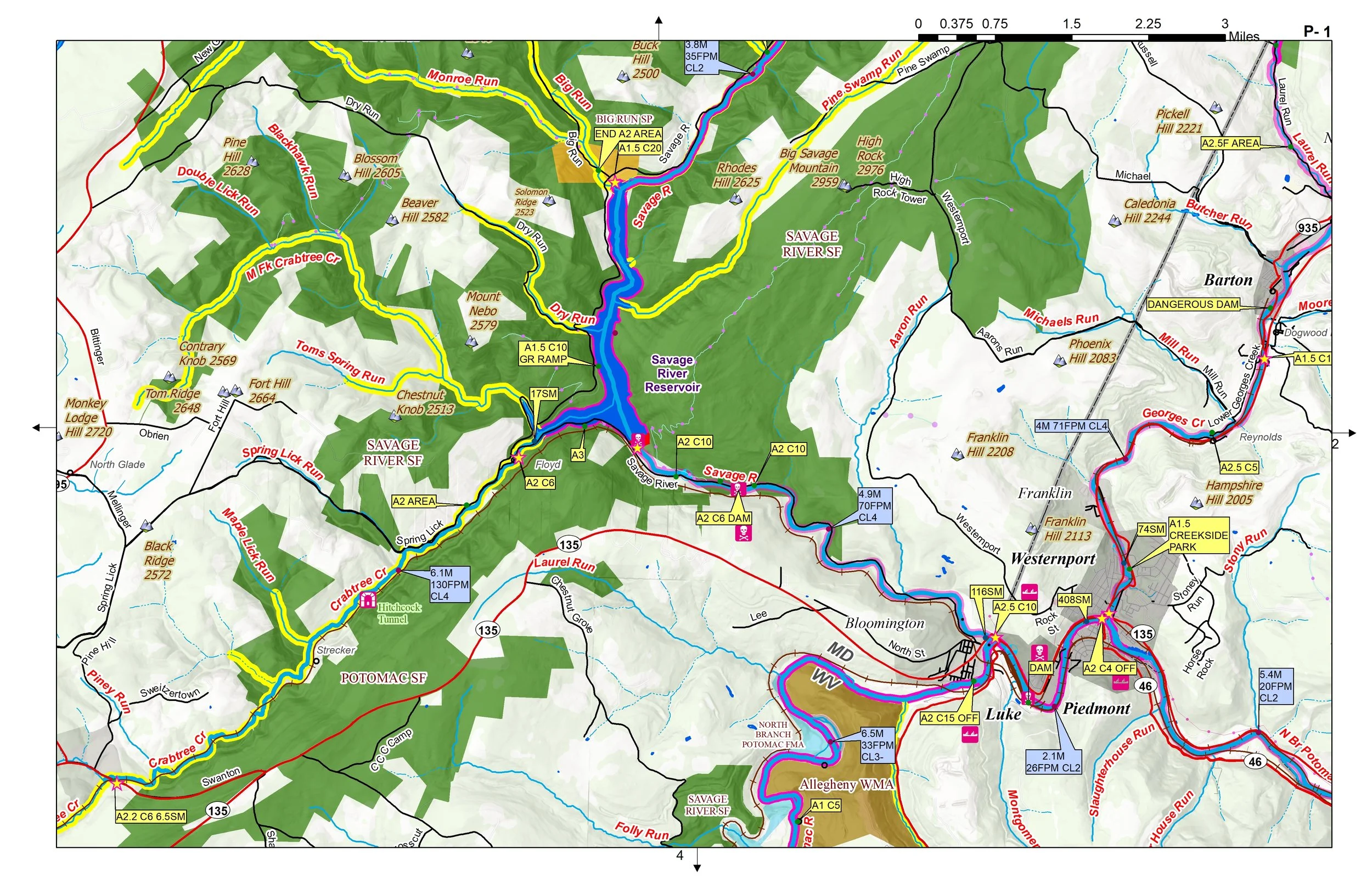 Image 3 of 4
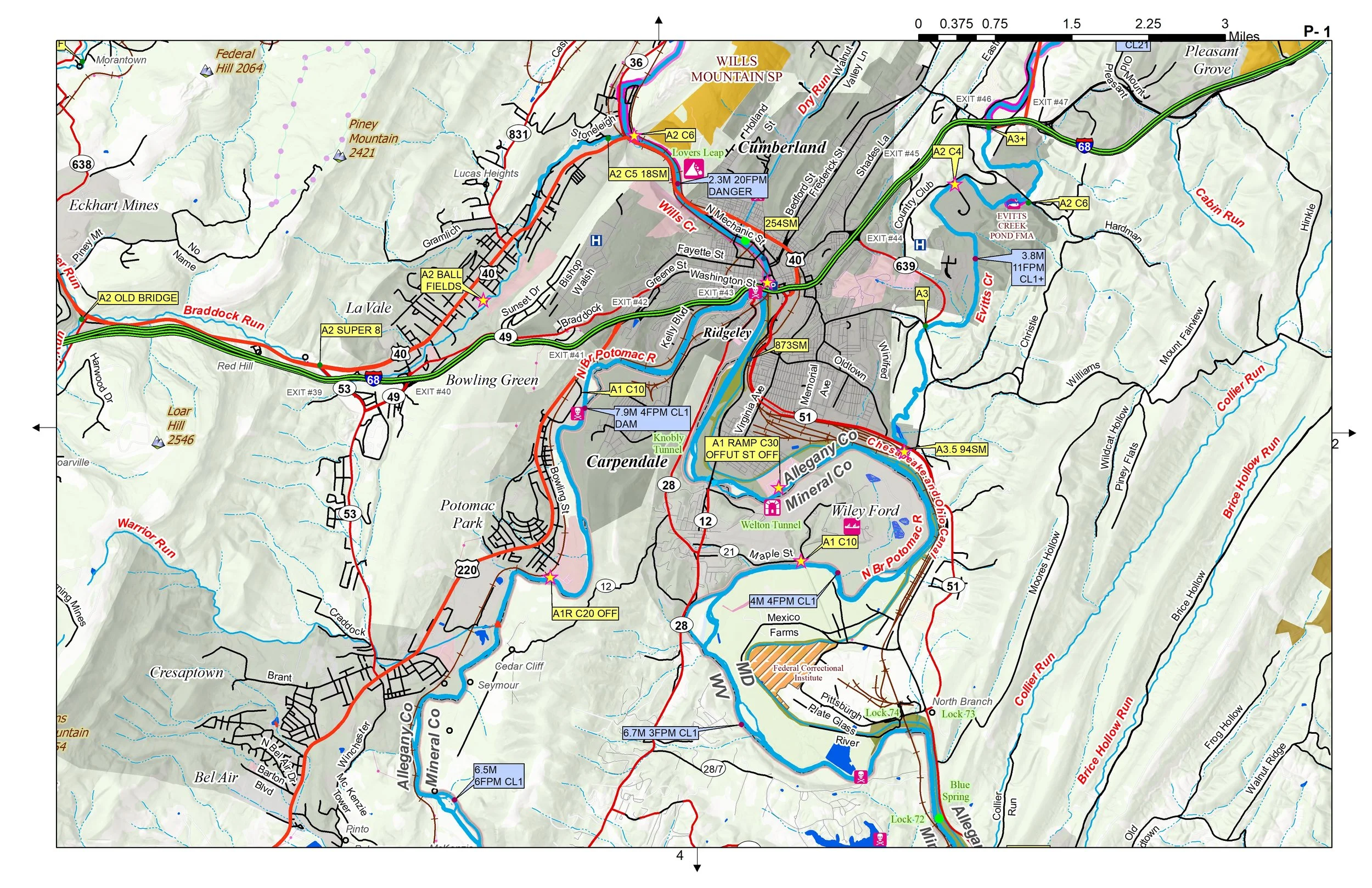 Image 4 of 4
The North Branch Potomac River is the rugged, scenic boundary between Maryland and West Virginia, carving a path through the heart of the Appalachian Mountains. Known for its dramatic transformation, the river begins as a cold, clear mountain stream at the Fairfax Stone and evolves into a premier destination for trout fishing and whitewater paddling. While its history is marked by a long struggle with industrial pollution from coal mining, decades of dedicated restoration efforts have revitalized its ecosystem, bringing back diverse aquatic life and turning it into a thriving recreational area. Today, the river’s rushing rapids and quiet, forested stretches offer a peace. You’ll receive a secure link to the file lasting 24 hours after the first download.
Some items found in these maps:
45 Rivers and Creeks to Paddle
120 Stream Trips with Distance, Gradient and Rapid Class
Nearly 300 Stream, River, and Lake Access Sites
All Access Sites Personally Visited and Rated
Well Over 100 Native Trout Streams
30 Trout Stocked Streams and 20 Lakes
Nearly 200 Hiking Trails
170 Springs- To Help Find Those Native Trout
Public Land Boundaries Very Clearly Shown
Towers, Cliffs, Tunnels, Dams , Falls and Hospitals
13 Campgrounds and Dispersed Camping Areas
101 Mountain Peaks Over 2000'
Try out classic whitewater runs on rivers like Stony, Savage, and Kitzmiller section of the North Branch. Whitewater creeks include Abrams, Evitts, Georges, and Wills. Flatwater float fishing may be found on Town Creek and lower sections of the North Branch.