 Image 1 of 4
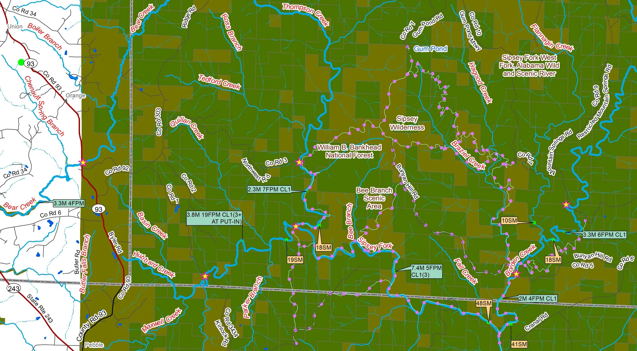 Image 2 of 4
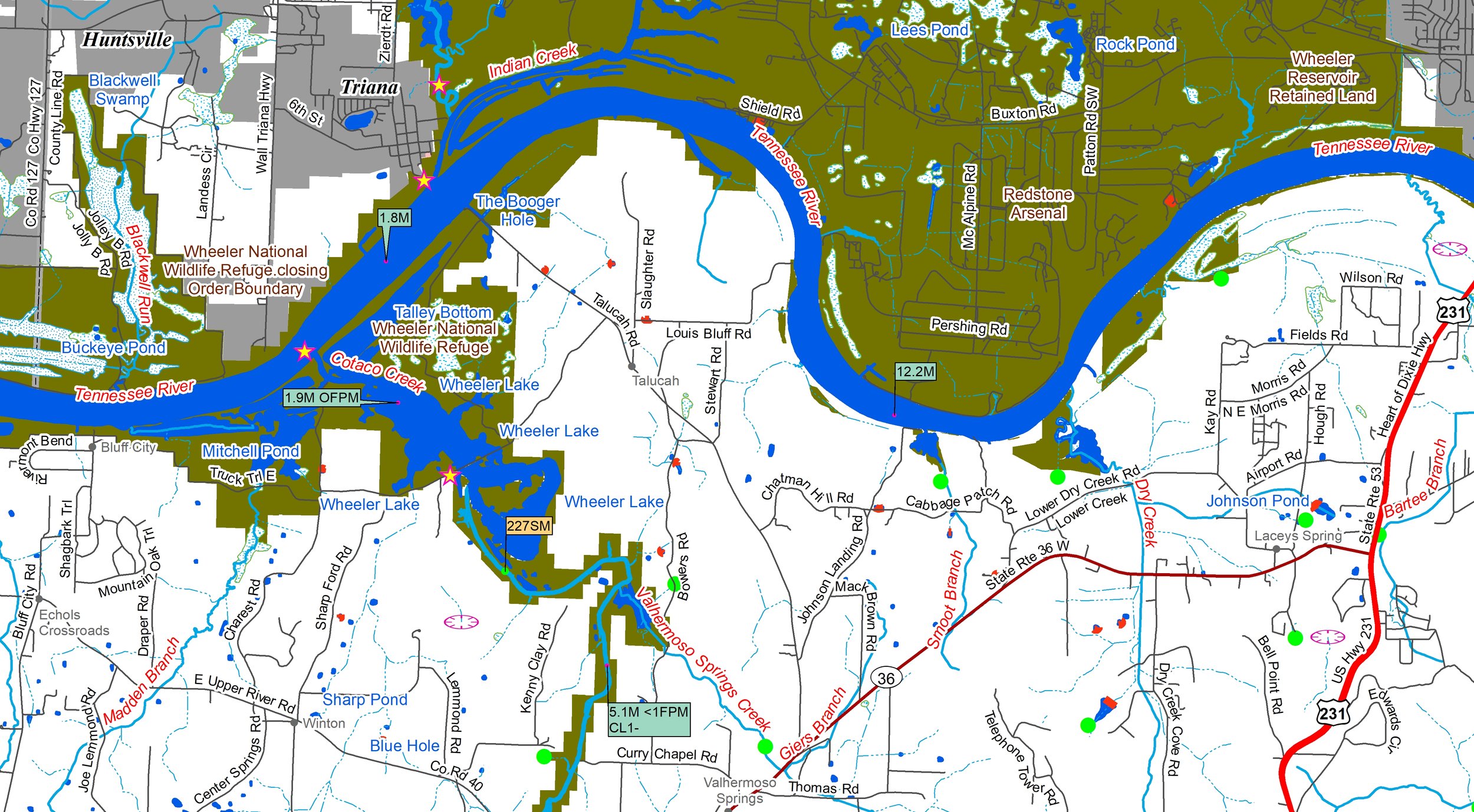 Image 3 of 4
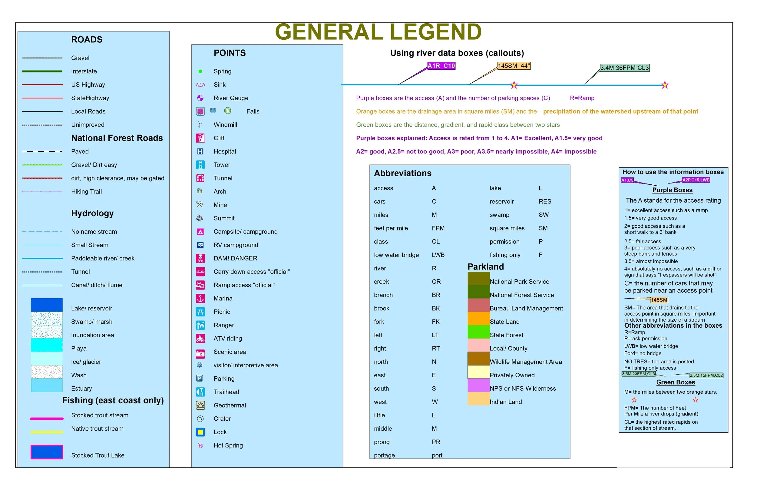 Image 4 of 4
Come explore the southwestern end of the Appalachian Mountains as they give way to the vast Gulf Coastal Plain.
You’ll receive a secure link to the file lasting 24 hours after the first download.
Some items in these maps include:
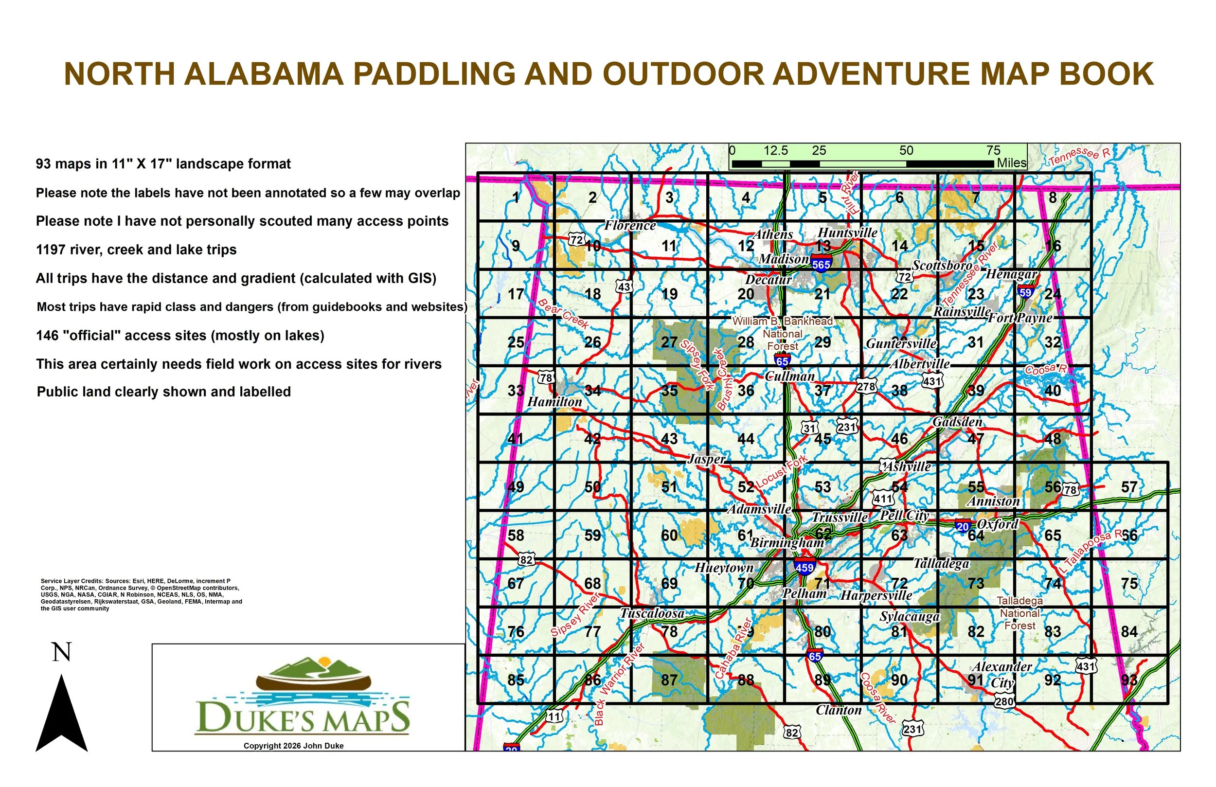
93 maps in 11" X 17" landscape format
Please note the labels have not been annotated so a few may overlap
Please note I have not personally scouted many access points
1197 river, creek and lake trips
All trips have the distance and gradient (calculated with GIS)
Most trips have rapid class and dangers (from guidebooks and websites)
146 "official" access sites (mostly on lakes)
This area certainly needs field work on access sites for rivers
Public land clearly shown and
Try canoeing and float fishing some of the larger rivers such as the Tennessee, Sipsey, Black Warrior, Cahaba, Coosa, and Little Tallapoosa.
Try the heavy duty whitewater on creeks such as Austin, Beaver, Black, Coon, Cotaco, Flat Rock, Guess, Hicks, Honeycomb and Johnnies.
How about the mild whitewater of Cahaba, North and Blackburn Fork Rivers.
Come explore the southwestern end of the Appalachian Mountains as they give way to the vast Gulf Coastal Plain.
You’ll receive a secure link to the file lasting 24 hours after the first download.
Some items in these maps include:
93 maps in 11" X 17" landscape format
Please note the labels have not been annotated so a few may overlap
Please note I have not personally scouted many access points
1197 river, creek and lake trips
All trips have the distance and gradient (calculated with GIS)
Most trips have rapid class and dangers (from guidebooks and websites)
146 "official" access sites (mostly on lakes)
This area certainly needs field work on access sites for rivers
Public land clearly shown and
Try canoeing and float fishing some of the larger rivers such as the Tennessee, Sipsey, Black Warrior, Cahaba, Coosa, and Little Tallapoosa.
Try the heavy duty whitewater on creeks such as Austin, Beaver, Black, Coon, Cotaco, Flat Rock, Guess, Hicks, Honeycomb and Johnnies.
How about the mild whitewater of Cahaba, North and Blackburn Fork Rivers.