 Image 1 of 3
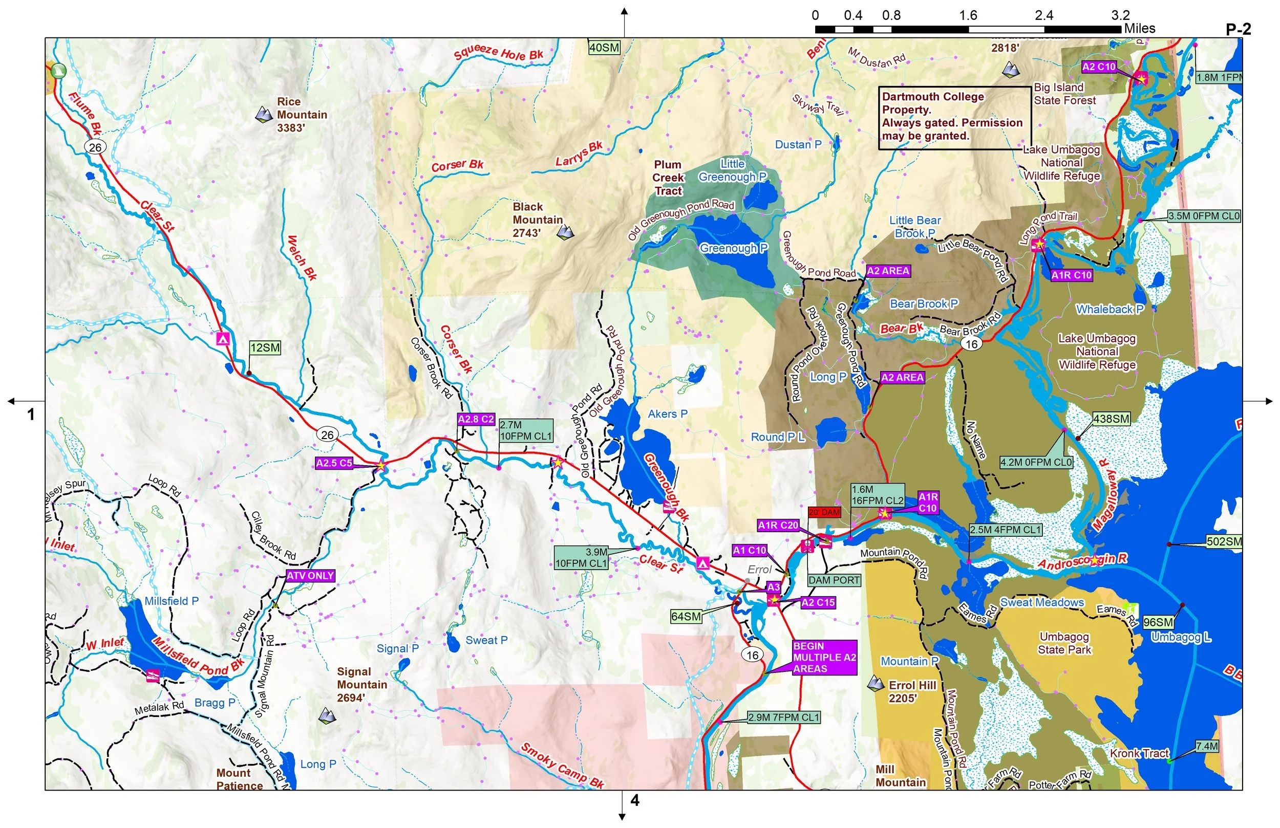 Image 2 of 3
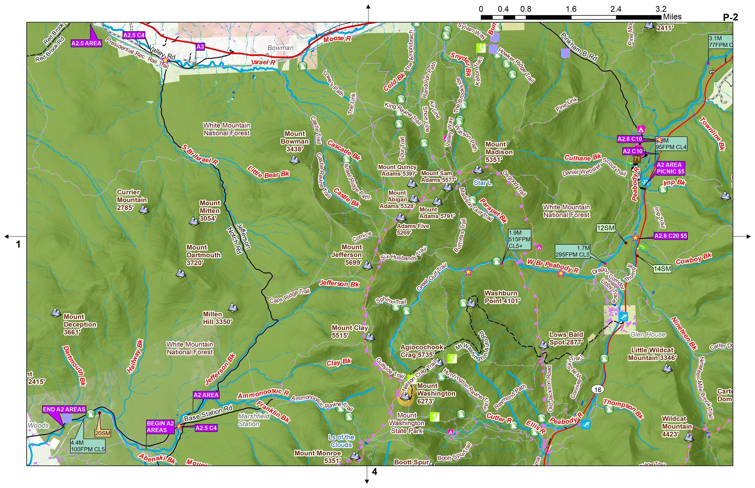 Image 3 of 3
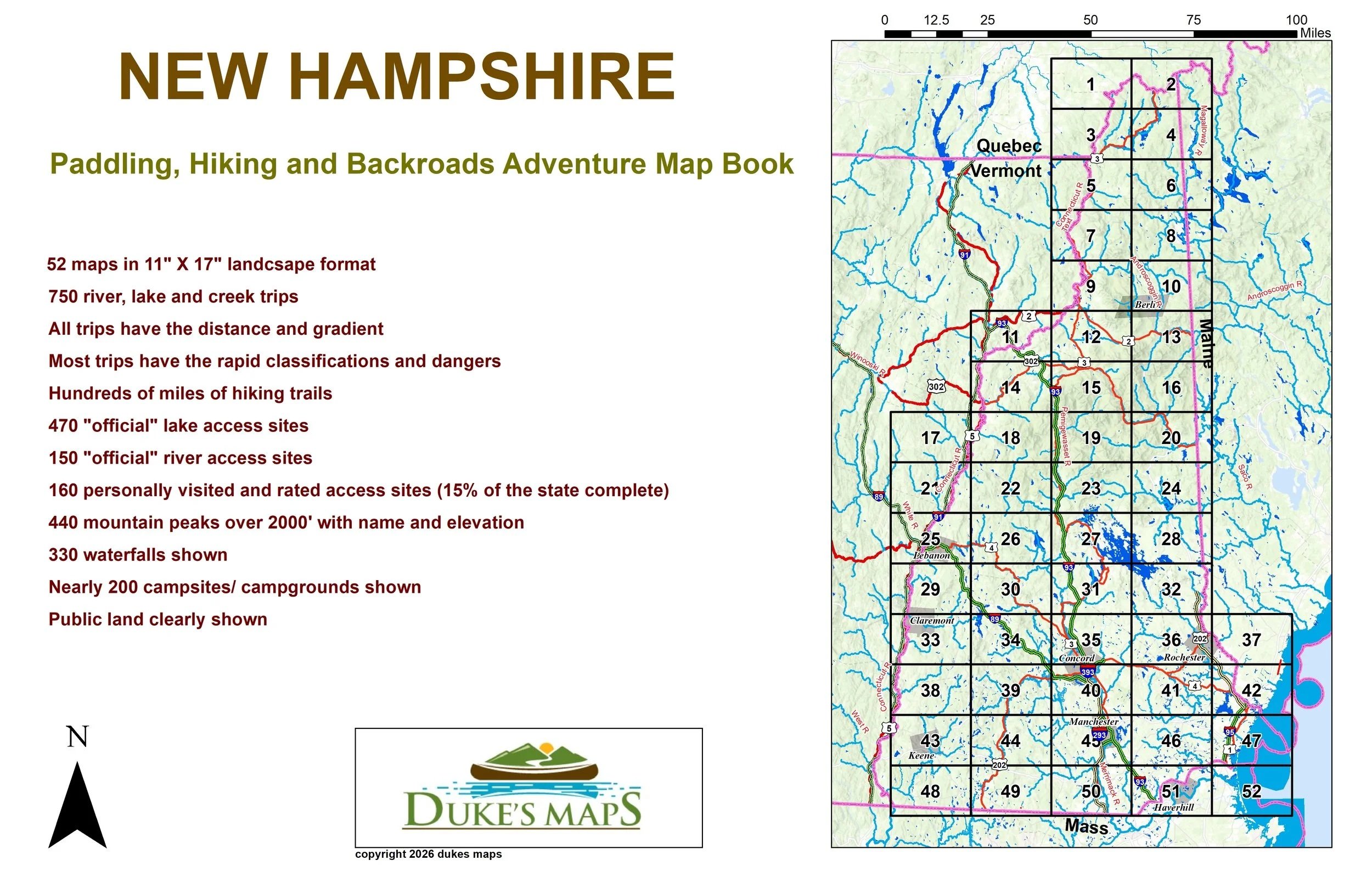
Come explore the whitewater and float fishing filled state of New Hampshire. I’ve got 750 river, lake, and creek trips computed with the latest GIS software. All of the trips have the distance and gradient (drop in feet per mile) computed. I’ve researched all the old guidebooks and websites to include the rapid classifications on most rivers and creeks. Some of these segments are considered “explorers specials” because no previous data is found on the river. Included are the SM (square miles of drainage) to determine the feasibility of paddling these creeks.
You’ll receive a secure link to the file lasting 24 hours after the first download
Included in these maps:
52 maps in 11" X 17" landscape format
470 "official" lake access sites
150 "official" river access sites
160 personally visited and rated access sites (15% of the state complete)
440 mountain peaks over 2000' with name and elevation
330 waterfalls shown
Nearly 200 campsites/ campgrounds shown
Public land clearly shown