 Image 1 of 4
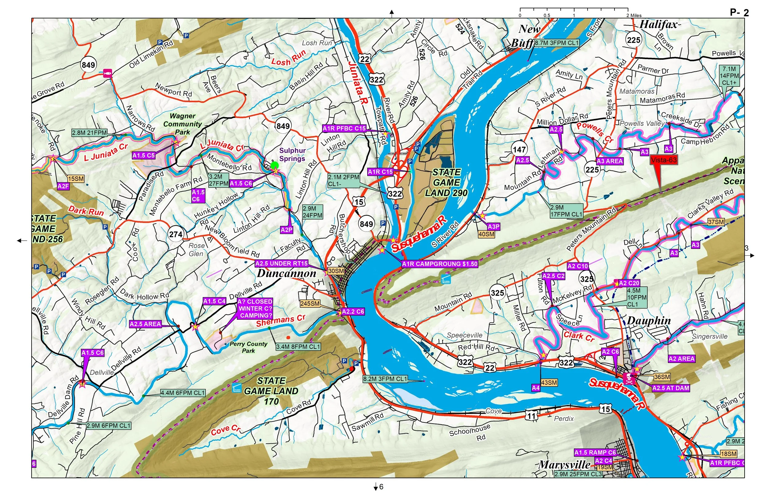 Image 2 of 4
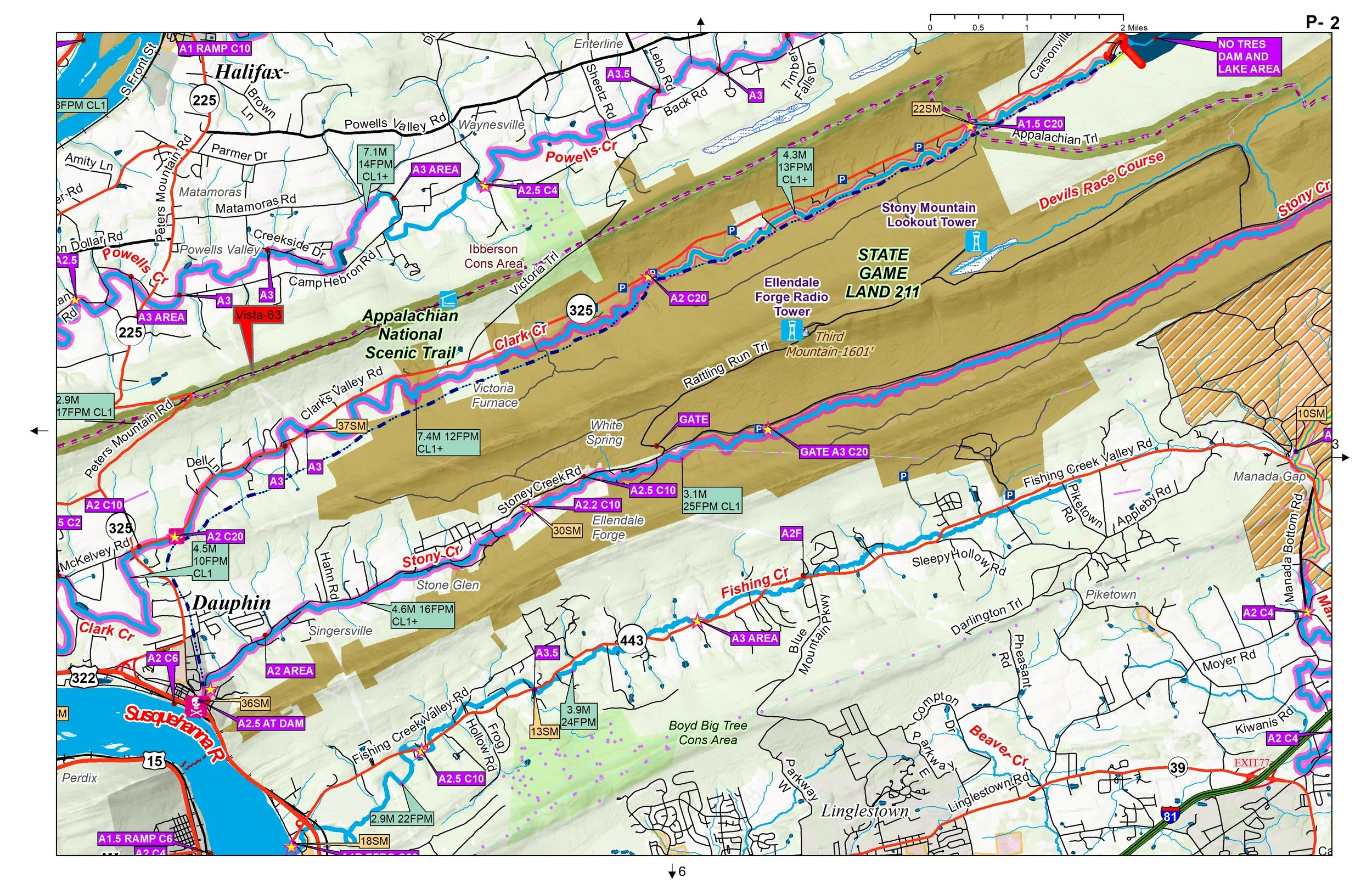 Image 3 of 4
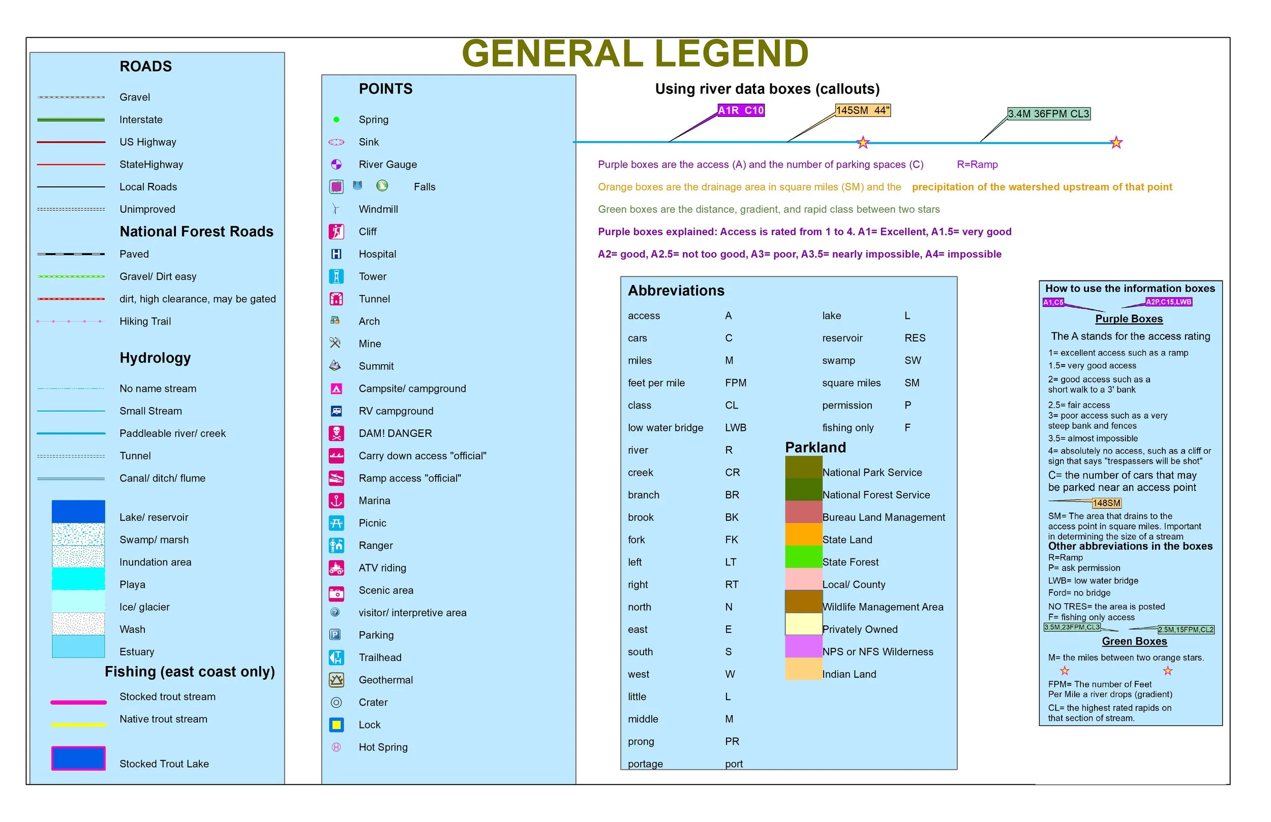 Image 4 of 4
Paddling, Trout Fishing, Hiking, and Country Roads Map Book.
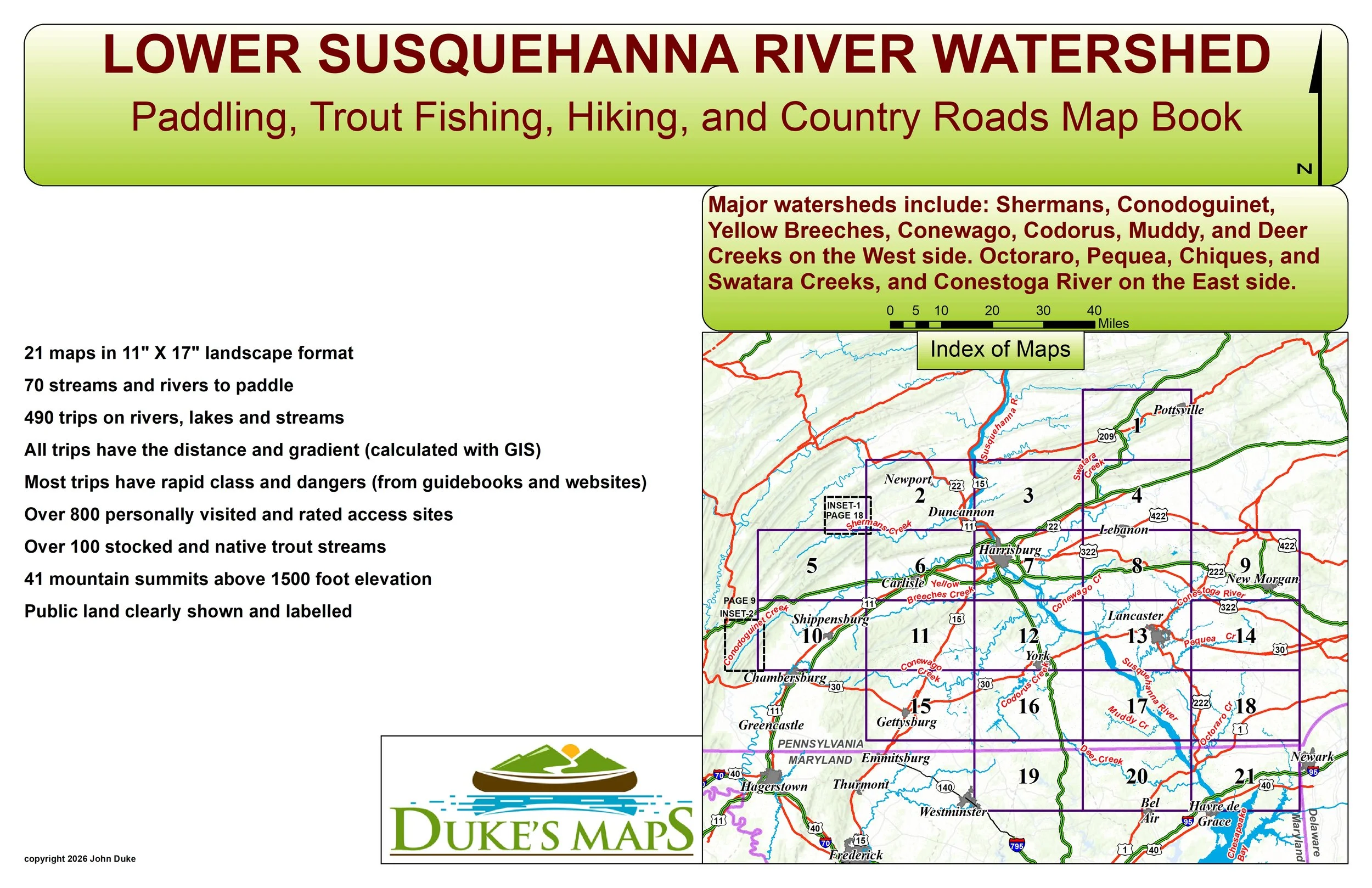
The geography of the Lower Susquehanna River is defined by its dramatic transition from the Appalachian Highlands to the Atlantic Coastal Plain. Flowing through south-central Pennsylvania and northeastern Maryland, the river carves a deep, rugged path through the Susquehanna Gorge, where it is flanked by steep, forested hillsides and rocky cliffs. Unlike many large rivers, the Lower Susquehanna is relatively shallow and wide, characterized by a rocky bed and numerous islands rather than a deep navigable channel. As it nears its end, the river drops significantly in elevation—a feature harnessed by massive hydroelectric dams like Holtwood and Conowingo—before finally emptying into the northern reaches of the Chesapeake Bay at Havre de Grace.
You’ll receive a secure link to the file lasting 24 hours after the first download.
Some items found in these maps include:
21 maps in 11" X 17" landscape format
70 streams and rivers to paddle
490 trips on rivers, lakes and streams
All trips have the distance and gradient (calculated with GIS)
Most trips have rapid class and dangers (from guidebooks and websites)
Over 800 personally visited and rated access sites
Over 100 stocked and native trout streams
41 mountain summits above 1500 foot elevation
Public land clearly shown and labelled
Major watersheds include: Shermans, Conodoguinet, Yellow Breeches, Conewago, Codorus, Muddy, and Deer Creeks on the West side. Octoraro, Pequea, Chiques, and Swatara Creeks, and Conestoga River on the East side.
Paddling, Trout Fishing, Hiking, and Country Roads Map Book.
The geography of the Lower Susquehanna River is defined by its dramatic transition from the Appalachian Highlands to the Atlantic Coastal Plain. Flowing through south-central Pennsylvania and northeastern Maryland, the river carves a deep, rugged path through the Susquehanna Gorge, where it is flanked by steep, forested hillsides and rocky cliffs. Unlike many large rivers, the Lower Susquehanna is relatively shallow and wide, characterized by a rocky bed and numerous islands rather than a deep navigable channel. As it nears its end, the river drops significantly in elevation—a feature harnessed by massive hydroelectric dams like Holtwood and Conowingo—before finally emptying into the northern reaches of the Chesapeake Bay at Havre de Grace.
You’ll receive a secure link to the file lasting 24 hours after the first download.
Some items found in these maps include:
21 maps in 11" X 17" landscape format
70 streams and rivers to paddle
490 trips on rivers, lakes and streams
All trips have the distance and gradient (calculated with GIS)
Most trips have rapid class and dangers (from guidebooks and websites)
Over 800 personally visited and rated access sites
Over 100 stocked and native trout streams
41 mountain summits above 1500 foot elevation
Public land clearly shown and labelled
Major watersheds include: Shermans, Conodoguinet, Yellow Breeches, Conewago, Codorus, Muddy, and Deer Creeks on the West side. Octoraro, Pequea, Chiques, and Swatara Creeks, and Conestoga River on the East side.