 Image 1 of 3
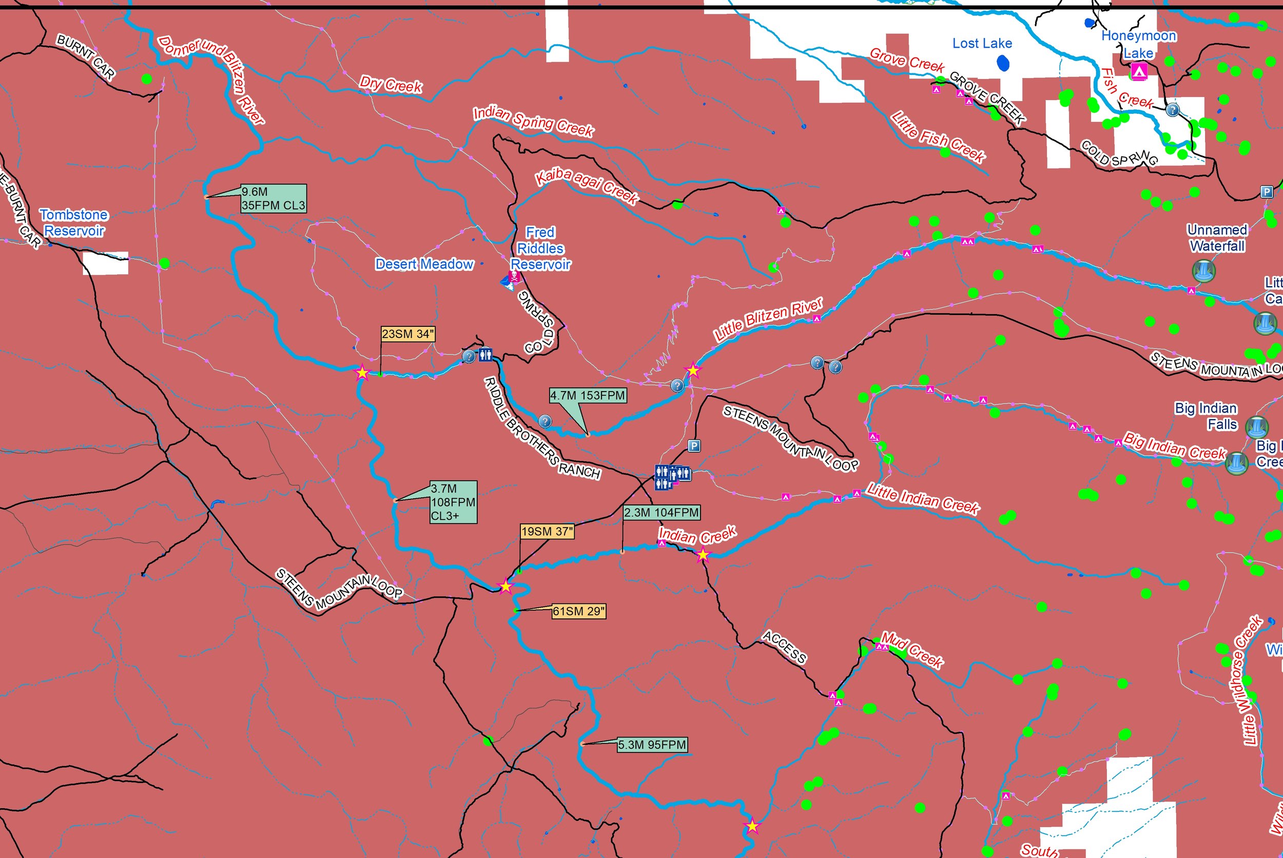 Image 2 of 3
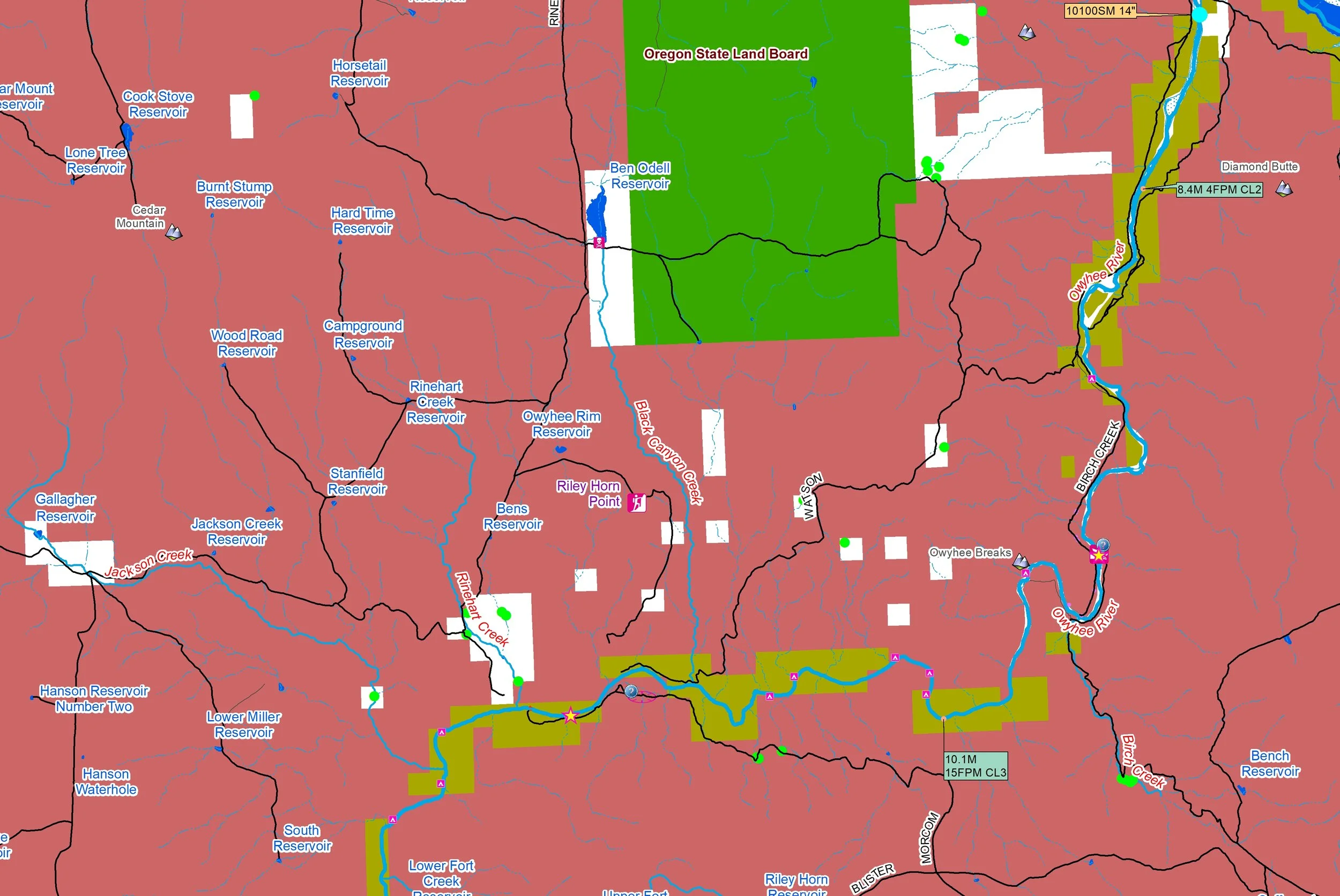 Image 3 of 3
Southeastern Oregon features a remote, dramatic Basin and Range geography dominated by the arid High Desert. Certainly not a whitewater hotspot because water is scarce in this rain shadow region, yet it plays a vital role. Rivers like the Owyhee River and the Malheur River carve spectacular, deep basalt canyons as they flow northeast toward the Snake River. Rivers like like the Donner und Blitzen River, Silvies River, and Chewaucan River drain snowmelt into closed, landlocked basins, nourishing critical desert wetlands like the Malheur National Wildlife Refuge.
You’ll receive a secure link to the file lasting 24 hours after the first download.
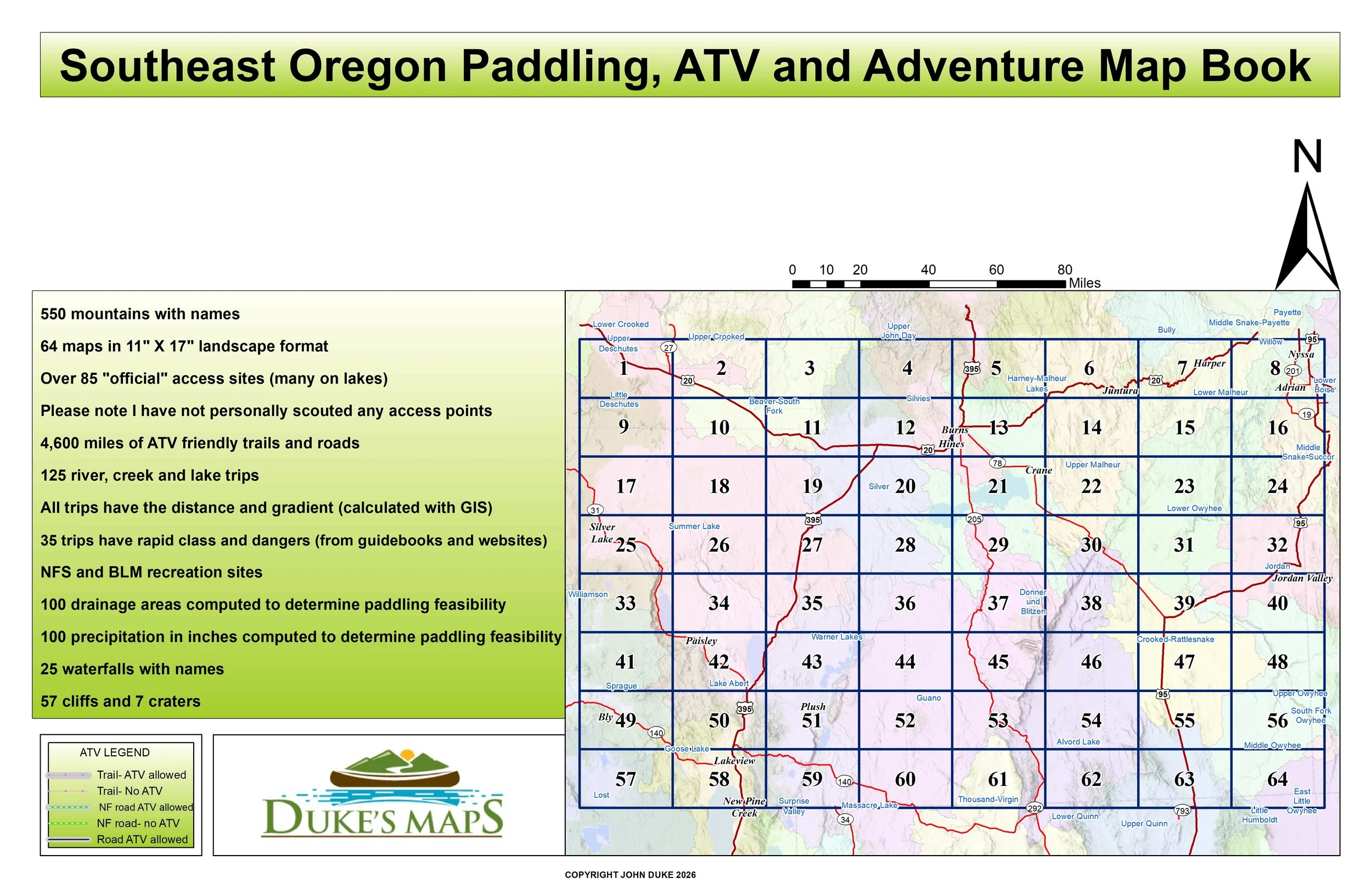
Some of the items found in these maps include:
64 maps in 11" X 17" landscape format
125 river, creek and lake trips
All trips have the distance and gradient (calculated with GIS)
35 trips have rapid class and dangers (from guidebooks and websites)
Over 85 "official" access sites (many on lakes)
Please note I have not personally scouted any access points
4,600 miles of ATV friendly trails and roads
550 mountains with names
Public land clearly shown
NFS and BLM recreation sites
100 drainage areas computed to determine paddling feasibility
100 precipitation in inches computed to determine paddling feasibility
Southeastern Oregon features a remote, dramatic Basin and Range geography dominated by the arid High Desert. Certainly not a whitewater hotspot because water is scarce in this rain shadow region, yet it plays a vital role. Rivers like the Owyhee River and the Malheur River carve spectacular, deep basalt canyons as they flow northeast toward the Snake River. Rivers like like the Donner und Blitzen River, Silvies River, and Chewaucan River drain snowmelt into closed, landlocked basins, nourishing critical desert wetlands like the Malheur National Wildlife Refuge.
You’ll receive a secure link to the file lasting 24 hours after the first download.
Some of the items found in these maps include:
64 maps in 11" X 17" landscape format
125 river, creek and lake trips
All trips have the distance and gradient (calculated with GIS)
35 trips have rapid class and dangers (from guidebooks and websites)
Over 85 "official" access sites (many on lakes)
Please note I have not personally scouted any access points
4,600 miles of ATV friendly trails and roads
550 mountains with names
Public land clearly shown
NFS and BLM recreation sites
100 drainage areas computed to determine paddling feasibility
100 precipitation in inches computed to determine paddling feasibility