 Image 1 of 3
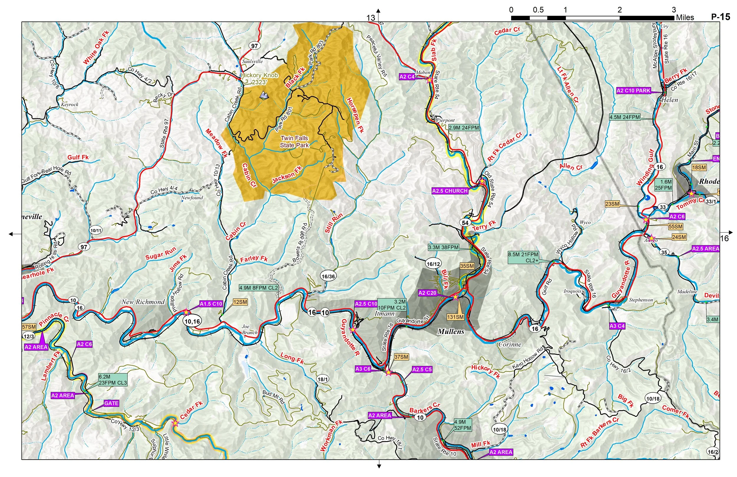 Image 2 of 3
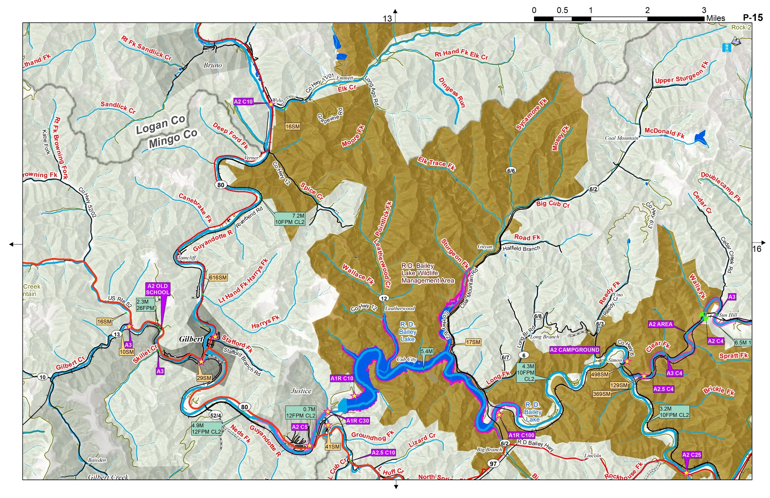 Image 3 of 3
COME EXPLORE THE RUGGED HOLLOWS OF WEST VIRGINIA COAL COUNTRY
Customers receive a secure link to the file lasting 24 hours after the first download.
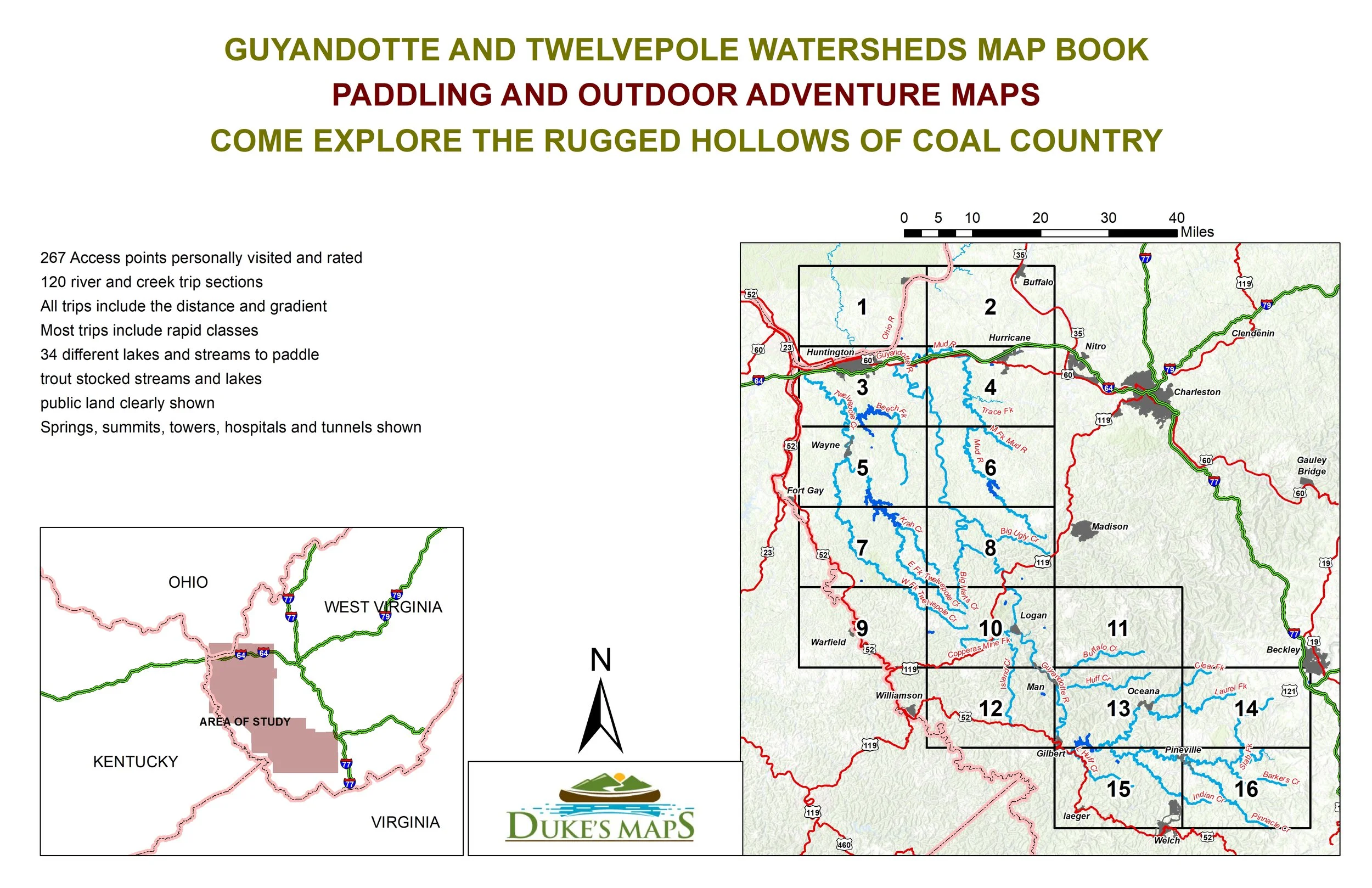
16 maps in the 11” X 17” landscape format
267 Access points personally visited and rated
120 river and creek trip sections
All trips include the distance and gradient. Most trips include rapid classes
34 different lakes and streams to paddle
trout stocked streams and lakes
public land clearly shown
Springs, summits, towers, hospitals and tunnels shown
Come explore the rugged coal country of West Virginia. The Guyandotte River and Twelvepole Creek are full of bass to be caught by the savvy float fisherman. Tributaries to explore in the area include Huff Creek, Clear Fork, Laurel Fork, Pinnacle Creek, Buffalo Creek, Island Creek, Mud River, Big Ugly Creek, Big Harts Creek, and Beech Fork.
COME EXPLORE THE RUGGED HOLLOWS OF WEST VIRGINIA COAL COUNTRY
Customers receive a secure link to the file lasting 24 hours after the first download.
16 maps in the 11” X 17” landscape format
267 Access points personally visited and rated
120 river and creek trip sections
All trips include the distance and gradient. Most trips include rapid classes
34 different lakes and streams to paddle
trout stocked streams and lakes
public land clearly shown
Springs, summits, towers, hospitals and tunnels shown
Come explore the rugged coal country of West Virginia. The Guyandotte River and Twelvepole Creek are full of bass to be caught by the savvy float fisherman. Tributaries to explore in the area include Huff Creek, Clear Fork, Laurel Fork, Pinnacle Creek, Buffalo Creek, Island Creek, Mud River, Big Ugly Creek, Big Harts Creek, and Beech Fork.