 Image 1 of 4
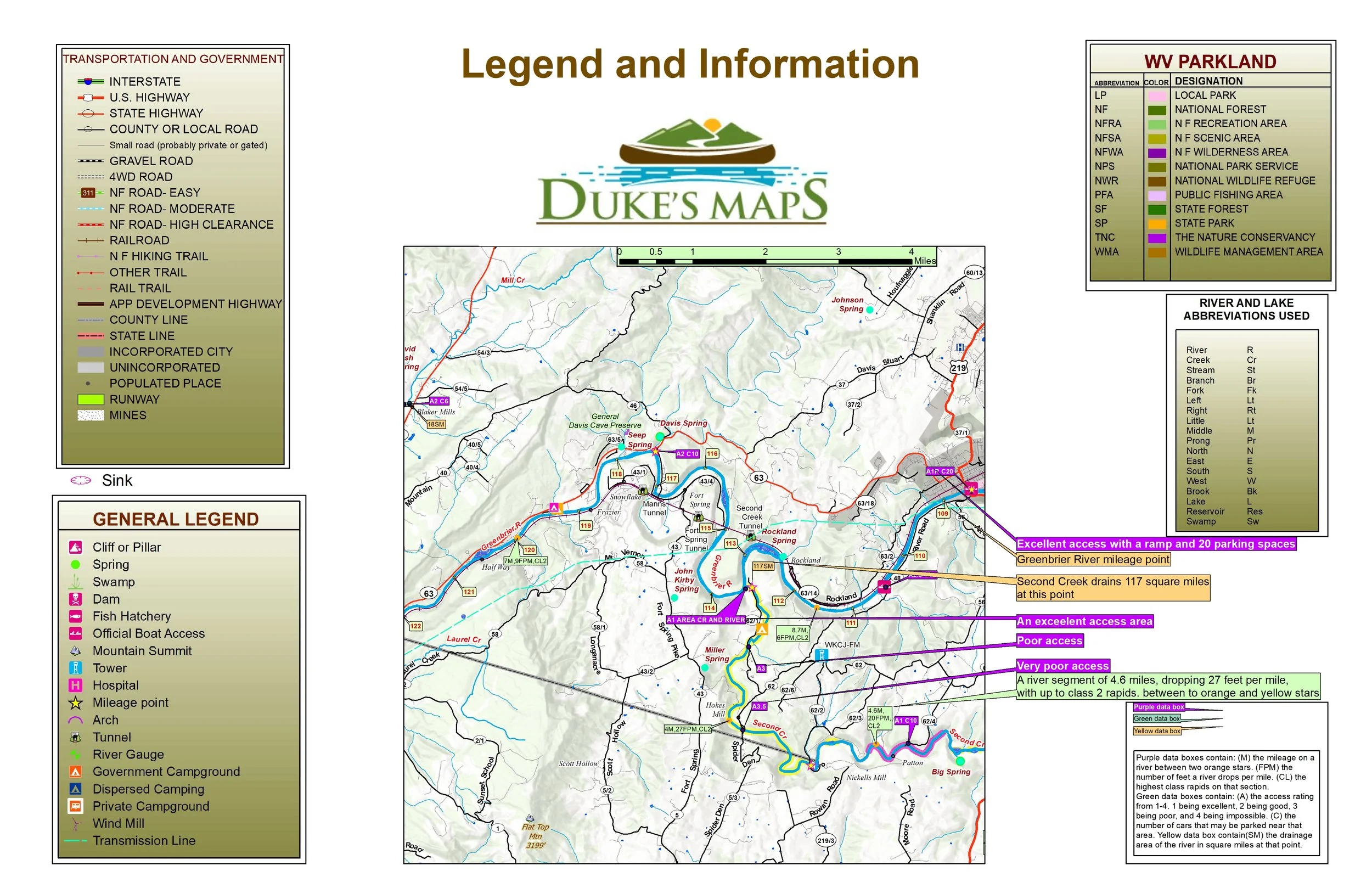 Image 2 of 4
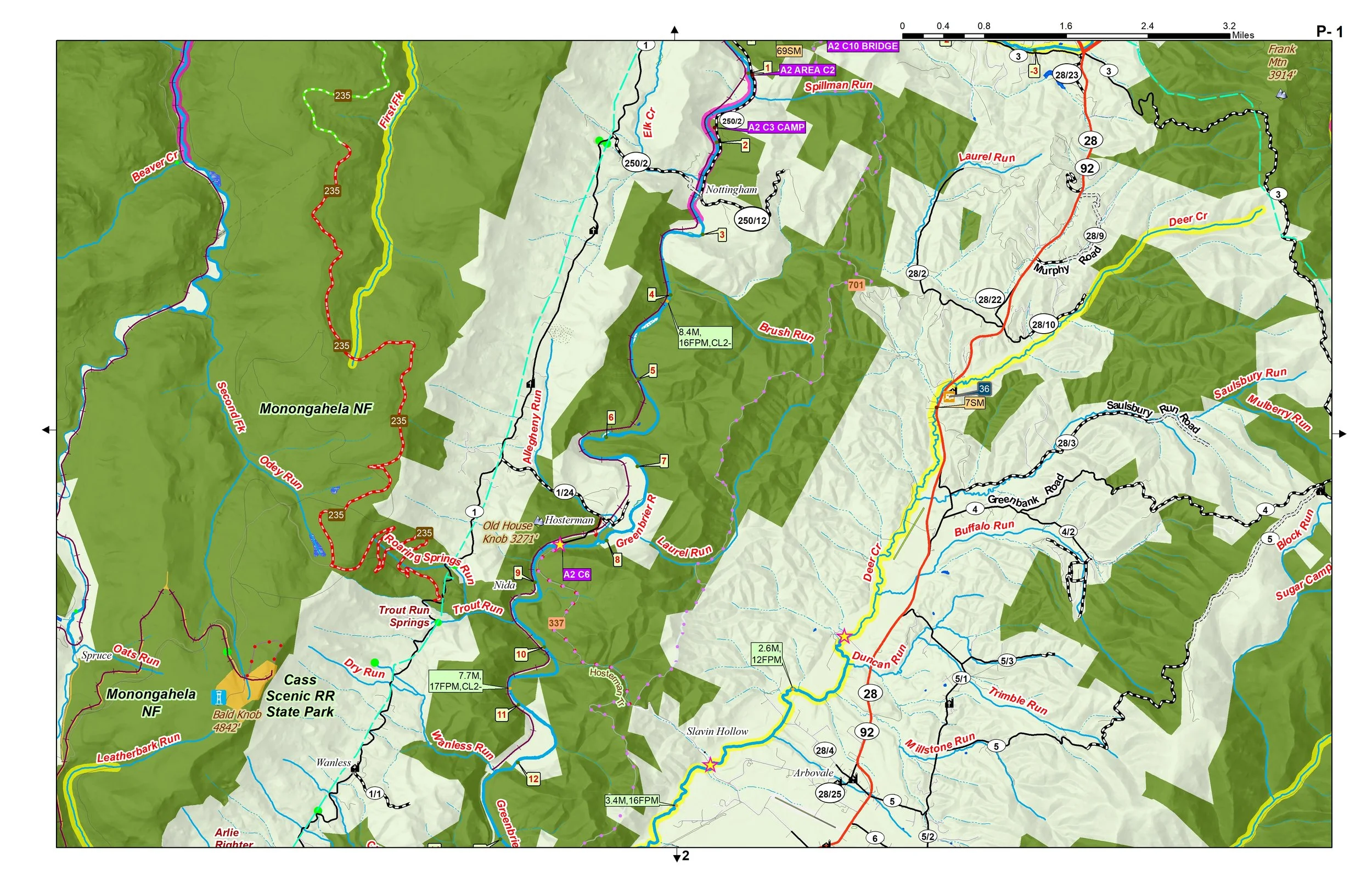 Image 3 of 4
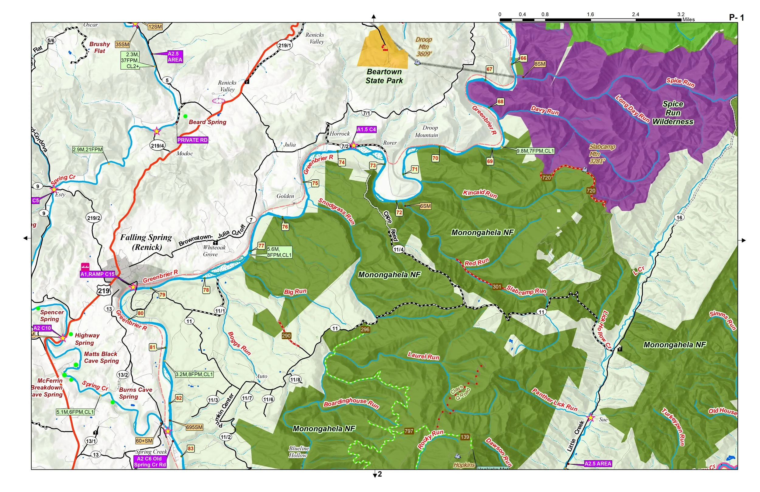 Image 4 of 4
Paddling, Fishing, Camping, and Backroads Map Book. Download the maps and print when needed.
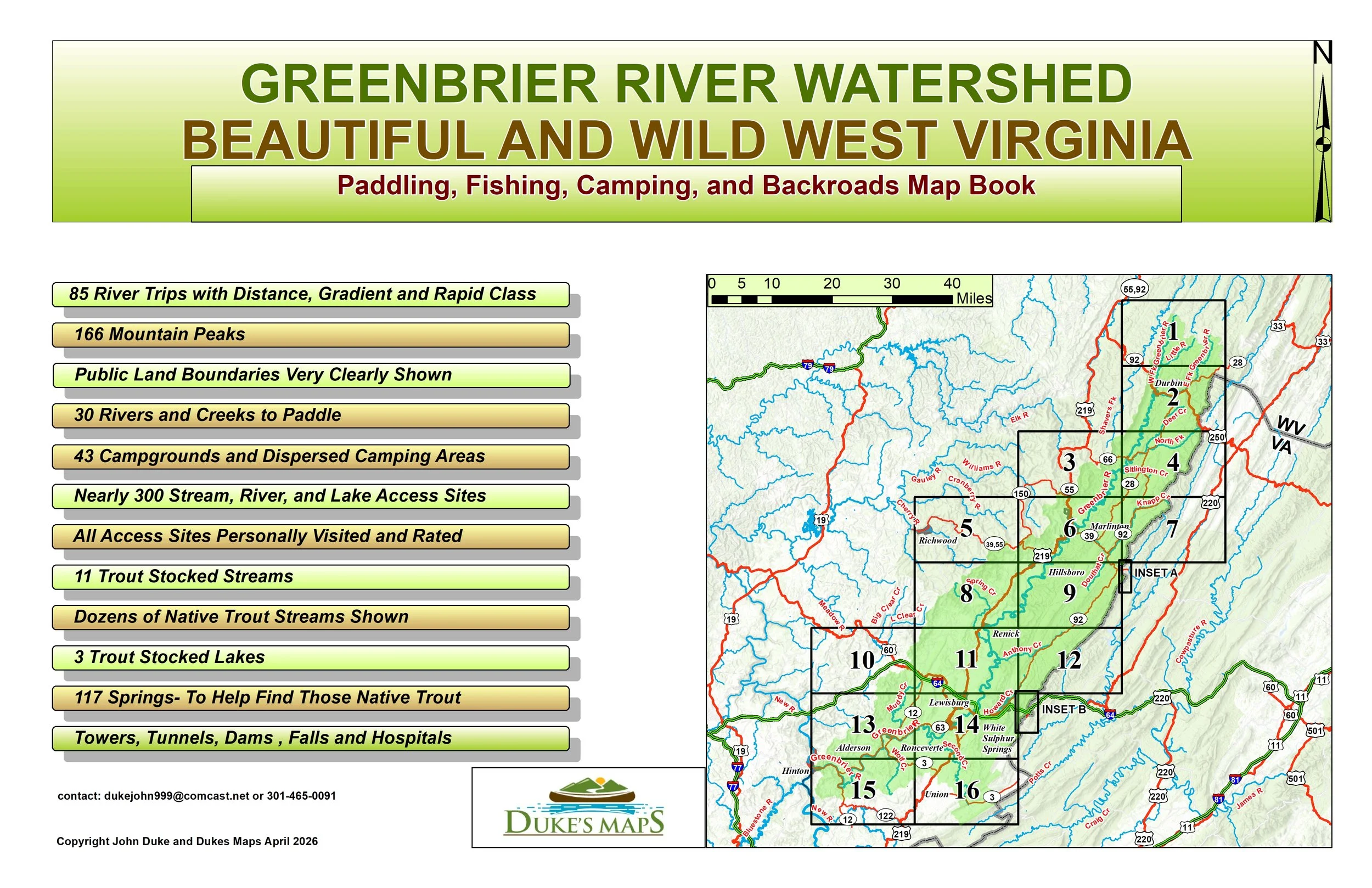
This may very well be the most beautiful part of Wild West Virginia! The Greenbrier river just can’t be beat for float fish camping.
You’ll receive a secure link to the file lasting 24 hours after the first download.
Some of the items found in these maps include:
16 maps in 11" X 17" landscape format
85 River Trips with Distance, Gradient and Rapid Class
30 Rivers and Creeks to Paddle
Nearly 300 Stream, River, and Lake Access Sites
All Access Sites Personally Visited and Rated
166 Mountain Peaks
Public Land Boundaries Very Clearly Shown
43 Campgrounds and Dispersed Camping Areas
11 Trout Stocked Streams and 3 Lakes
Dozens of Native Trout Streams Shown
117 Springs- To Help Find Those Native Trout
Towers, Tunnels, Dams , Falls and Hospitals
Paddling, Fishing, Camping, and Backroads Map Book. Download the maps and print when needed.
This may very well be the most beautiful part of Wild West Virginia! The Greenbrier river just can’t be beat for float fish camping.
You’ll receive a secure link to the file lasting 24 hours after the first download.
Some of the items found in these maps include:
16 maps in 11" X 17" landscape format
85 River Trips with Distance, Gradient and Rapid Class
30 Rivers and Creeks to Paddle
Nearly 300 Stream, River, and Lake Access Sites
All Access Sites Personally Visited and Rated
166 Mountain Peaks
Public Land Boundaries Very Clearly Shown
43 Campgrounds and Dispersed Camping Areas
11 Trout Stocked Streams and 3 Lakes
Dozens of Native Trout Streams Shown
117 Springs- To Help Find Those Native Trout
Towers, Tunnels, Dams , Falls and Hospitals