 Image 1 of 3
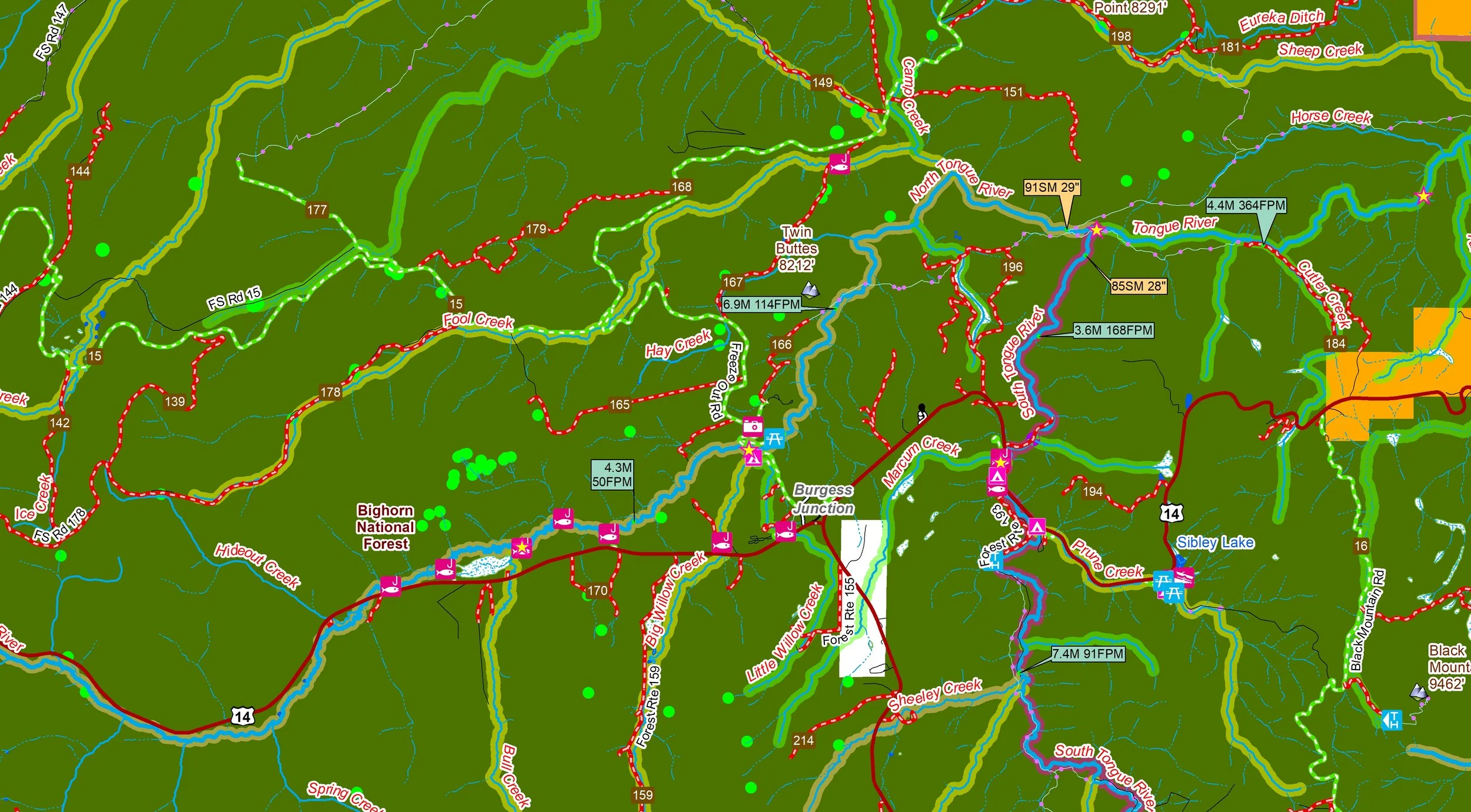 Image 2 of 3
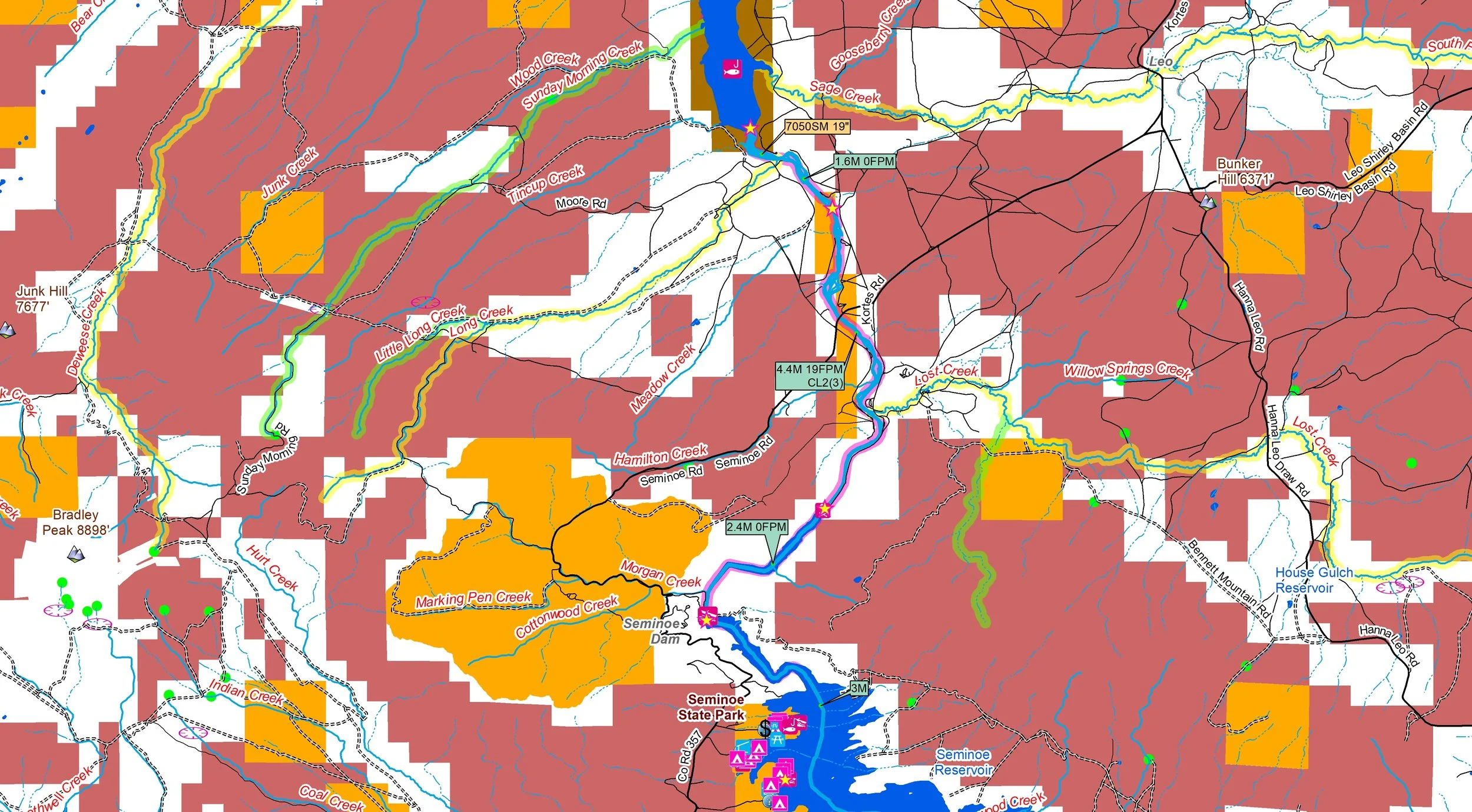 Image 3 of 3
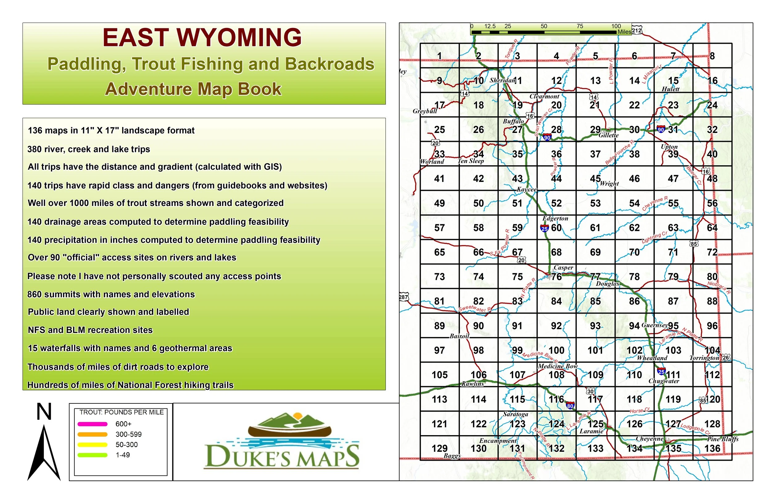
East Wyoming is a less explored destination that is absolutely wonderful! It contains the Bighorn and Medicine Bow mountain ranges, two of my favorite in this country. The North Platte River is a world renowned fishing destination. While certainly not a mecca for whitewater enthusiasts it does have some great rivers. There are thousands of miles of dirt roads to get found on the millions of acres of public land.
You’ll receive a secure link to the file lasting 24 hours after the first download.
Some items found in these maps include:
136 maps in 11" X 17" landscape format
380 river, creek and lake trips
All trips have the distance and gradient (calculated with GIS)
140 trips have rapid class and dangers (from guidebooks and websites)
Well over 1000 miles of trout streams shown and categorized
Over 90 "official" access sites on rivers and lakes
Thousands of miles of dirt roads to explore
Please note I have not personally scouted any access points
140 drainage areas computed to determine paddling feasibility
140 precipitation in inches computed to determine paddling feasibility
860 summits with names and elevations
Public land clearly shown and labelled
NFS and BLM recreation sites
15 waterfalls with names and 6 geothermal areas
Hundreds of miles of National Forest hiking trails